Another Sep 7 tornado in southwestern Ontario
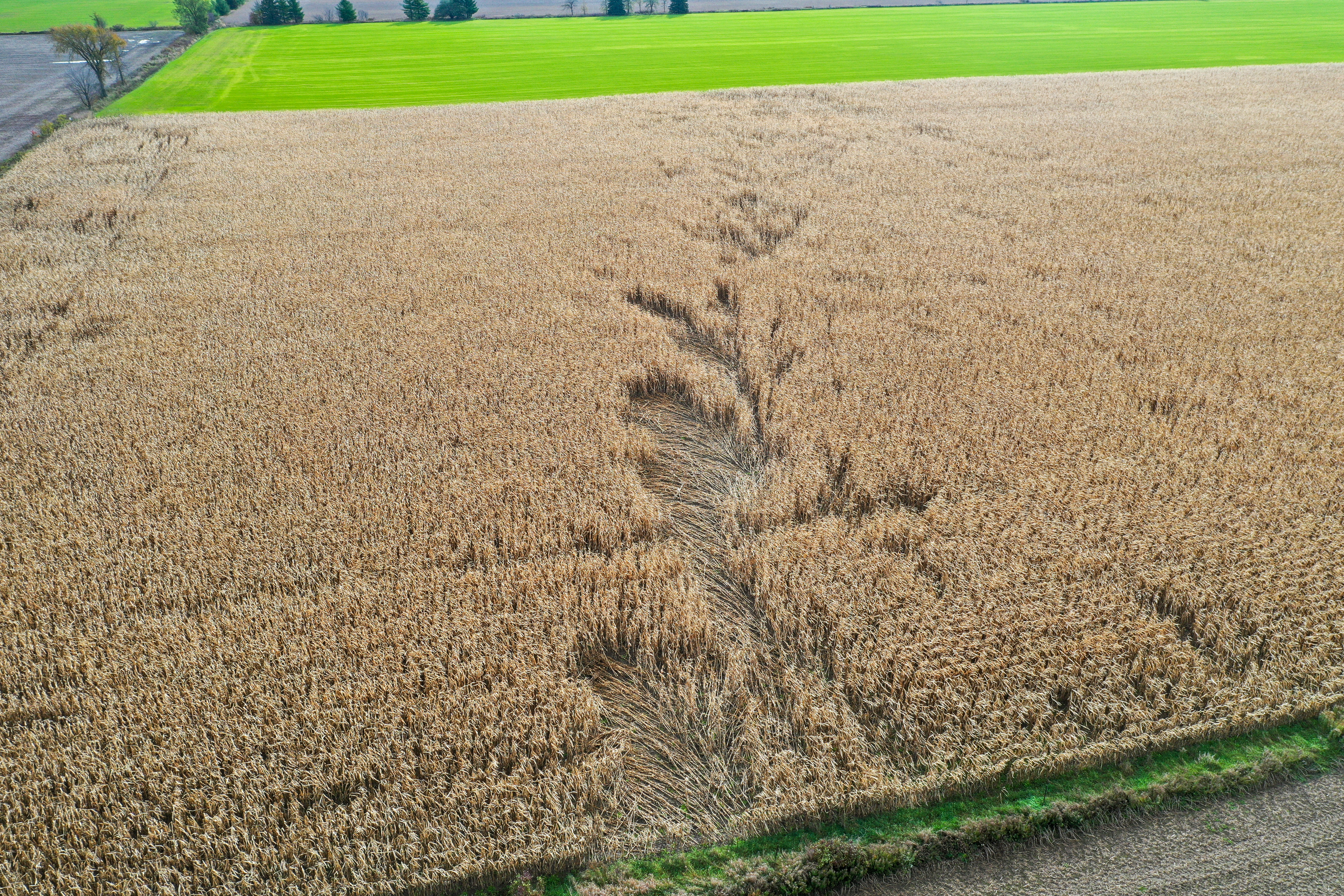
Follow-up hi-res satellite review of the area affected by the quasi-linear convective system (QLCS) on Sep 7 in southwestern Ontario turned up a short but clear track through a corn field near Monkton (N of Stratford). A subsequent ground/drone survey confirmed a tornado track and damage to trees along a windbreak.
Details are provided in the summary below.
Event Name: Monkton ON
Date: September 7, 2021
Time: 5:30 PM EDT (2130Z)
Final Classification: Tornado (Over Land)
Final EF-Scale Rating: EF0
EF-Scale Damage Indicator / Degree of Damage: C-T/DOD-2
Start of damage track: 43.5713N, 81.1098W
End of damage of track: 43.5671N, 81.1054W
Location of worst damage: 43.5701N, 81.1087W
Description: A short track of crop damage was detected southwest of Monkton during satellite imagery review. An NTP ground and drone survey was completed on October 28, 2021. Damage assessed as EF0 tornado, with an estimated max. wind speed of 90 km/h, track length of 590 m and max. path width of 30 m. Tornado motion was from the NW (approx. 320 degrees). The same storm later produced an EF0 tornado near Kuhryville, ON.