Oct 10th tornadoes in NW ON
NTP has confirmed two tornadoes in NW Ontario that occurred with severe storms on October 10th. Details and images provided below.
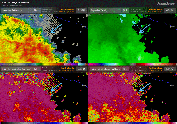
Event Name: Bending Lake ON
Date: October 10, 2021
Time: 5:55 PM CDT (2255Z)
Final Classification: Tornado (Over Land)
Preliminary EF-Scale Rating: EF2
EF-Scale Damage Indicator / Degree of Damage: C-T/DOD-6
Start of damage track: 49.2822N, 92.1442W
End of damage of track: 49.3386N, 92.1392W
Location of worst damage: 49.3178N, 92.1416W
Description: A storm track of interest was identified after a Tornado Debris Signature (arrow below) was observed southwest of Ignace based on CASDR radar products. Satellite imagery review revealed a tornado damage path in a forested area. Damage assessed as EF2 tornado, with an estimated max. wind speed of 190 km/h, preliminary track length of 6.46 km and max. path width of 640 m. Tornado motion was from the S (approx. 185 degrees).
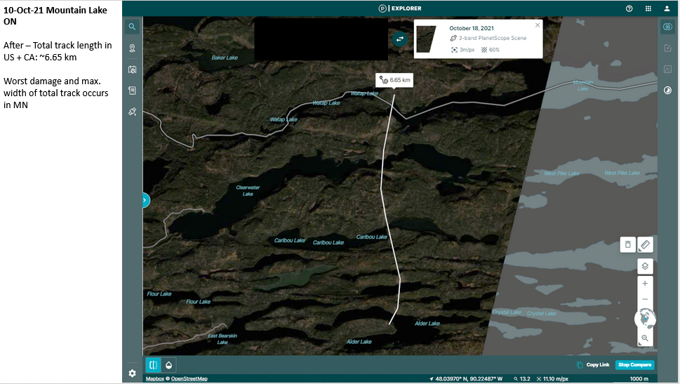
Event Name: Mountain Lake ON
Date: October 10, 2021
Time: 7:20 PM EDT (2320Z)
Final Classification: Tornado (Over Land)
Preliminary EF-Scale Rating: EF1
EF-Scale Damage Indicator / Degree of Damage: C-T/DOD-5
Start of damage track: 48.1017, 90.2967W
End of damage of track: 48.1053N, 90.2969W
Location of worst damage: 48.1034N, 90.2971W
Description: Satellite imagery review of a storm track of interest revealed a tornado damage path that developed at Alder Lake, Minnesota (start point approx. 48.0396N, 90.3001W) and ended north of the Canadian border (grey line in image) at Mountain Lake (Thunder Bay), Ontario. NTP analyzed the Canadian portion of the tornado track. Damage is assessed as EF1 tornado, with an estimated max. wind speed of 145 km/h, preliminary track length of 700 m and max. path width of 760 m. Tornado motion was from the S (approx. 180 degrees).