July 23rd tornadoes at Saint-Adolphe-d'Howard, QC
An NTP survey team was sent to Saint-Adolphe-d'Howard, QC after photos and video showed a tornado that caused significant damage there. The ground/drone analysis confirmed that three tornadoes occurred with the intense supercell storm that affected that area on July 23rd. The full details are included in the summaries below, as well as a map of the tornadoes, some of the ground/drone photos for the EF2 tornado, and a radar animation.
Event Name: Saint-Adolphe-d’Howard (Lac Bruyère)
Date: July 23, 2022
Start Time: 5:55 PM EDT (2155 UTC)
Final Classification: Tornado (Over Land, concurrent - primary)
Final EF-Scale Rating: EF1
EF-Scale Damage Indicator / Degree of Damage: C-T / DOD-5
Start of damage track: 45.9948N, 74.4113W
End of damage of track: 45.9820N, 74.3749W
Location of worst damage: 45.9819N, 74.3823W
Description: Witness captured video showing supercell tornado occurring concurrently with nearly stationary tornado near the west shore of Lac Saint-Joseph. No injuries were reported. Satellite imagery revealed a path of tree damage. Damage assessed as EF1 with max. wind speed of 145 km/h, track length of 3.31 km, max. width of 310 m. The tornado track was curved – the part of track with the worst damage was from the W (approx. 270). Time is radar estimated and coordinated with video. Radar showed a tornado debris signature.
Event Name: Saint-Adolphe-d’Howard (Mont Howard)
Date: July 23, 2022
Start Time: 5:55 PM EDT (2155 UTC)
Final Classification: Tornado (Over Land, concurrent - secondary)
Final EF-Scale Rating: EF0
EF-Scale Damage Indicator / Degree of Damage: C-T / DOD-4
Start of damage track: 45.9726N, 74.3463W
End of damage of track: 45.9725N, 74.3416W
Location of worst damage: 45.9726N, 74.3450W
Description: Witness captured video showing a nearly stationary tornado (likely landspout) near the west shore of Lac Saint-Joseph occurring concurrently with tornado at Lac Bruyère. No injuries were reported. Satellite imagery revealed a short path of tree damage. Damage assessed as EF0 with max. wind speed of 130 km/h, track length of 360 m, max. width 70 m. Tornado motion was from the W (approx. 270 degrees). Time is radar estimated and coordinated with video.
Event Name: Saint-Adolphe-d’Howard
Date: July 23, 2022
Start Time: 6:05 PM EDT (2205 UTC)
Final Classification: Tornado (Over Land)
Final EF-Scale Rating: EF2
EF-Scale Damage Indicator / Degree of Damage: FR12 / DOD-6
Start of damage track: 45.9776N, 74.3584W
End of damage of track: 45.9799N, 74.2337W
Location of worst damage: 45.9825N, 74.3273W
Description: Witnesses captured video and photos of a supercell tornado that developed west of Lac Saint-Joseph and tracked roughly NE. No injuries were reported. Structural and extensive tree damage were reported along much of the tornado path and satellite / drone imagery revealed the start and end points. Environment Canada conducted an initial ground survey and NTP followed up with a thorough ground/drone survey on July 25, 2022. Damage assessed as EF2 with max. wind speed of 195 km/h (roof off house), track length of 10.1 km, max. width 770 m. The tornado track was curved – the part of track with the worst damage was from the SW (approx. 245 degrees). Time is radar estimated and coordinated with video. Radar showed a tornado debris signature.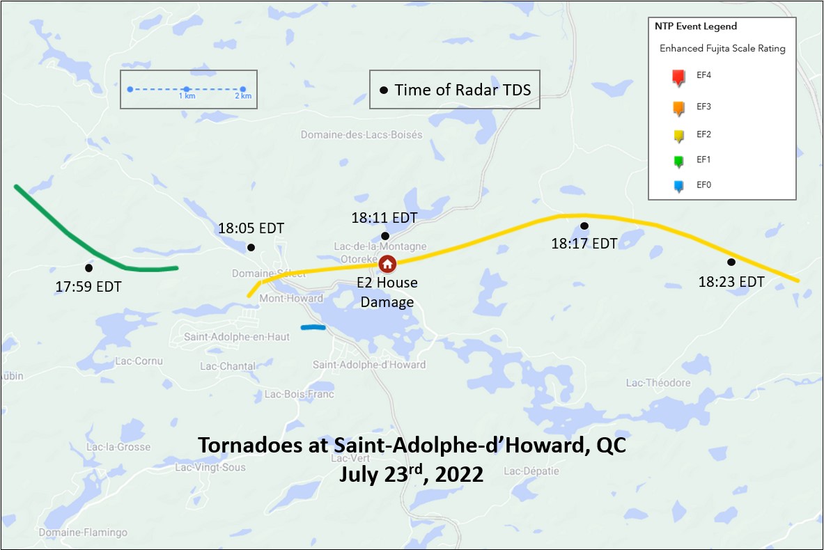
Map showing the tracks of each of the three tornadoes. Tornado debris signature times are from the CASBV radar at Blainville, QC. The location of the house with the roof removed is also shown.
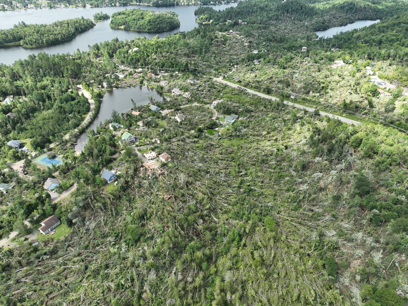
Drone image looking at the worst damage area from the NE.
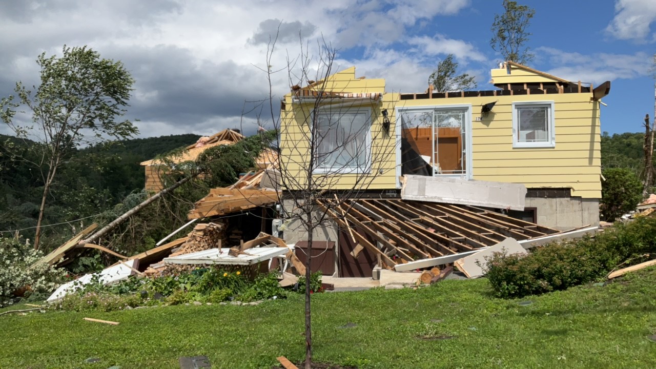
Roof removed from house - EF2 damage.
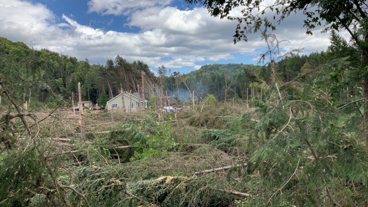
Tree damage along the path of the EF2 tornado.
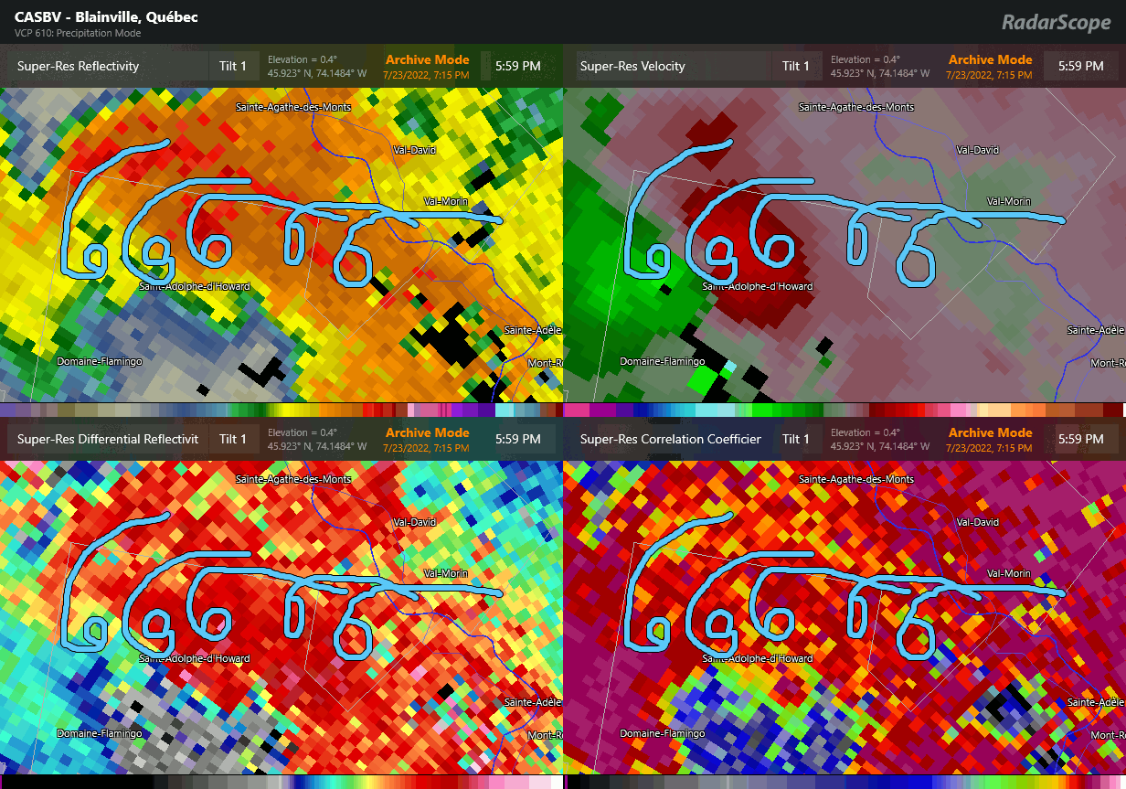
CASBV radar image animation showing various radar parameters during the storm. The annotations indicate the hook echo and circle the tornado debris signature.