June 16 Downbursts at Belleville and Mallorytown areas
A potent storm environment was present in the area between Toronto and Montreal on June 16th. A number of thunderstorms developed including supercells and bow-segment MCSs. However, the damage was thankfully limited - mostly tree damage was reported and perhaps some damage from the large hail that fell in a few locations. No reports of injuries.
The following are storm survey summaries for several downburst events that resulting in wind damage. Other storm summaries for this day are still in preparation.
Event Name: Belleville, ON
Date: June 16, 2022
Time: 3:40 PM EDT (1940Z)
Final Classification: Downburst
Preliminary EF-Scale Rating: EF0
EF-Scale Damage Indicator / Degree of Damage: C-T/DOD-3
Location of worst damage: 44.1682N, 77.3876W
Description: Tree and structural damage was reported in Belleville after a storm passed through the area. No injuries were reported. An NTP ground and drone survey was completed on June 17, 2022. Damage assessed as EF0 downburst, with an estimated max. wind speed of 115 km/h, with weak damage in multiple locations over an area at least 6.6 km long and 1.1 km wide. Note that the structural damage to downtown heritage buildings and a solar system removed from an apartment building are not associated with official EF-scale damage indicators. While they could not be used for the EF-scale rating, the damage was approximately in line with the wind speed range for an EF0 rating (90-130 km/h). Satellite imagery review is pending after which more details will be provided.
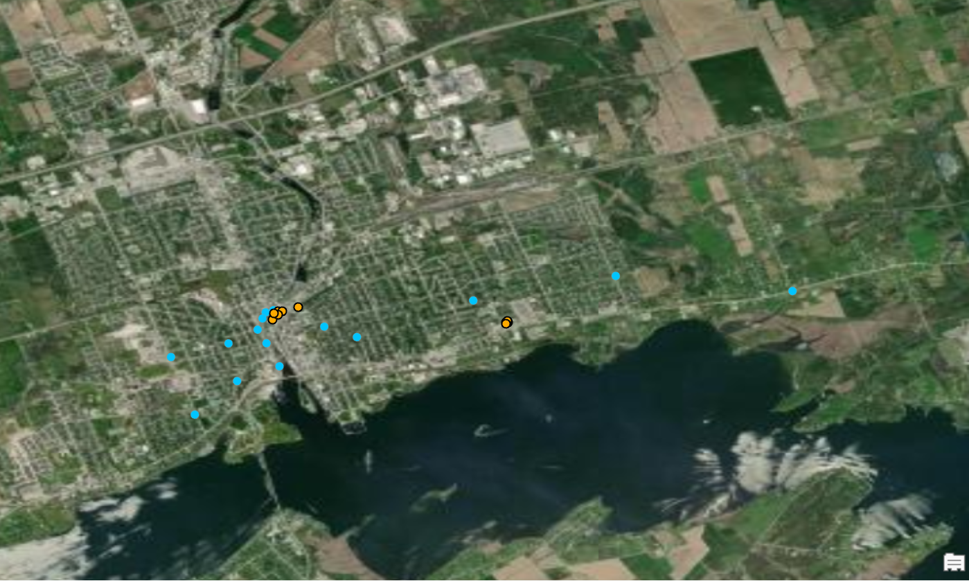
Draft map of ground (blue) and drone (orange) damage points for the Belleville survey. Distance between farthest ground points was about 6.6 km, but the damage may have extended somewhat farther.
Event Name: Hungry Bay (Shannonville), ON
Date: June 16, 2022
Time: 3:50 PM EDT (1950Z)
Final Classification: Downburst
Preliminary EF-Scale Rating: EF0
EF-Scale Damage Indicator / Degree of Damage: C-T/DOD-3
Location of worst damage: 44.1690N, 77.1899W
Description: Tree damage was reported near Hungry Bay (south of Shannonville) after a storm passed through the area. A property owner also reported a vehicle was briefly lifted several cm off the ground by the wind (note there is no vehicle-based damage indicator with the current EF scale so vehicle damage cannot be rated). No injuries were reported. An NTP ground survey was completed on June 17, 2022. Damage assessed as EF0 downburst, with an estimated max. wind speed of 115 km/h, with weak damage in multiple locations over an area at least 5.96 km long and 850 m wide. Satellite imagery review is pending.
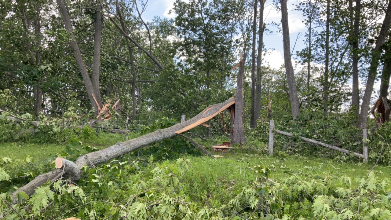
An area with several healthy trees snapped.
Event Name: Mallorytown, ON
Date: June 16, 2022
Time: 4:30 PM EDT (2030Z)
Preliminary Classification: Downburst (microburst)
Preliminary EF-Scale Rating: EF0
EF-Scale Damage Indicator / Degree of Damage: C-T/DOD-3
Location of worst damage: 44.4579N, 75.8553W
Description: Tree damage was reported in the Charleston Lake area after a storm passed through the area. No injuries were reported. An NTP ground and drone survey was completed on June 17, 2022 documented scattered minor tree damage from Lansdowne to Yonge Mills area. A cluster of weak tree damage in the Mallorytown area was assessed as an EF0 downburst (microburst), with an estimated max. wind speed of 115 km/h, with weak damage observed over an area 3.96 km long and 900 km wide. Satellite imagery review is pending.
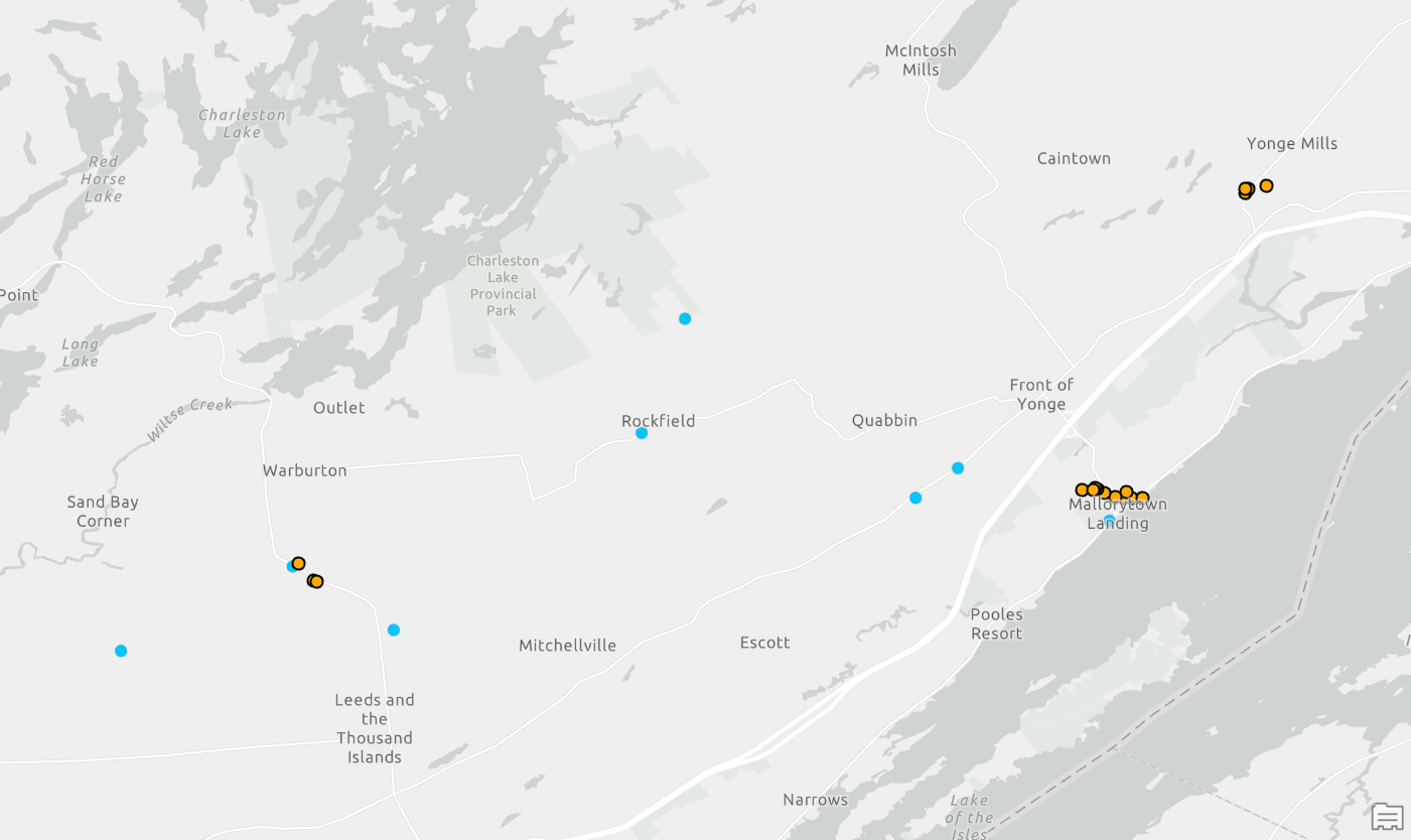
Map of the greater area of light straight-line wind damage. Outside of Mallorytown area, never more than a couple trees down at a time. Area of damage spread over 23 km.