Two EF1 tornadoes in London, ON
NTP has completed thorough investigations of two locations in London, ON where significant damage was reported. Two EF1 tornadoes have been confirmed based on the results of these surveys. Details for each are provided below.
London (Huron Heights, NE part of city)
EF1 Tornado
Time – 11:36 AM ET
Worst damage – loss of apartment roof covering (ACT DOD2 EXP 160 km/h), damage to airport hangar doors and flipped plane, numerous healthy trees snapped/uprooted
Path length – 5.7 km
Max path width – 450 m
Motion from WSW
See images below.
London (Wilton Grove, S side of city)
EF1 Tornado
Time – 11:39 AM ET
Worst damage – large power pole leaning (C-ETL DOD4 EXP 175 km/h), warehouse building with roof removed and partial wall collapse (WHB DOD5 EXP 185 km/h but lowered due to lack of surrounding damage in immediate vicinity), trees snapped/uprooted
Path length – 3.4 km
Max path width – 400 m
Motion from WSW
See images below.
In both cases, there was a CASET radar velocity couplet that went over the location at the leading edge of the derecho, supporting the classification of QLCS tornado. Note that the tornadoes occurred within minutes of each other.
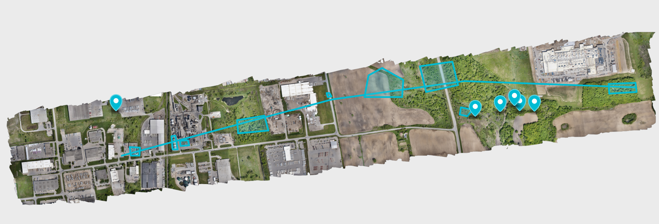
Huron Heights images
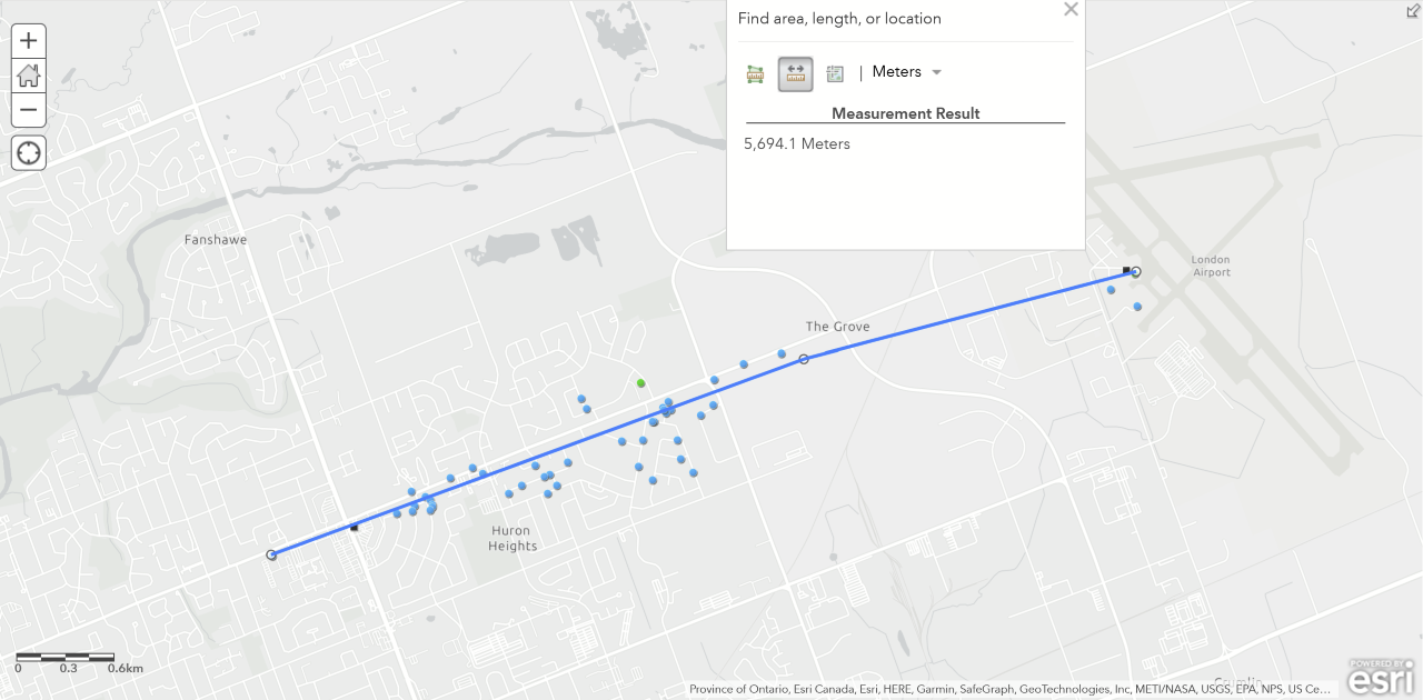
Map of damage points along Huron Street east of Highbury Ave
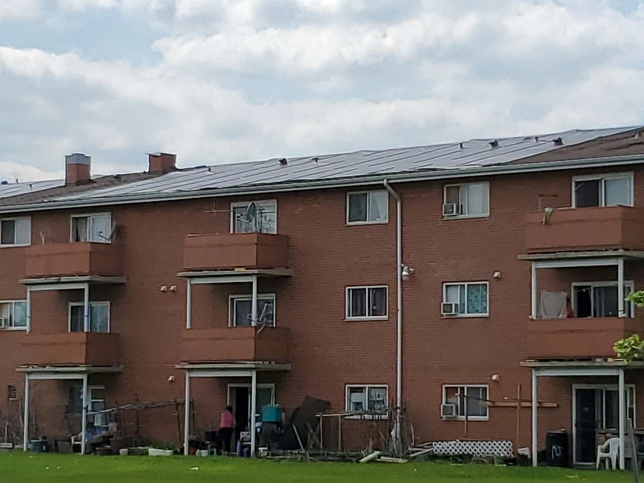
Roof damage to apartment building on Huron Street
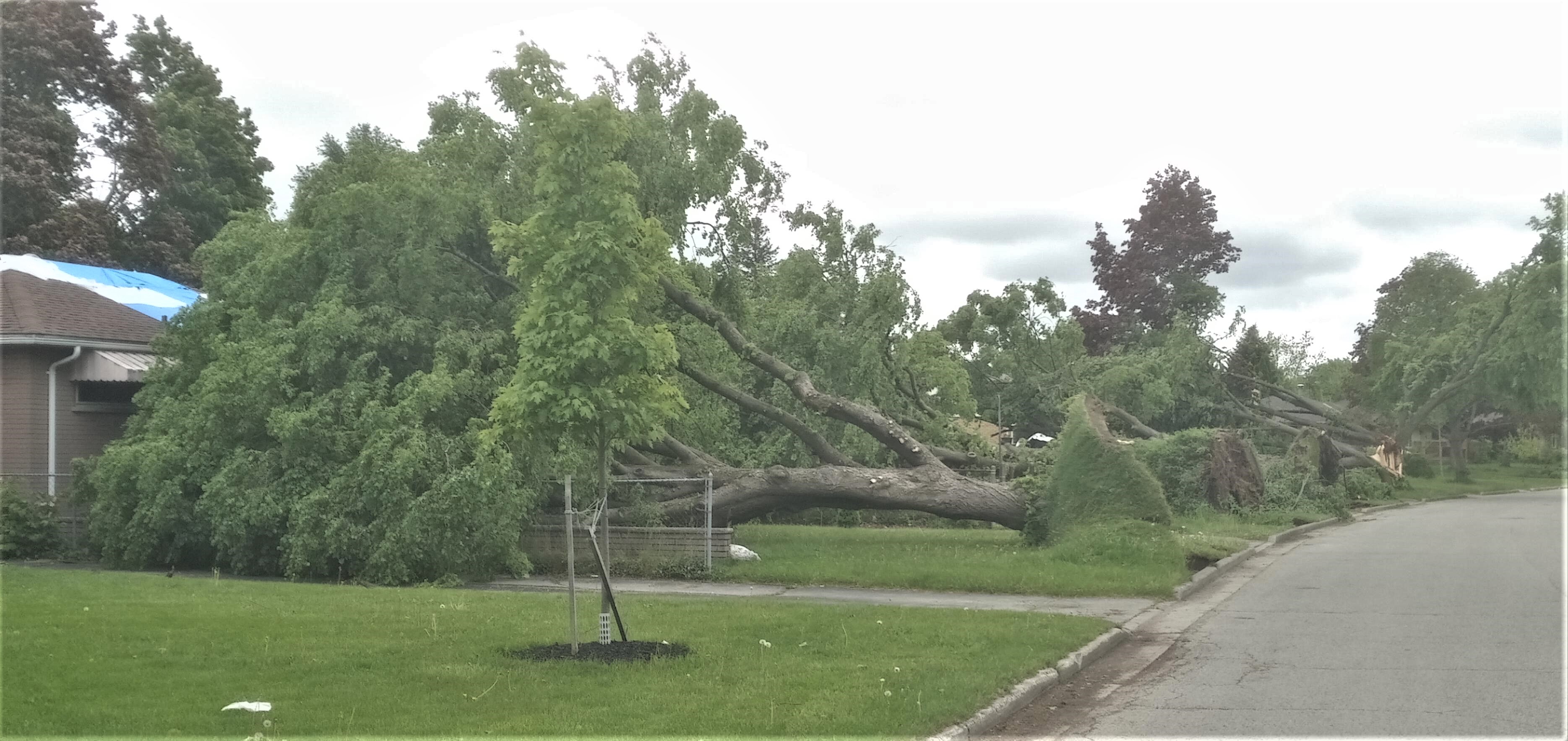
Several large trees down in the Huron Heights neighbourhood
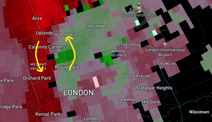
CASET radar velocity couplet just before the tornado
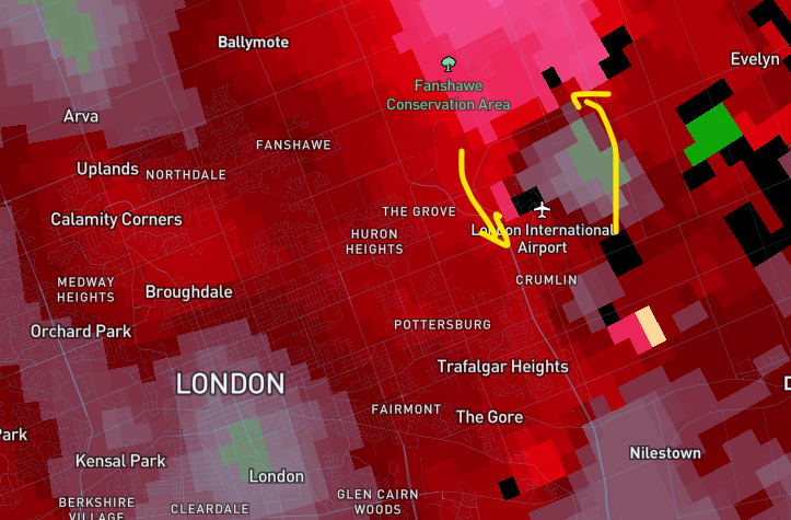
CASET radar velocity couplet just after the tornado
Wilton Grove / Westminster images
Damage along Green Valley Road in Wilton Grove (Westminster) area
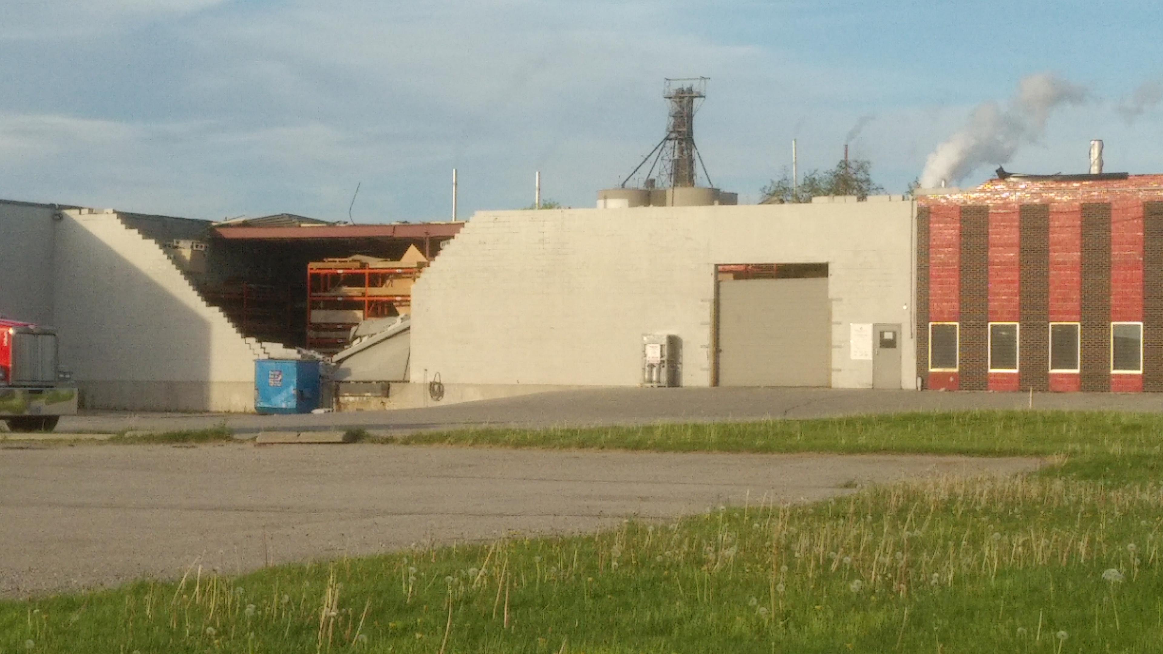
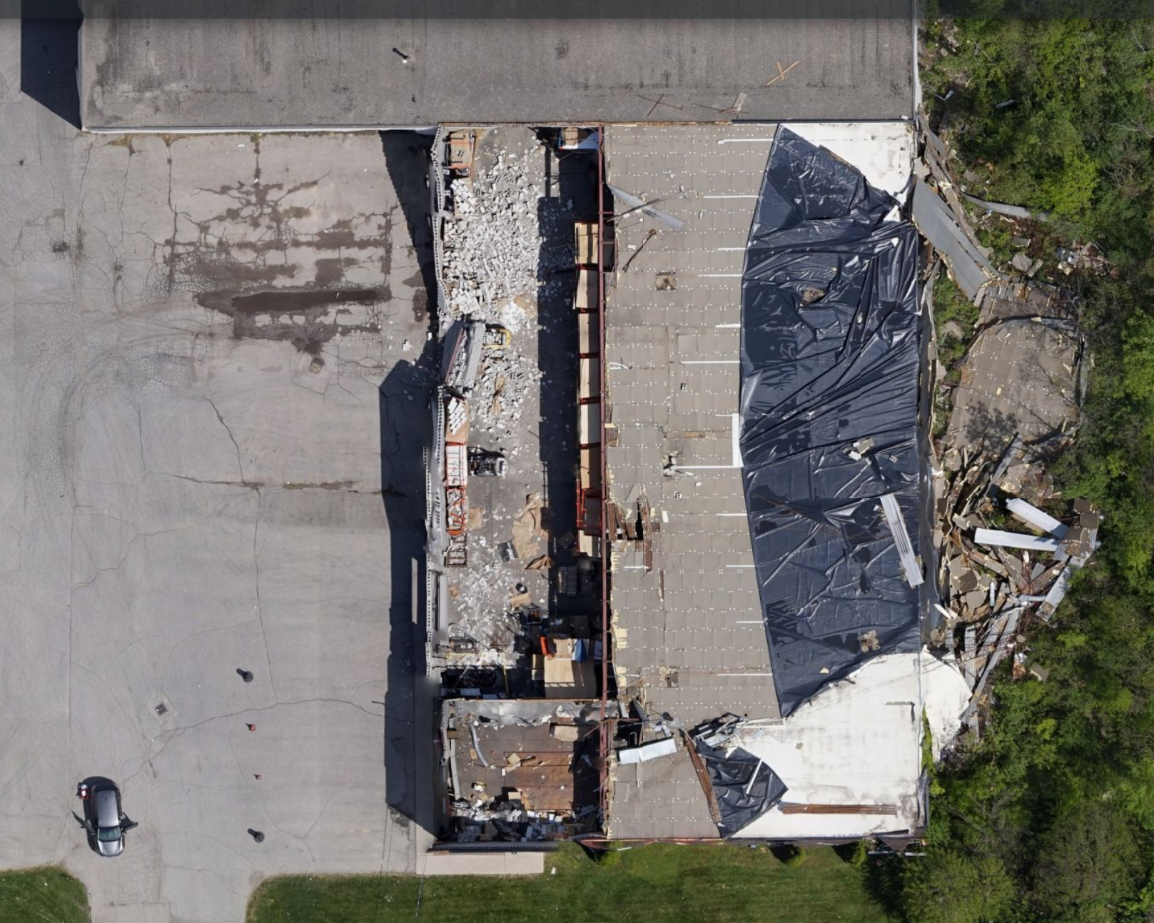
Damaged industrial building
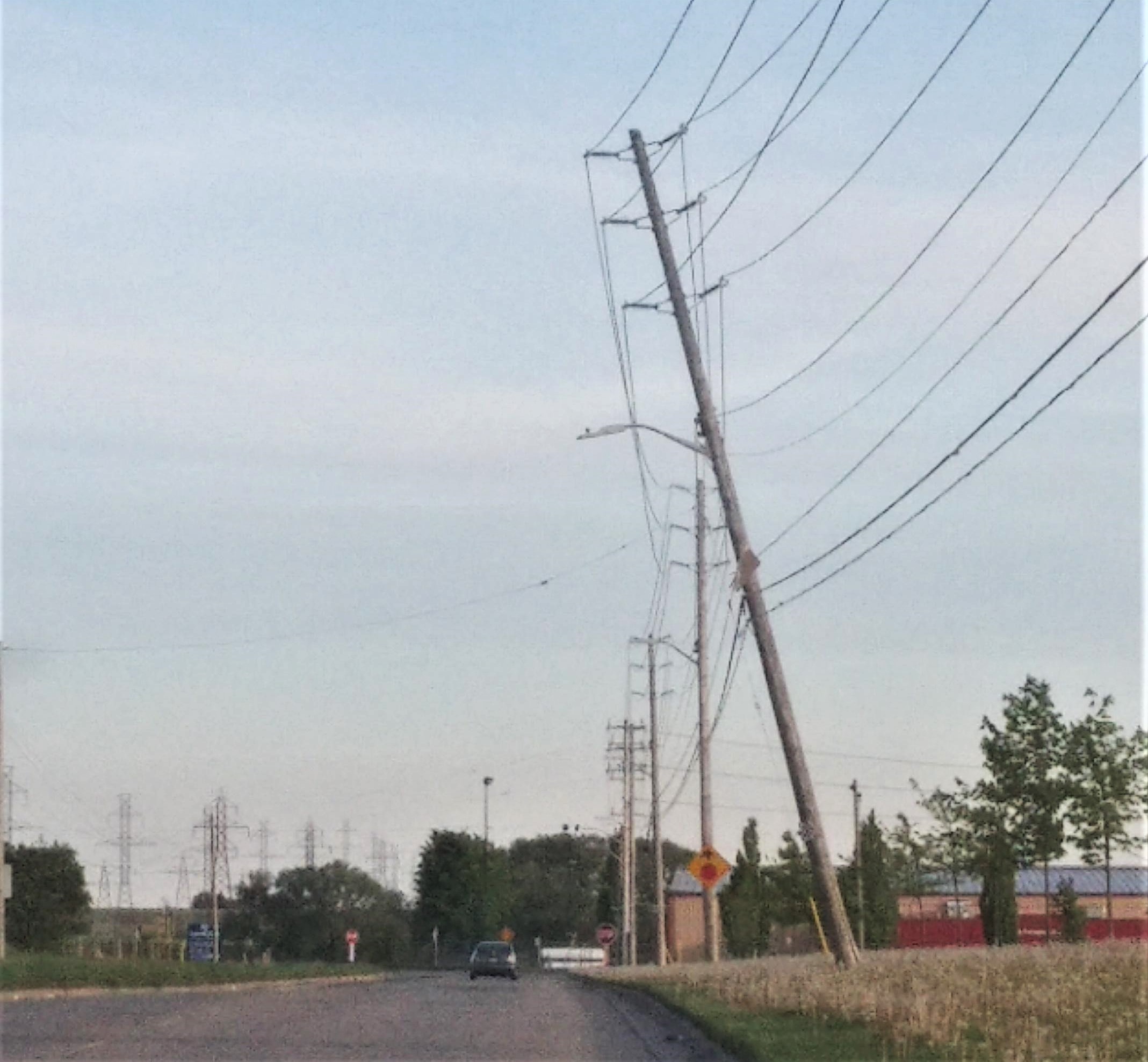
Large power pole leaning
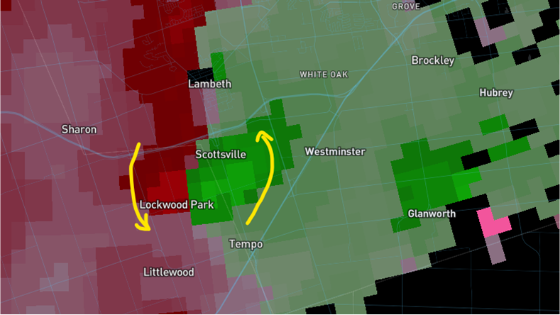
CASET radar velocity couplet just minutes before the tornado.
The couplet had mostly dissipated by the next radar scan.