Tornado in Tecumseh ON on Aug 24
An NTP investigation has concluded that an EF1 tornado hit Tecumseh, ON on the evening of August 24 as a severe storm moved rapidly through the area. The tornado continued toward the southeast, into the Municipality of Lakeshore, hitting Elmstead and going past Highway 401 to the northeast of Pleasant Park.
Details are provided in the event summary below, along with a map, radar, and ground and drone survey photos.
The track of surveyed damage did continue further southeast but damage became sporadic. Additional analysis is required to know if it is related to this tornado or something else, possibly a second tornado.
====
Event Name: Tecumseh, ON
Date: August 24, 2023
Estimated Start Time: 10:30 PM EDT (0230 UTC)
Final Classification: Tornado (over land)
Final EF-Scale Rating: EF1
Start of Damage Track: 42.3281N, 82.8747W
Worst Damage Location: 42.2779N, 82.8361W
End of Damage Track: 42.2244N, 82.7862W
Description: Photos of damage were received over social media. A ground/drone survey found damage along a narrow path, including collapsed barns, snapped power poles, damaged grain bins, trees and branches down, and roof shingles removed on numerous homes. No injuries were reported. The event is assessed as an EF1 tornado, with an estimated max. wind speed of 145 km/h, a preliminary length of 14 km and max. width of 700 m. There was additional damage to the southeast but further analysis is needed to know if it was related to this tornado. Drone and satellite imagery review is pending. Start time is based on radar, which showed an area of tight rotation along the entire damage path. Note that radar suggests the entire event took less than 10 minutes, giving a tornado motion of nearly 80 km/h.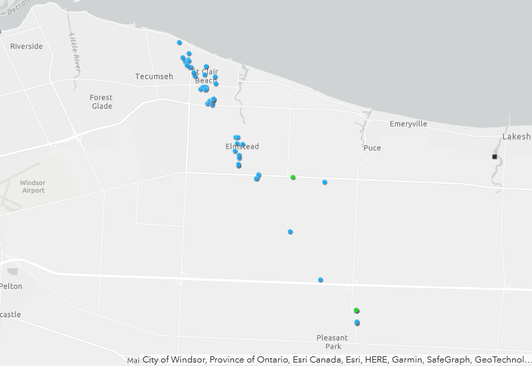
Map showing the locations of ground photos of damage along the track of the tornado. Drone imagery was also collected (locations not shown).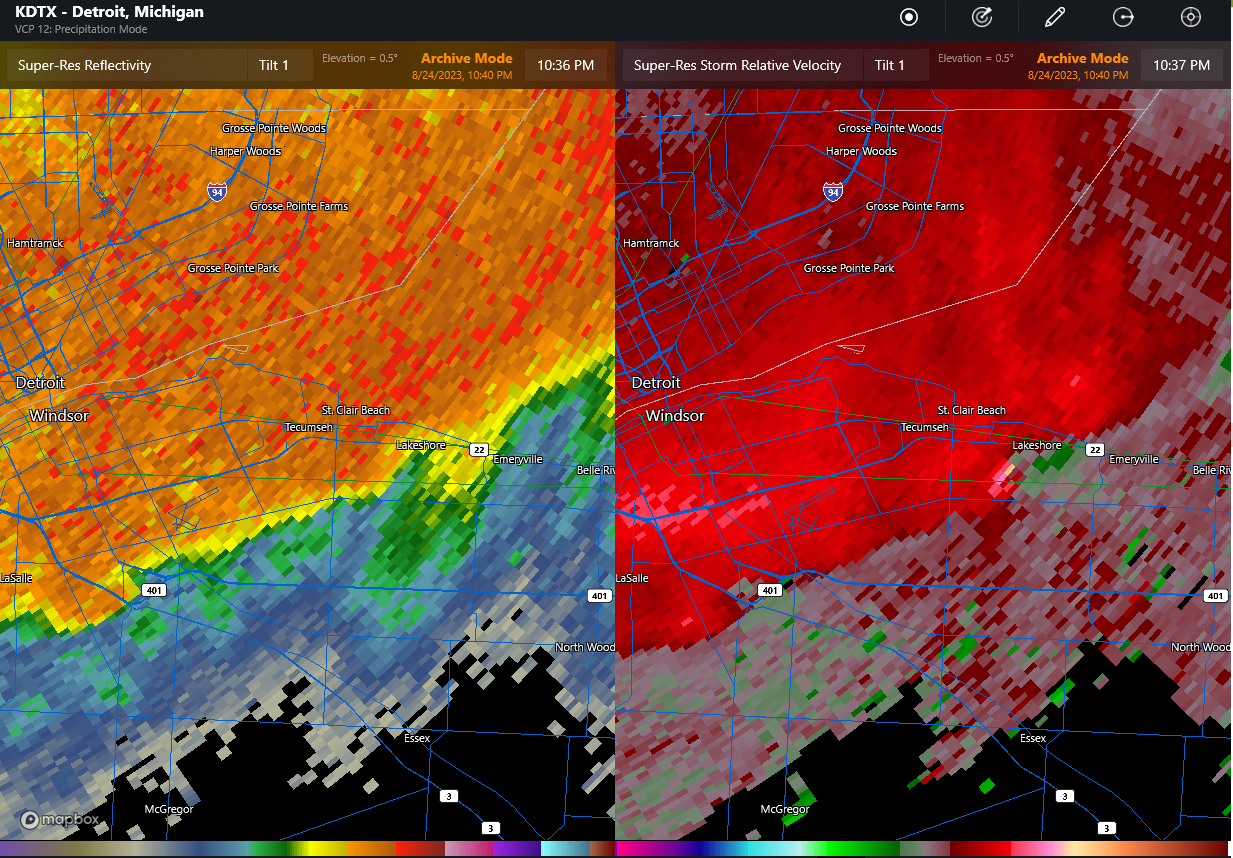
KDTX radar image showing reflectivity (left) and Doppler radial velocity (right) at 10:37 PM EDT (0237 UTC) after the tornado developed along the leading edge of the storm. Note the compact area of rotation southeast of Tecumseh at that time.
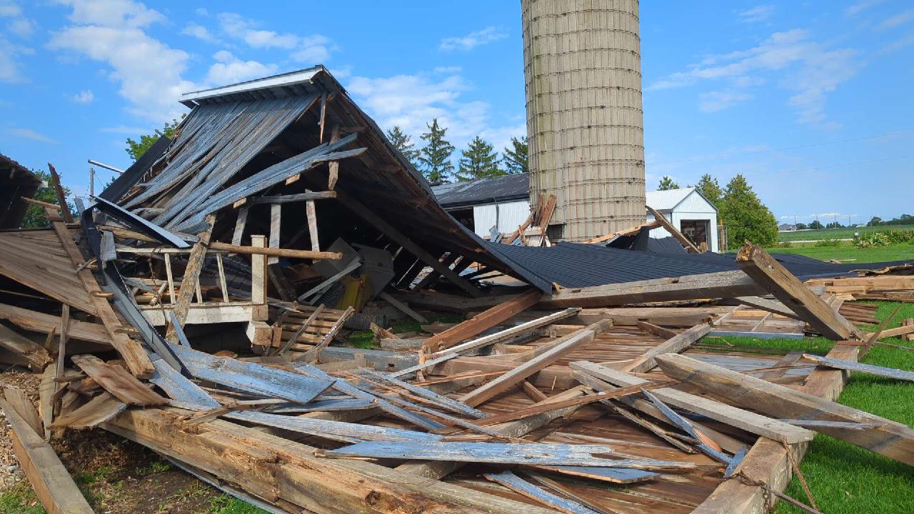
Barn with walls collapsed, Lakeshore Road 103. Barn was in fair condition, but nothing around it appeared to be damaged. Therefore, the 'expected' value of 155 km/h (SBO DOD6) was lowered somewhat toward the lower bound giving 145 km/h.
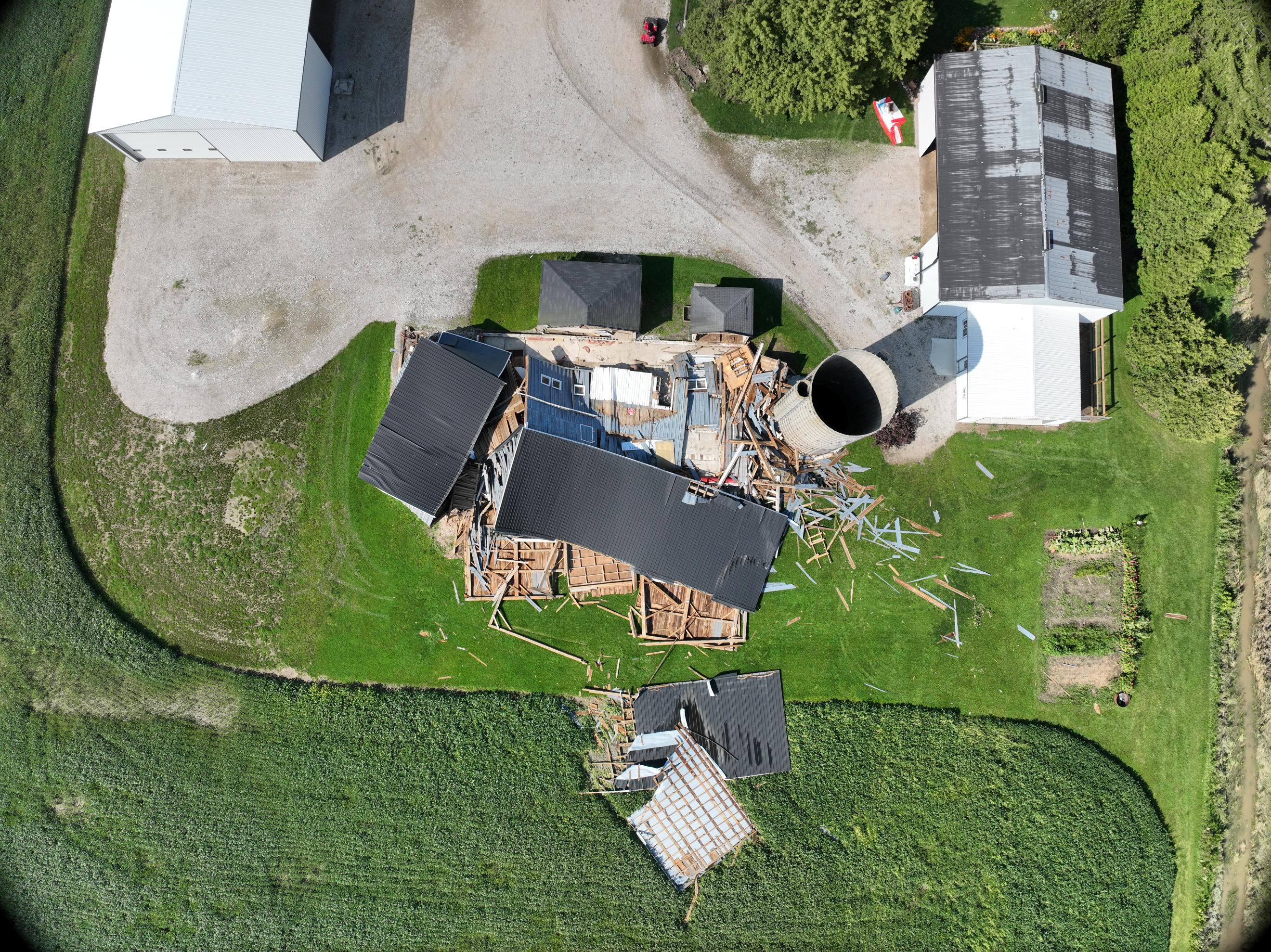
Drone view of collapsed barn with debris tossed into the field, Lakeshore Road 103.
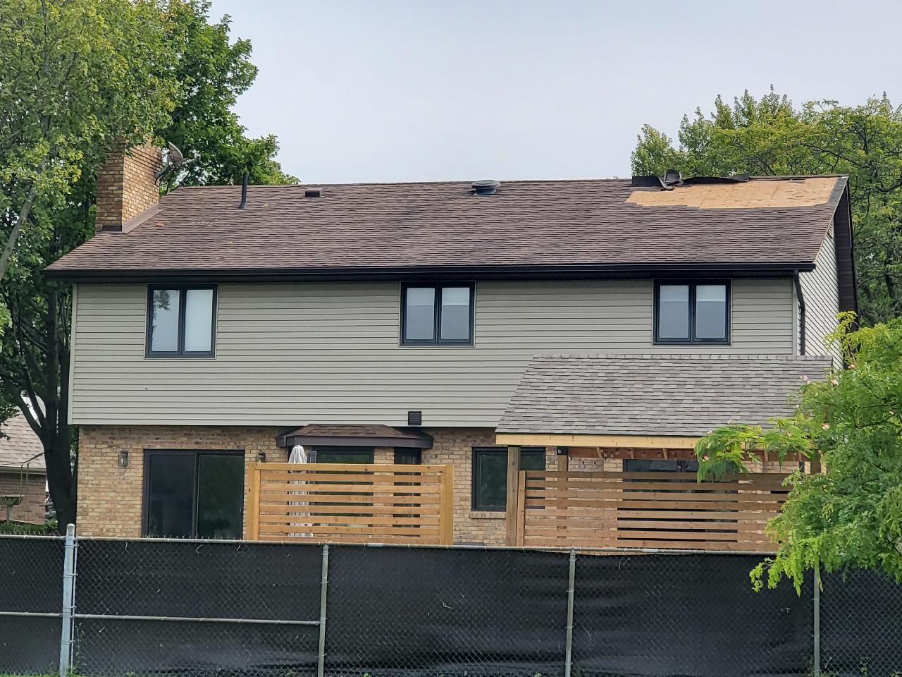
Home with singles removed, St. Thomas Street.
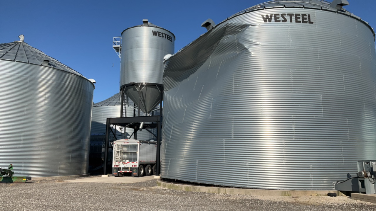
Anchored grain bin damaged, Lakeshore Road 105.
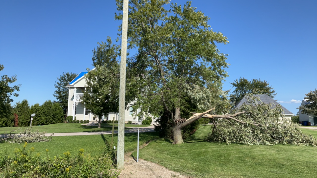
Roof and tree damage, County Road 25.