Tornado in Windsor ON on Aug 24
An NTP investigation has concluded that an EF0 tornado hit the west side of Windsor, ON on the evening of August 24 as a severe storm moved rapidly through the area. Details are provided in the event summary below, along with a map, radar, ground and drone survey photos.====
Event Name: Windsor, ON
Date: August 24, 2023
Estimated Start Time: 10:30 PM EDT (0230 UTC)
Final Classification: Tornado (over land)
Final EF-Scale Rating: EF0
Start of Damage Track: 42.2987N, 83.0717W
Worst Damage Location: 42.2638N, 83.0401W
End of Damage Track: 42.2093N, 82.9992W
Description: Photos of damage received over social media. A ground survey found damage along a narrow path, including numerous downed trees and branches, roof shingles removed on a number of homes, and damaged fences. The event is assessed as an EF0 tornado, with an estimated max. wind speed of 125 km/h, a length of 11.6 km and a max. width of 470 m. Drone and satellite imagery review is pending. Start time is based on radar, which showed an area of tight rotation along the entire damage path. Note that radar suggests the entire event took less than 10 minutes, giving a tornado motion of nearly 80 km/h.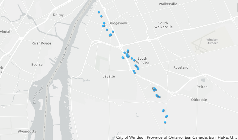
Map showing locations where photos were taken from the ground along the 11.6 km damage path. Drone imagery was also taken and will be fully analyzed at a later time.
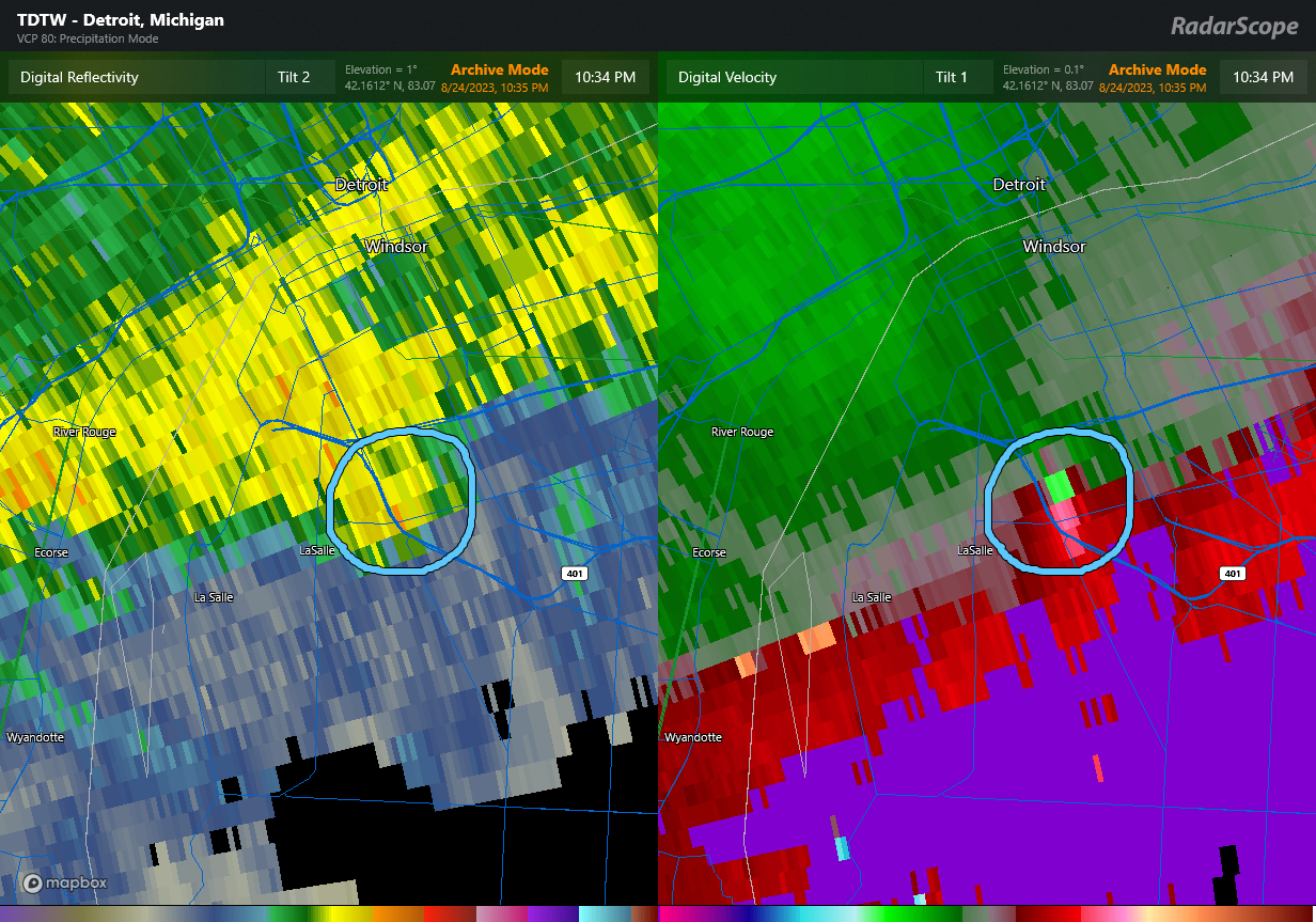
TDTW radar image valid at 10:34 PM EDT showing reflectivity (left) and Doppler radial velocity (right). The tight rotation with this part of the storm is circled, moving SSE. The tornado occurred beneath this area of rotation along the storm's leading edge.
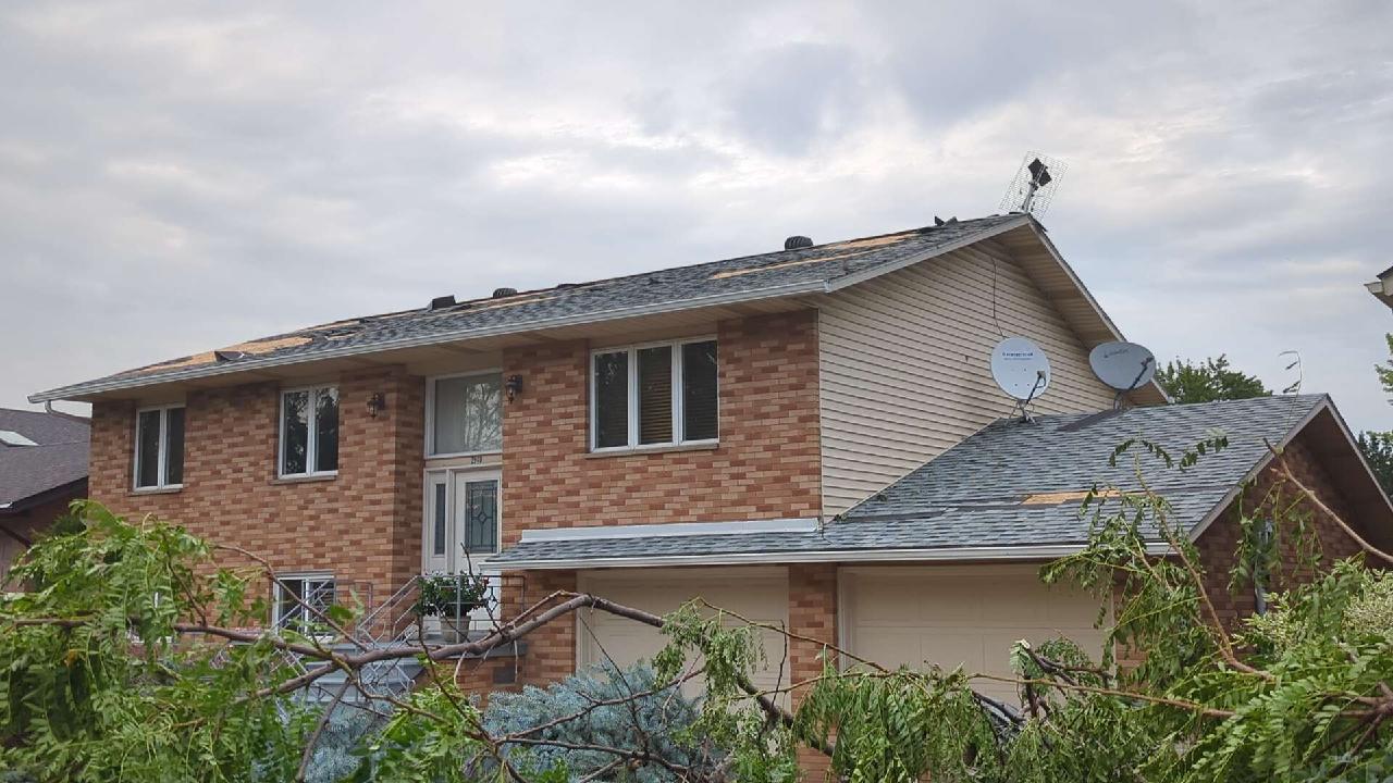
Home on Northway Ave with shingles removed (FR12 DOD2 EXP 125 km/h) and tree damage.
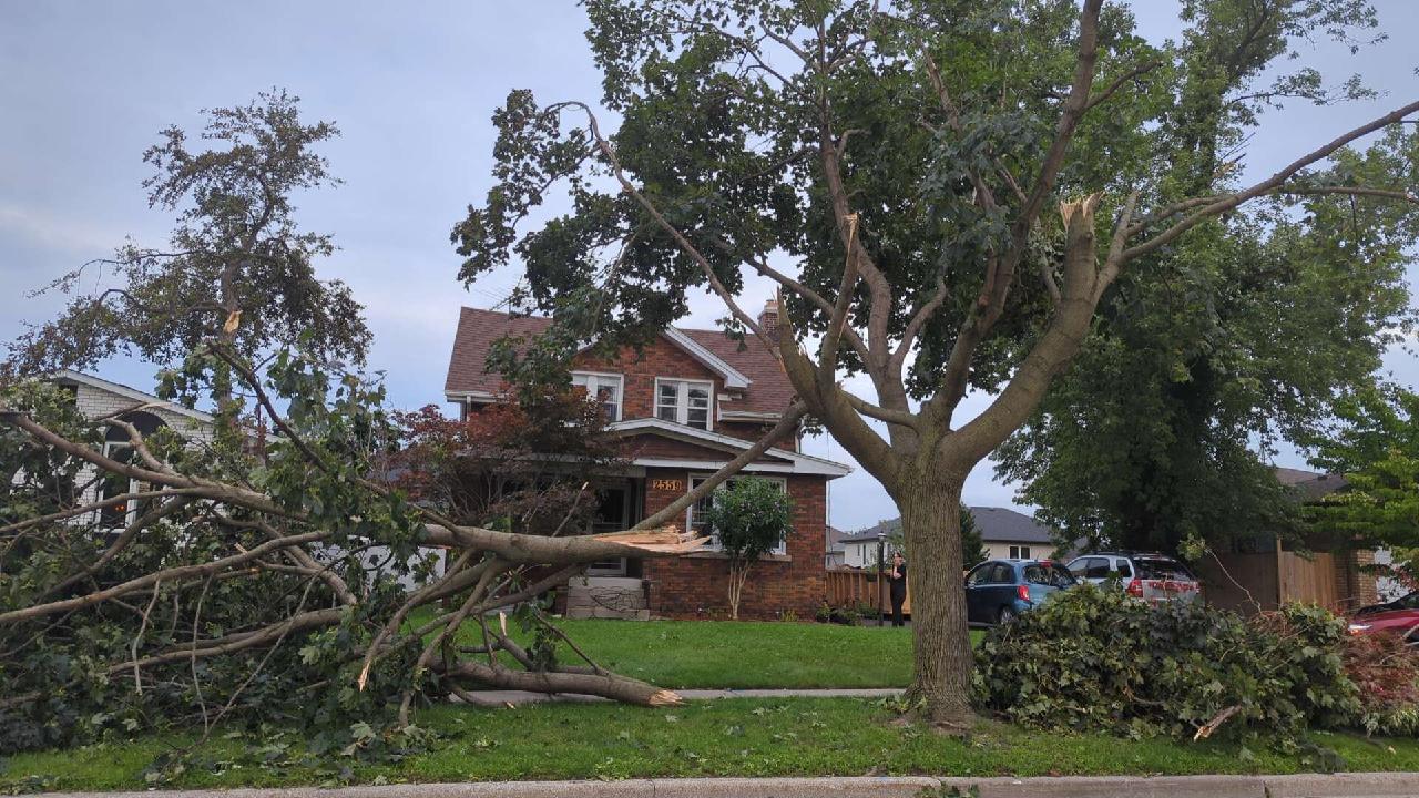
Extensive tree damage in the South Windsor area.
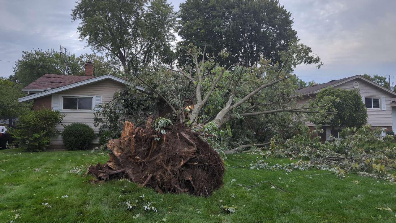
Extensive tree damage in the South Windsor area including snapping and uprooting. Note the shingle damage here as well.
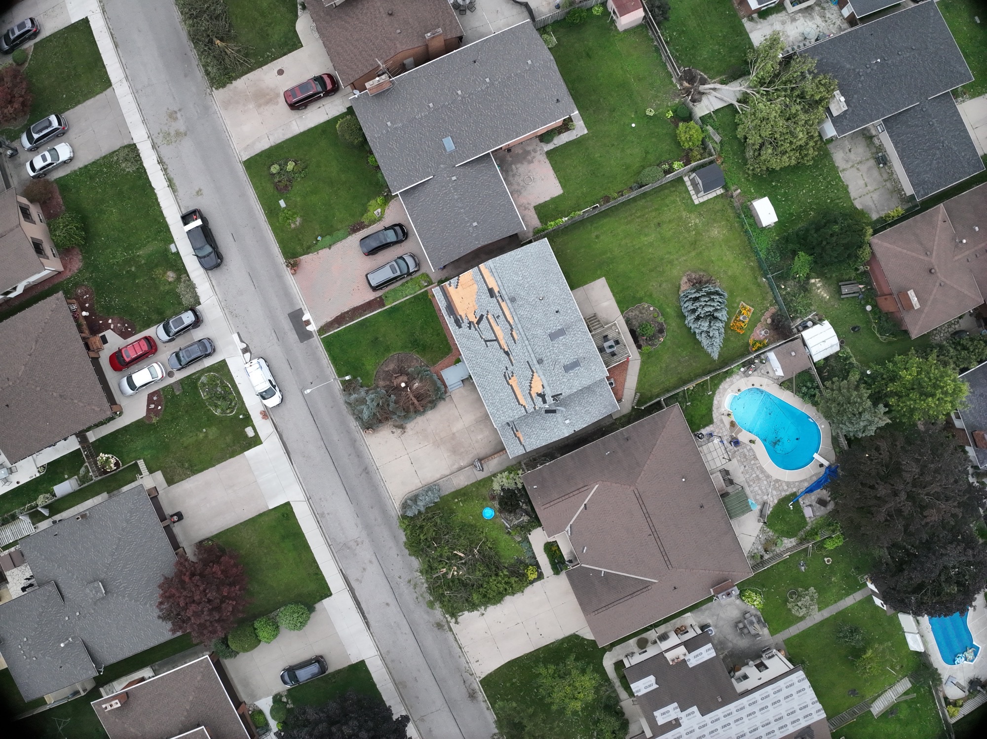
Drone image showing tree and roof damage on Northway Ave.
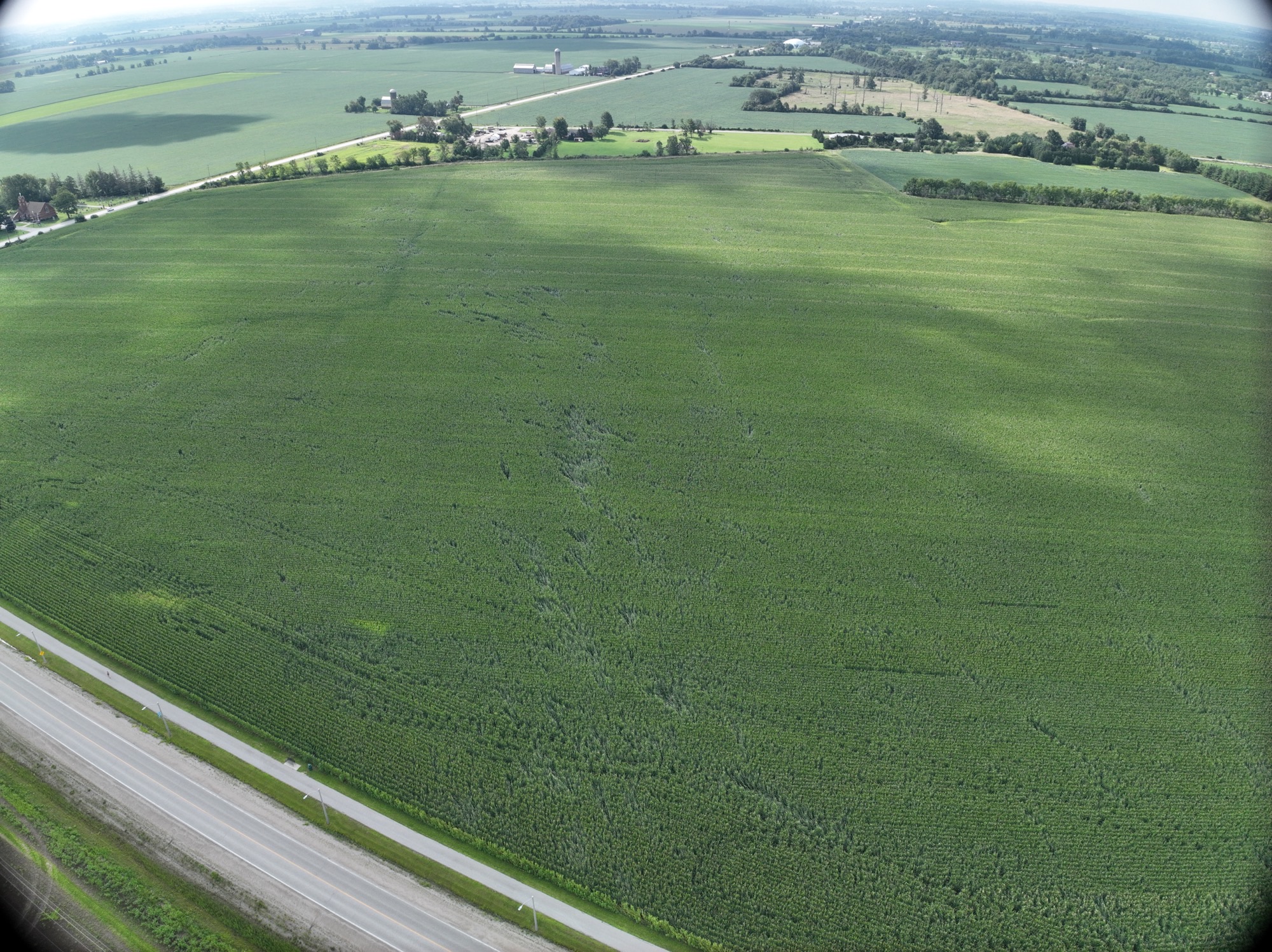
Drone image showing tornado damage through crops.
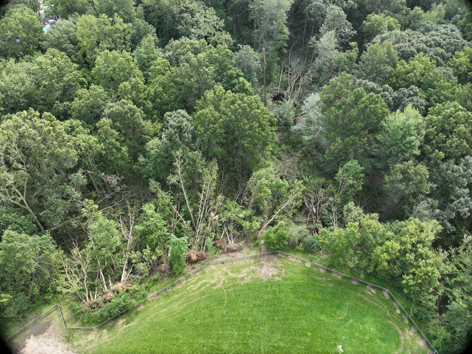
Drone image showing multiple trees uprooted along damage path.