August 5-6 storms in SW ON bring tornadoes, downbursts
NTP investigation, including NTP ground / drone surveys, has confirmed that the August 5-6 storms in southwestern ON brought weak tornadoes and downbursts. On the afternoon of August 5th, EF0 downbursts occurred in New Scotland (near Rondeau Prov. Park) and Jaffa (near Aylmer). And on the afternoon of August 6th, one storm produced two EF0 tornadoes - one at Muirkirk and one at New Glasgow.
Details are provided in the event summaries below along with maps and photos. The events can be plotted on a map via the NTP Dashboard here.
====
Event Name: New Scotland, ON
Date: August 5, 2024
Start Time: 1:15 PM EDT (1715 UTC)
Final Classification: Downburst
Final EF-Scale Rating: EF0
EF-Scale Damage Indicator / Degree of Damage: SBO/DOD-4
Location of worst damage: 42.3567N, 81.8746W
Description: Tree damage and roof damage to a barn was reported in the New Scotland and Rondeau Park areas after a storm passed through. No injuries were reported. An NTP ground and drone survey was completed on August 9, 2024 documenting intermittent damage over an area approximately 0.6 km long and up to 3.9 km wide. Damage assessed as EF0 downburst, with an estimated max. wind speed of 125 km/h. Start time is radar estimated. Satellite imagery review is pending.
Event Name: Jaffa, ON
Date: August 5, 2024
Start Time: 2:25 PM EDT (1825 UTC)
Final Classification: Downburst
Final EF-Scale Rating: EF0
EF-Scale Damage Indicator / Degree of Damage: FR12/DOD-2
Location of worst damage: 42.7436N, 81.0077W
Description: Tree damage was reported in the Jaffa area (near Aylmer) after a storm passed through. No injuries were reported. An NTP ground and drone survey was completed on August 9, 2024 documenting intermittent damage over an area approximately 9.8 km long and up to 2.5 km wide, including structural damage (shingle, fascia and siding loss) to a few homes and farm buildings. Satellite imagery review reveal some visible tree damage. Damage assessed as EF0 downburst, with an estimated max. wind speed of 125 km/h. Start time is radar estimated.
Event Name: Muikirk, ON
Date: August 6, 2024
Start Time: 12:00 PM EDT (1600 UTC)
Final Classification: Tornado (Over Land)
Final EF-Scale Rating: EF0
EF-Scale Damage Indicator / Degree of Damage: C-T/DOD-3
Start of damage track: 42.5411N, 81.8257W
End of damage track: 42.5240N, 81.6987W
Location of worst damage: 42.5288N, 81.7386W
Description: Tree damage was reported in the Muikirk and Duart areas after a storm passed through. No injuries were reported. An NTP ground and drone survey was completed on August 9, 2024, documenting a narrow path of tree damage starting northwest of Muikirk. Satellite imagery review revealed some isolated visible damage. Damage assessed as EF0 tornado, with an estimated max. wind speed of 115 km/h, track length of 10.6 km and max. path width of 430 m. Tornado motion was from the W (approx. 280 degrees). Event time is radar estimated. A second EF0 tornado developed east of the end of this tornado track near New Glasgow.
Event Name: New Glasgow, ON
Date: August 6, 2024
Start Time: 12:10 PM EDT (1610 UTC)
Final Classification: Tornado (Over Land)
Final EF-Scale Rating: EF0
EF-Scale Damage Indicator / Degree of Damage: C-T/DOD-3
Start of damage track: 42.5261N, 81.6503W
End of damage track: 42.5205N, 81.6223W
Location of worst damage: 42.5226N, 81.6254W
Description: Tree damage was reported in the New Glasgow area (south east of Rodney) after a storm passed through. No injuries were reported. An NTP ground and drone survey was completed on August 9, 2024, documenting a narrow path of tree damage starting northwest of New Glasgow. Satellite imagery review revealed some isolated visible damage. Damage assessed as EF0 tornado, with an estimated max. wind speed of 115 km/h, track length of 2.35 km and max. path width of 180 m. Tornado motion was from the WNW (approx. 285 degrees). Event time is radar estimated. An earlier tornado developed northwest of this tornado near Muikirk, also causing EF0 damage.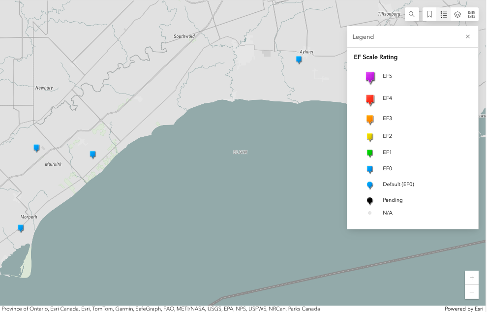
Regional map showing the locations of the two EF0 downbursts from August 5 (shown near Morpeth and Aylmer) and the two EF0 tornadoes (near Muirkirk) from August 6.
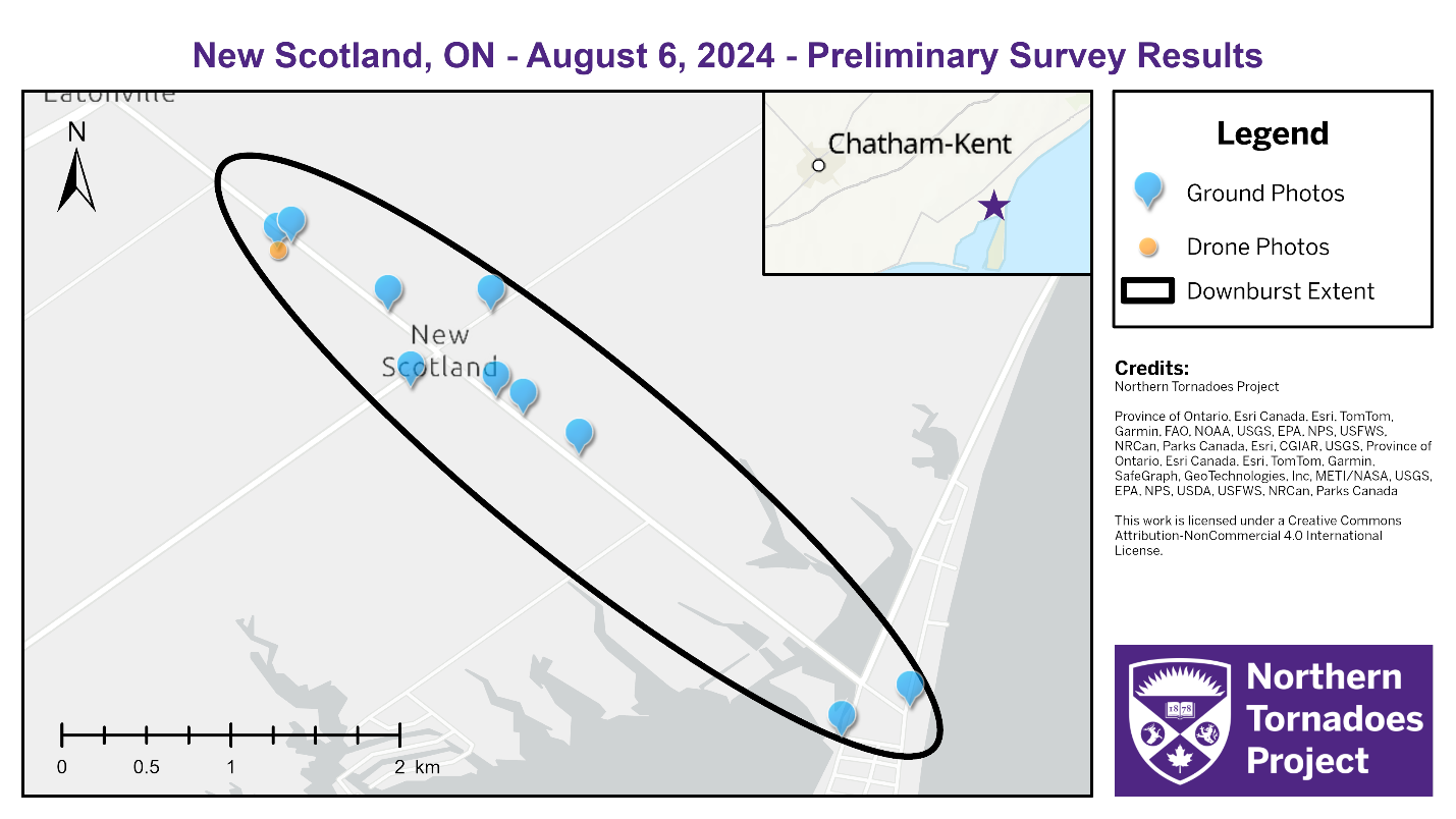
Survey map showing the extent of the EF0 downburst and locations of ground and drone photos.
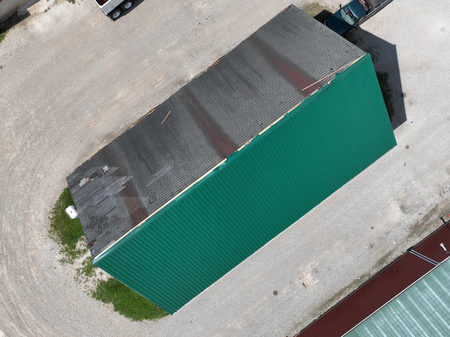
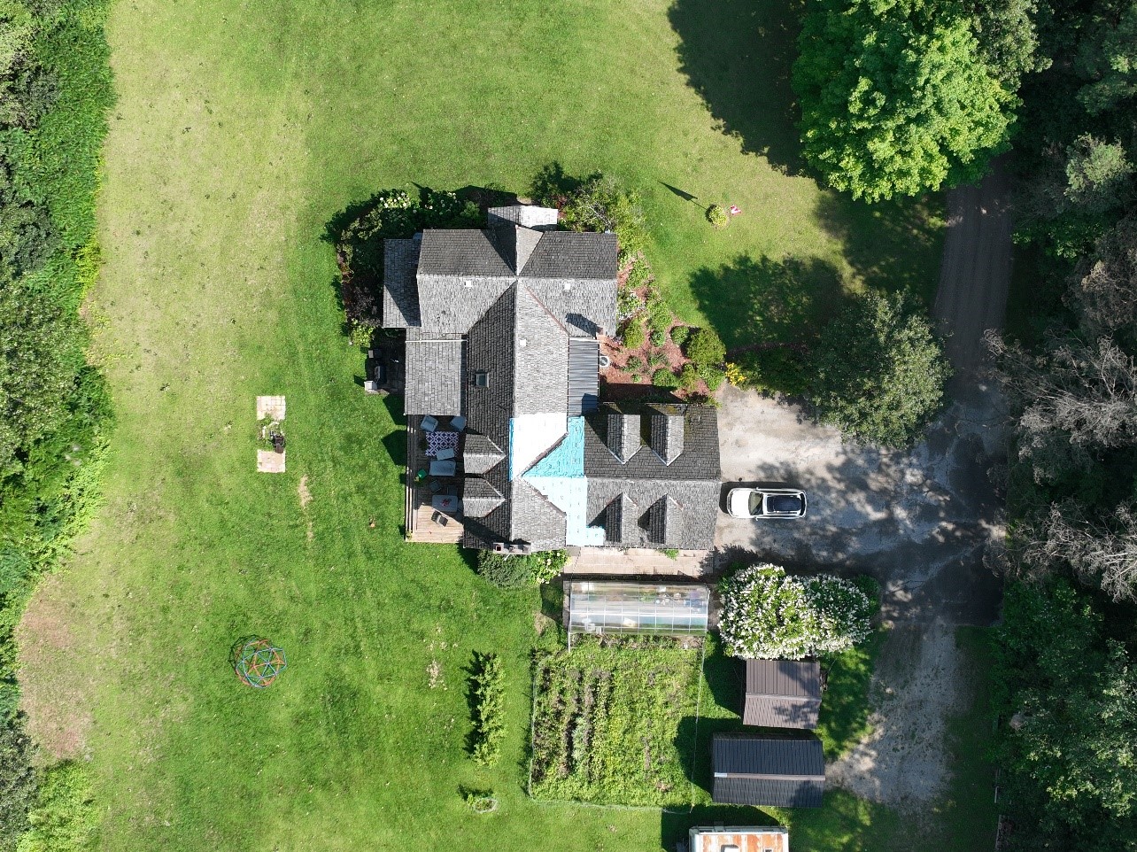
Drone photo of the worst damage point. One side of metal roofing was lost and thrown downwind but the old asphalt roof remains.
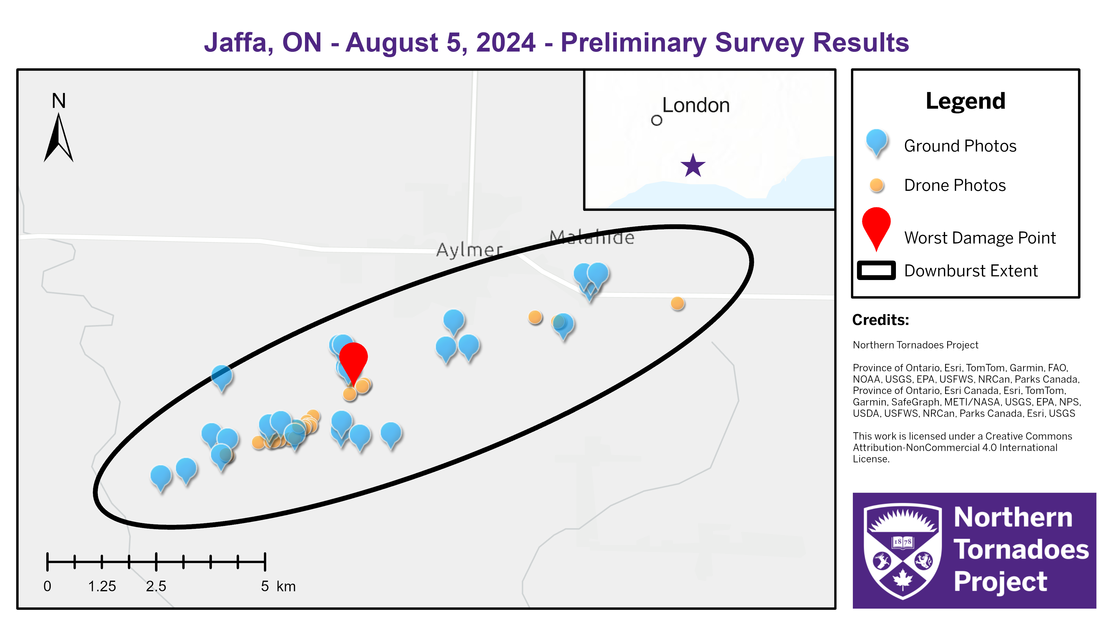
Survey map showing the extent of the EF0 downburst and locations of ground and drone photos. Jaffa is not shown on the map but is near the SW end of the downburst.
Drone photo of worst damage; shingle loss up to 20% on a 2-story family residence.
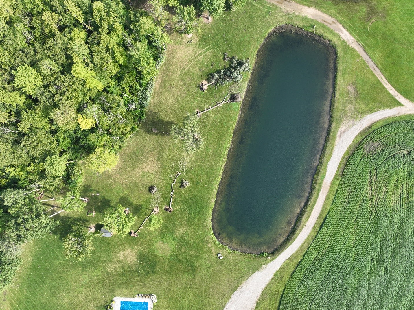
Drone photo showing several healthy trees uprooted and falling mostly to the NE - the same direction as storm motion.
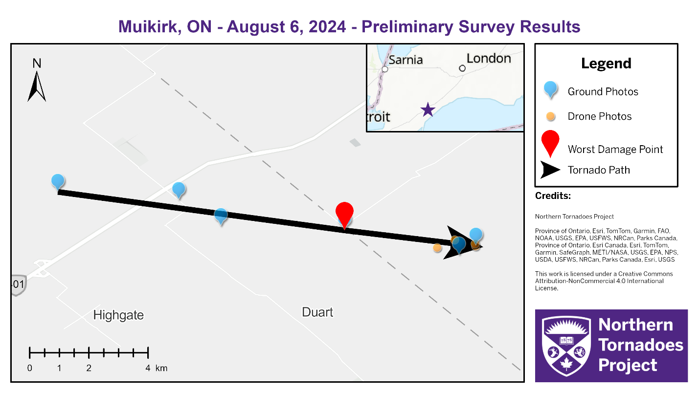
Survey map showing the track of the EF0 tornado and locations of ground and drone photos. Muirkirk is not shown on the map but is located to the south of the first third of the tornado track.
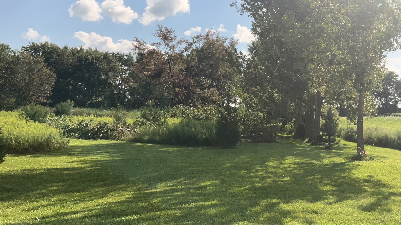
Ground photo of worst damage point with two healthy trees uprooted.
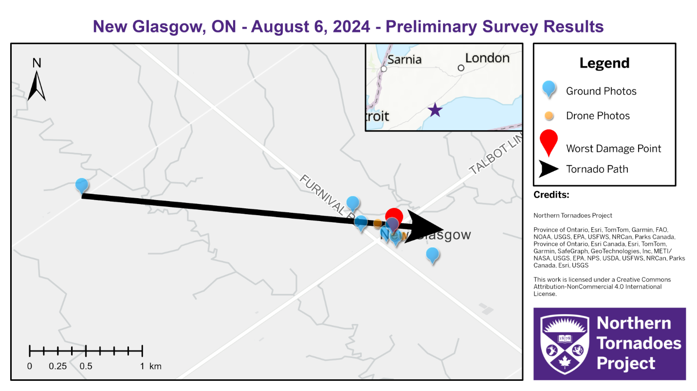
Survey map showing the track of the EF0 tornado and locations of ground and drone photos.
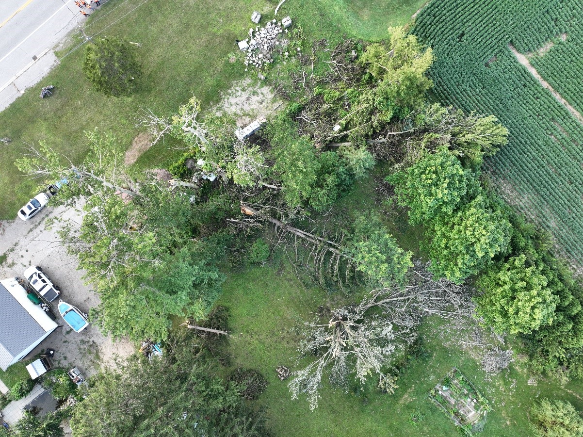
Drone photo of point of worst damage; several trees snapped and uprooted in different directions. This is representative of the high damage gradient along the tornado's damage path – other trees and structures nearby were unaffected.