EF0 tornado at Melancthon, ON on June 22
NTP investigation, including a thorough ground and drone survey, has confirmed the occurrence of an EF0 tornado at Melancthon, ON on June 22. The tornado resulted in snapped and uprooted trees but it also caused damage to a wind turbine.
Full details are provided in the event summary, along with maps and photos. The tornado can also be plotted using the NTP Dashboard here.
====
Event Name: Melancthon, ON
Date: June 22, 2024
Start Time: 2:00 PM EDT (1800 UTC)
Final Classification: Tornado (Over Land)
Final EF-Scale Rating: EF0
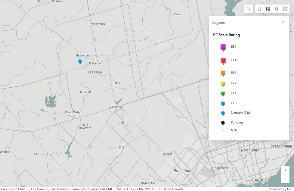
EF-Scale Damage Indicator / Degree of Damage: C-T/DOD-3
Start of damage track: 44.0741N, 80.2789W
End of damage track: 44.0665N, 80.2655W
Location of worst damage: 44.0726N, 80.2740W
Description: Damage to a wind turbine blade and trees was reported near Melancthon after a storm passed through the area. No injuries were reported. Satellite imagery revealed some isolated tree damage. An NTP ground and drone survey was completed on July 4, 2024, documenting the reported damage. Damage assessed as EF0 tornado, with an estimated max. wind speed of 115 km/h, track length of 1.37 km and max. path width of 140 m. Tornado motion was from the NW (approx. 310 degrees). Start time is radar estimated.
Regional map showing the start point for the EF0 tornado at Melancthon, ON.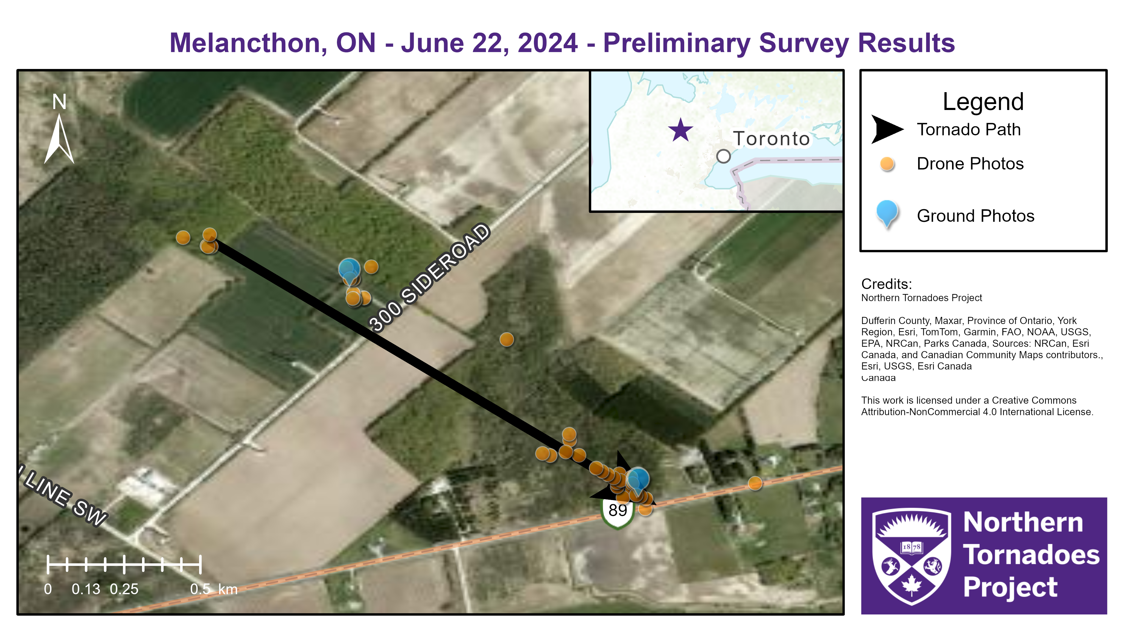
Survey map showing the path of the tornado and points where data were gathered.
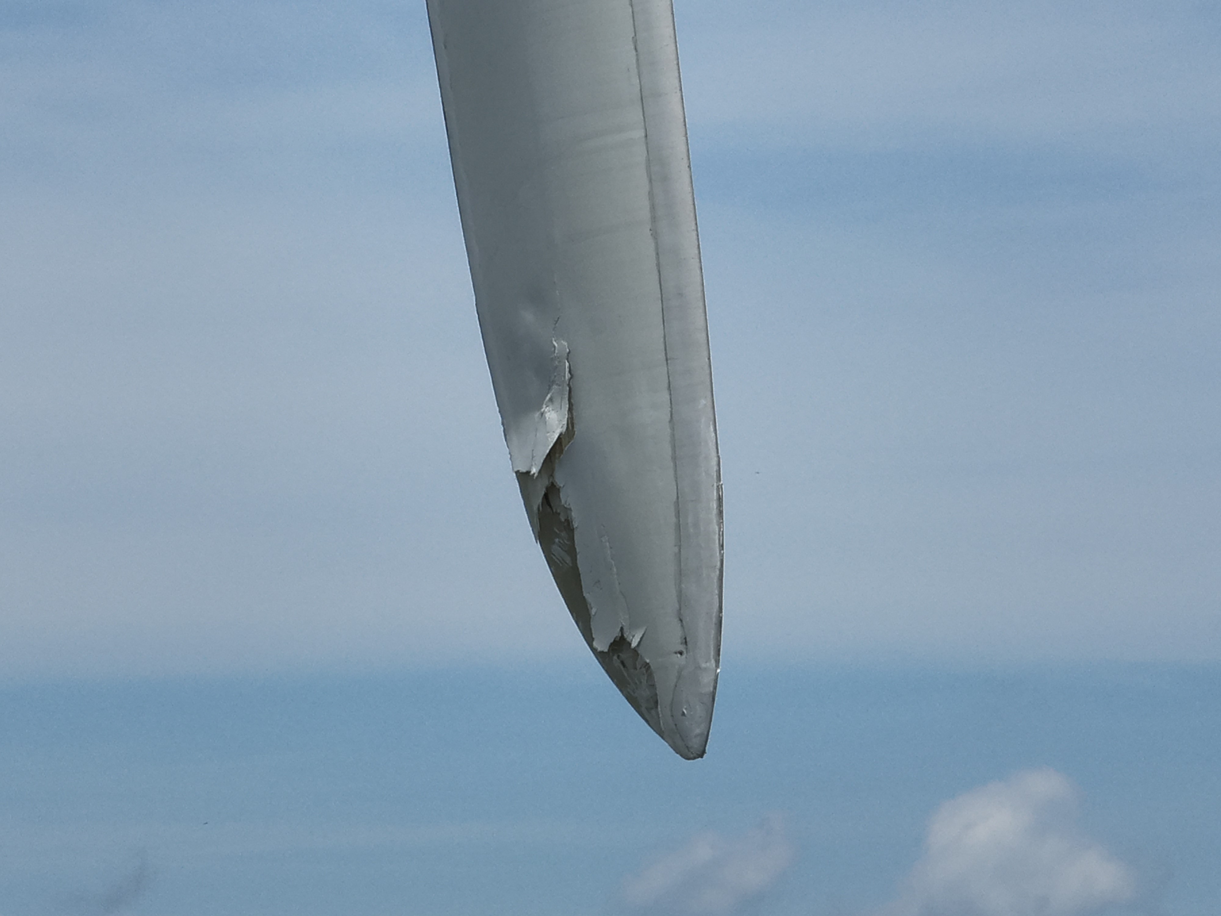
Drone photo of one of the damaged wind turbine blades.
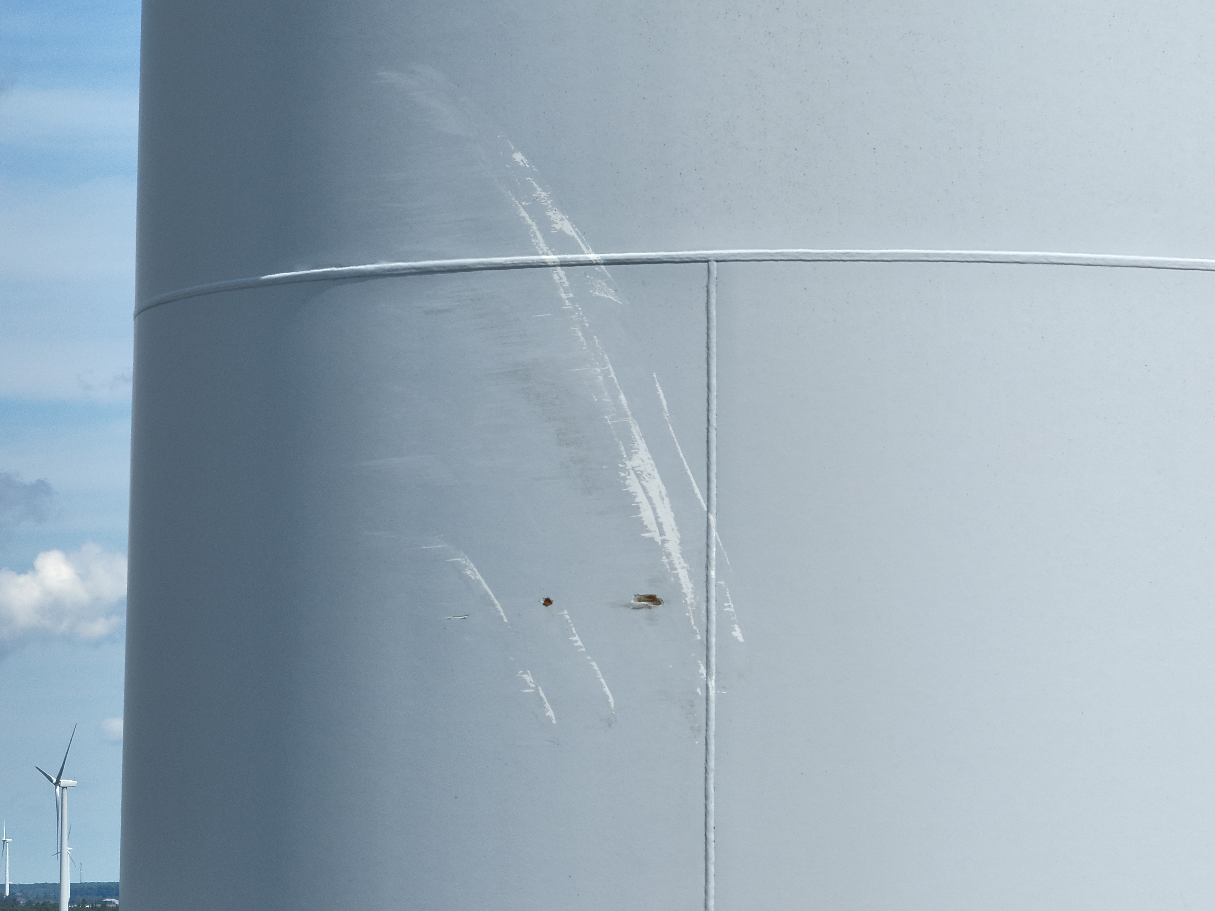
Drone photo of the wind turbine pedestal damaged when the blades briefly made contact due to the force of the tornadic winds.
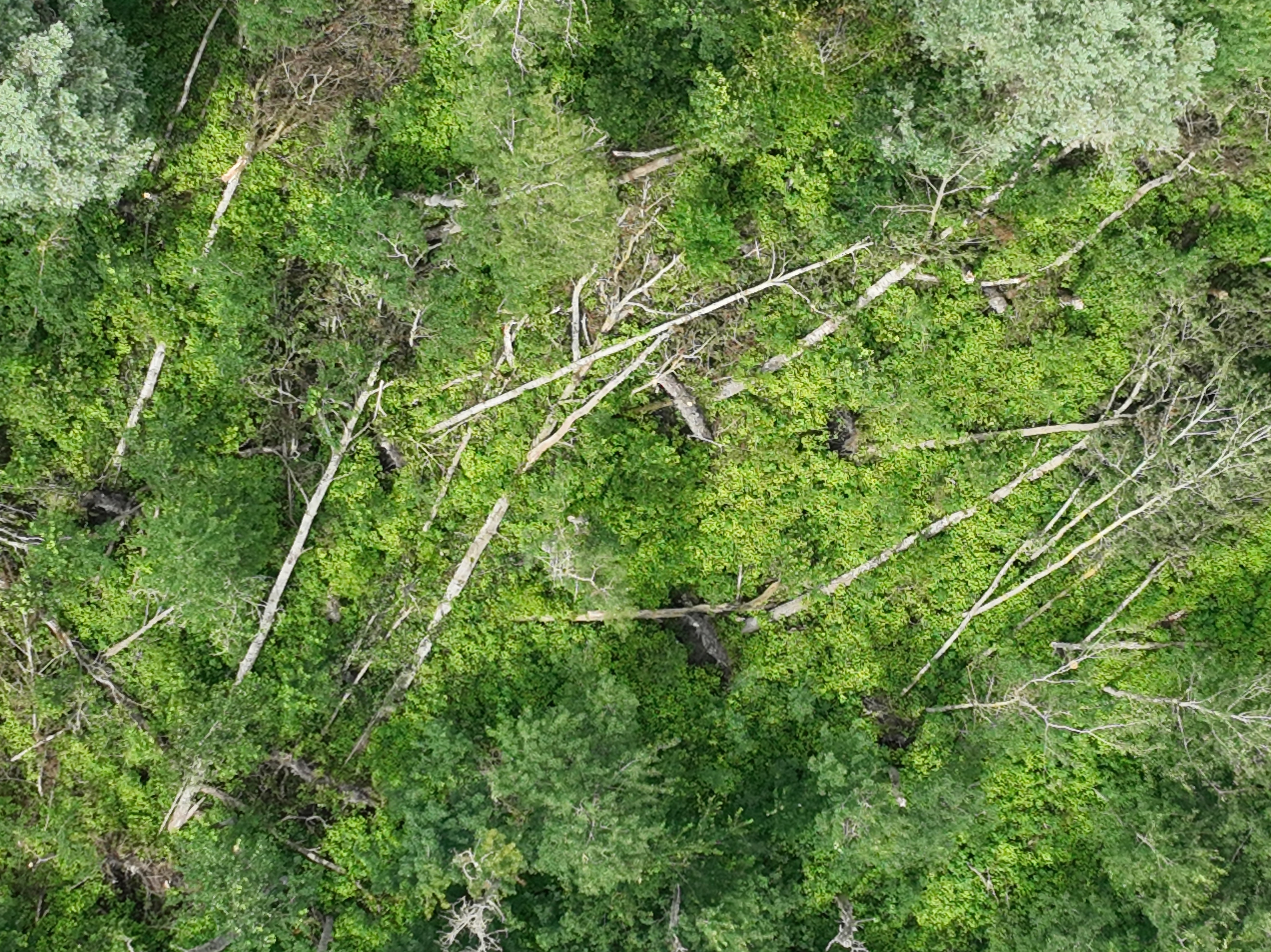
A drone photo showing trees uprooted and snapped by the tornado.

A ground photo showing uprooted trees.