EF0 tornado at Spencerville, ON on June 6
A June 6 tornado at Spencerville, ON has been confirmed by the NTP and the damage rated at EF0. After an initial report from NTP Super-Contributor Francis Lavigne-Theriault, an NTP ground/drone survey team conducted an investigation on June 7 in the Spencerville area and documented ground scouring through agricultural fields and numerous trees uprooted or snapped along a narrow path.
The event summary is provided below, along with a survey map and associated photos. The tornado can also be plotted on the NTP main dashboard here.
====
Event Name: Spencerville, ON
Date: June 6, 2024
Start Time: 3:35 PM EDT (1935 UTC)
Final Classification: Tornado (Over Land)
Final EF-Scale Rating: EF0
EF-Scale Damage Indicator / Degree of Damage: C-T/DOD-3
Start of damage track: 44.8174N, 75.5744W
End of damage track: 44.8465N, 75.5008W
Location of worst damage: 44.8194N, 75.5647W
Description: A tornado caused weak tree and crop damage south of Spencerville, where a section of the damage track was documented by a private citizen. No injuries were reported. An NTP ground and drone survey was completed on June 7-8, 2024, investigating the reported damage. Damage assessed as EF0 tornado, with an estimated max. wind speed of 115 km/h, track length of 6.83 km and max. path width of 250 m. Tornado motion was from the WSW (approx. 240 degrees). Start time is radar estimated. Satellite imagery review is pending.
Map showing location of tornado within the region of eastern Ontario.
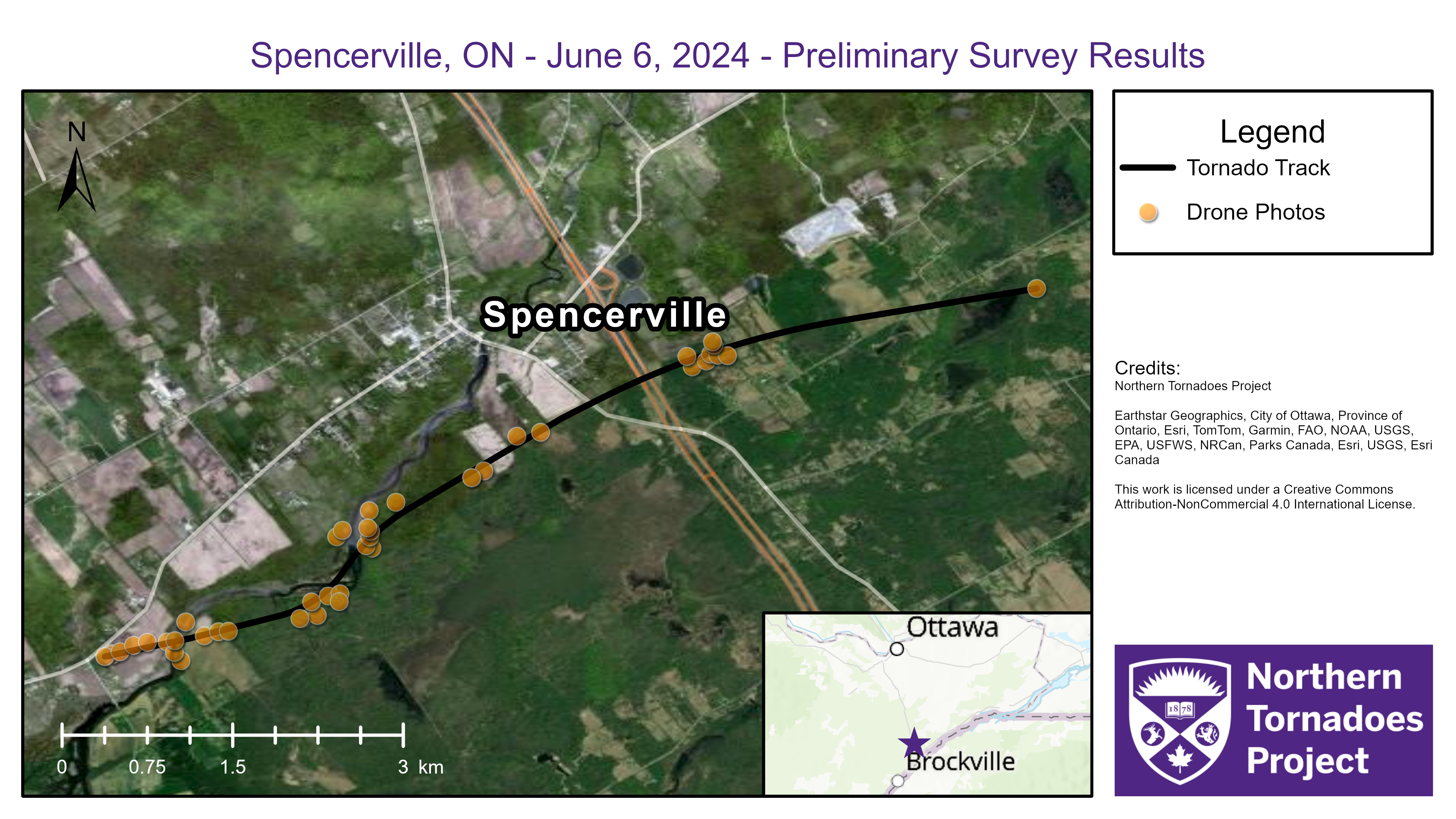
Survey summary map showing tornado track and locations of ground/drone observation points.
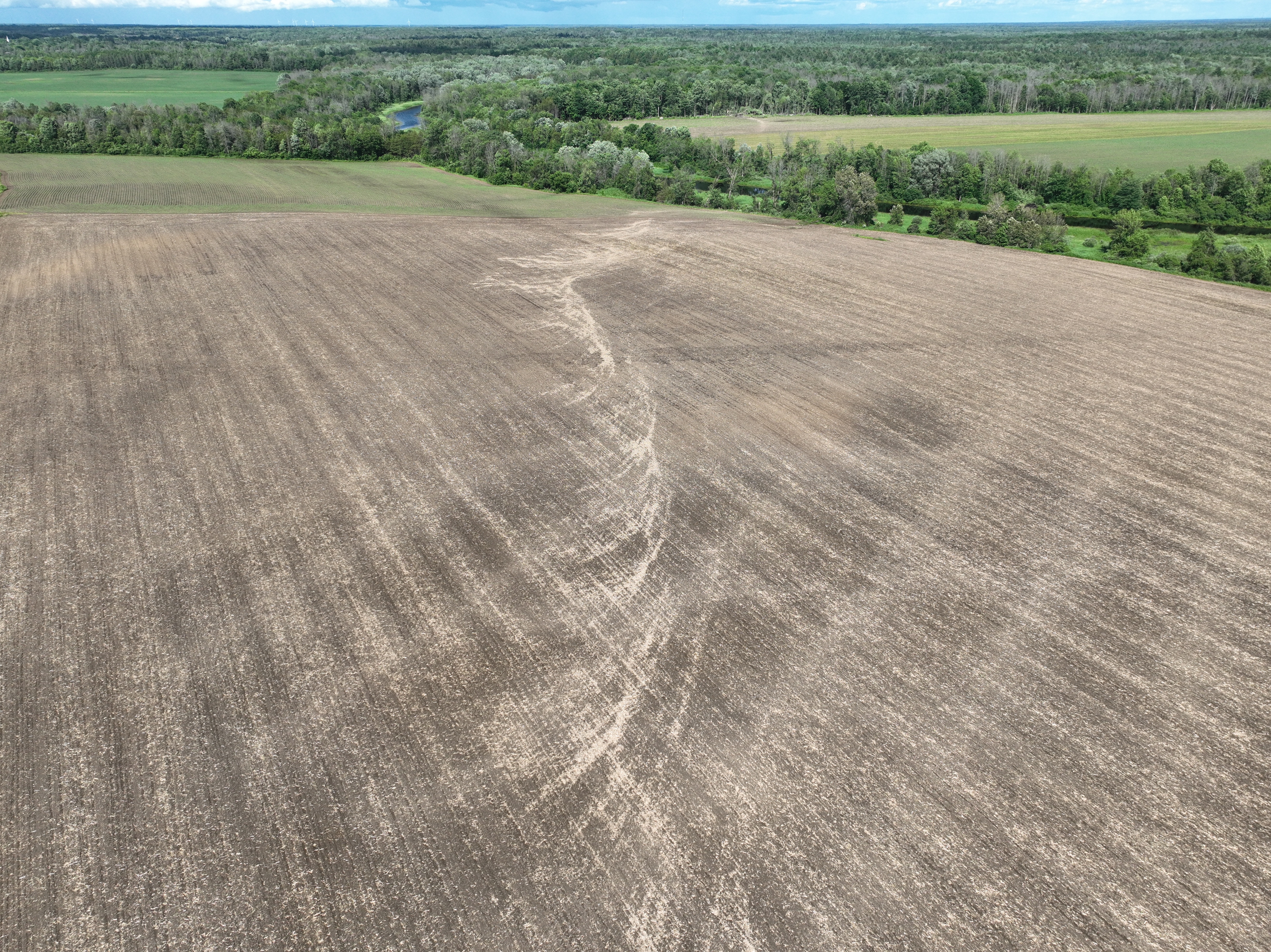
Drone photo showing field scouring produced by the tornado, looking down the track.

Drone photo showing field scouring leading to woodlot where numerous trees were uprooted or snapped.