EF1 tornado in eastern ON on July 24
NTP investigation, including a thorough ground / drone survey, has confirmed an EF1 tornado near Perth in eastern Ontario on July 24. Damage to structures and trees was reported at properties from the Christie Lake area to south of Rideau Ferry ending near Jasper.
Details can be found in the event summary below, as well as maps and photos. The tornado can be plotted on a map using the NTP Dashboard here.
====
Event Name: Christie Lake - Jasper, ON
Date: July 24, 2024
Start Time: 7:25 PM EDT (2325 UTC)
Final Classification: Tornado (Over Land)
Final EF-Scale Rating: EF1
EF-Scale Damage Indicator / Degree of Damage: SBO/DOD-8
Start of damage track: 44.8110N, 76.4319W
End of damage track: 44.8350N, 75.9386W
Location of worst damage: 44.8192N, 76.3795W
Description: Witness captured video of a tornado at Christie Lake (southwest of Perth). Tree and structural damage at several properties was reported from the Christie Lake area to south of Rideau Ferry and ending near Jasper. No injuries were reported. An NTP ground and drone survey was completed on July 27-28, 2024 documenting the reported damage. Satellite imagery review revealed visible tree damage along the tornado track. Damage assessed as EF1 tornado, with an estimated max. wind speed of 150 km/h, track length of 39.2 km and max. path width of 600 m. Tornado motion was from the W (approx. 265 degrees). Start time based on radar.
Regional map showing the location of the EF1 tornado near Perth, ON on July 24.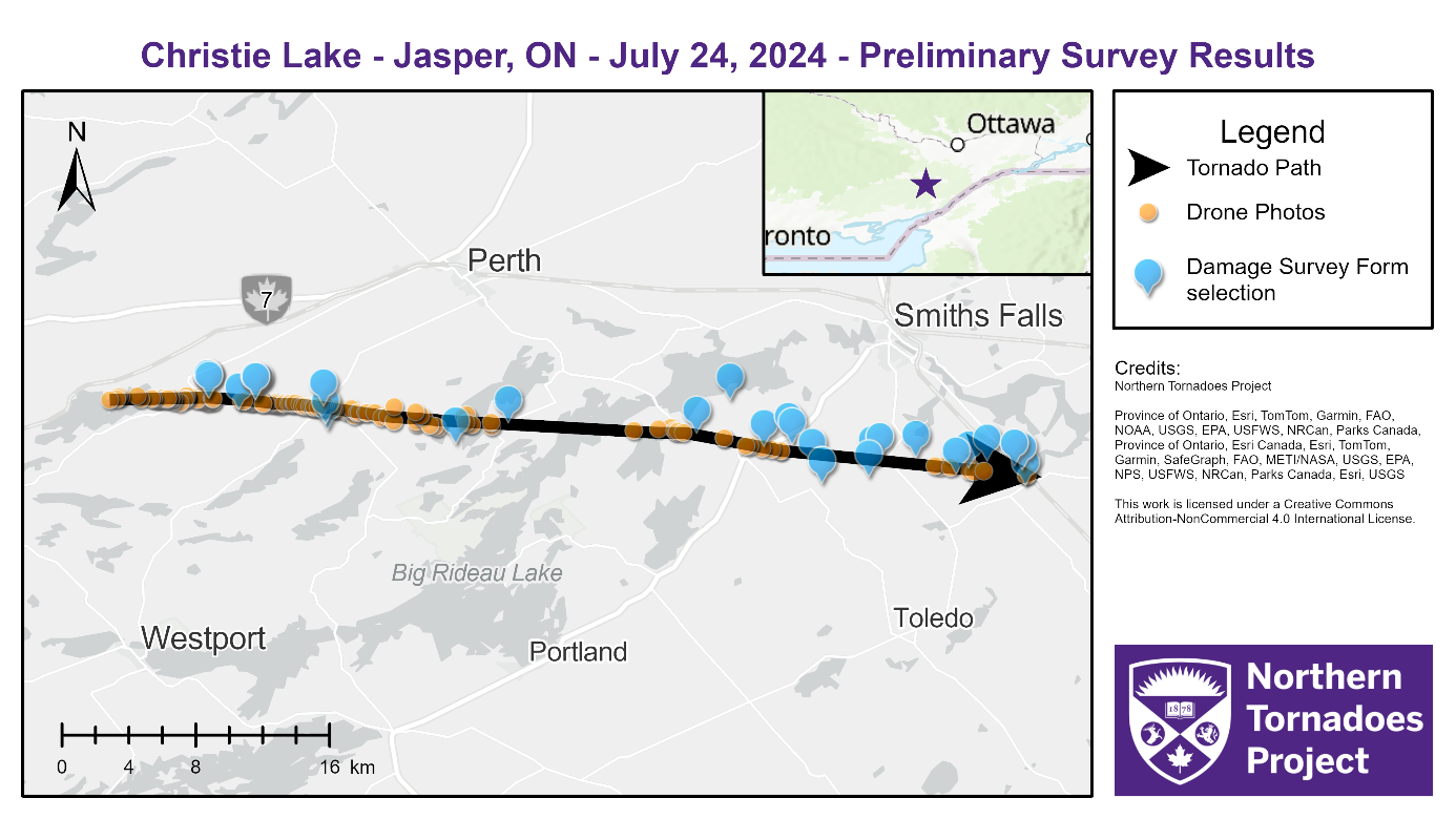
NTP survey map showing the path of the EF1 tornado with the locations of ground and drone photos.
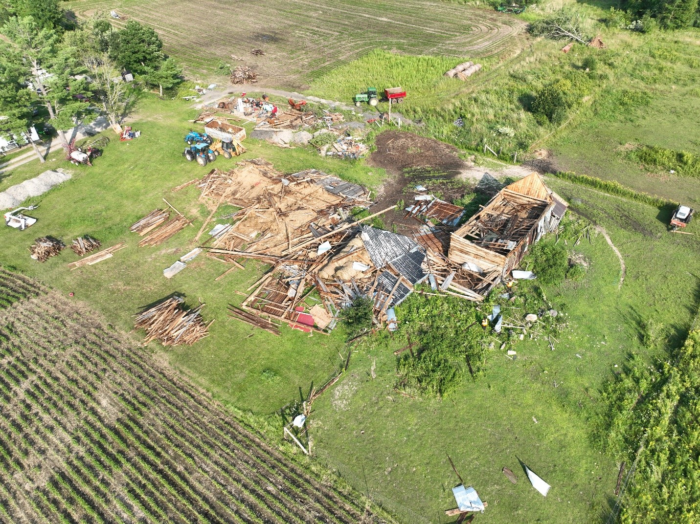
Drone photo of several barns and a shop damaged on one property where the worst damage was observed.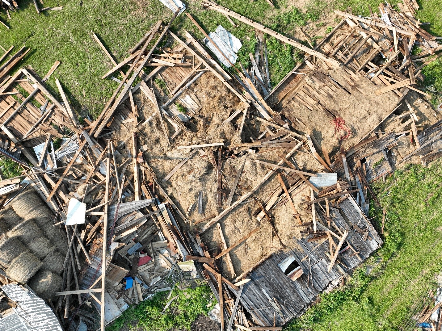
Nadir drone photo of one of the damaged structures in the previous photo.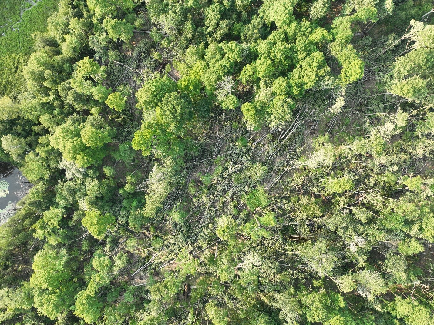
Drone photo of some of the worst tree damage along the tornado's path, located just west of Scotch Line where the worst tree damage was apparent in satellite imagery.