EF1 tornado in southern SK on Aug 24
An NTP investigation, including an NTP ground / drone survey, has determined that an EF1 tornado occurred in southern SK on August 24. The tornado developed at 4:30 AM local time near Arcola, resulting in a damage path 7.7 km long and 160 m wide. All of the documented damage was to trees, which were down in a convergent pattern. The tornado occurred along the leading edge of a line of storms.
Details are provided below in the event summary, along with maps and photos form the survey. The tornado can also be plotted on a map via the NTP Dashboard here.
====
Event Name: Arcola, SK
Date: August 24, 2024
Start Time: 4:30 AM CST (1030 UTC)
Final Classification: Tornado (Over Land)
Final EF-Scale Rating: EF1
EF-Scale Damage Indicator / Degree of Damage: C-T/DOD-4
Start of damage track: 49.7430N, 102.5233W
End of damage track: 49.7384N, 102.4178W
Location of worst damage: 49.7405N, 102.5061W
Description: Satellite imagery review revealed a tornado damage path in forested areas north of Arcola. An NTP ground and drone survey was completed on August 28, 2024, documenting the tree damage. Damage assessed as EF1 tornado, with an estimated max. wind speed of 150 km/h, track length of 7.71 km and max. path width of 160 m. Tornado motion was from the W (approx. 275 degrees). Start time is radar estimated.
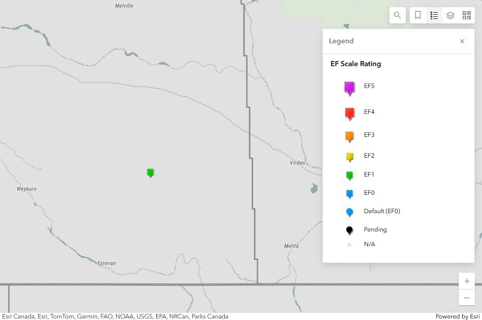
Regional map showing the location of the EF1 tornado at Arcola, SK.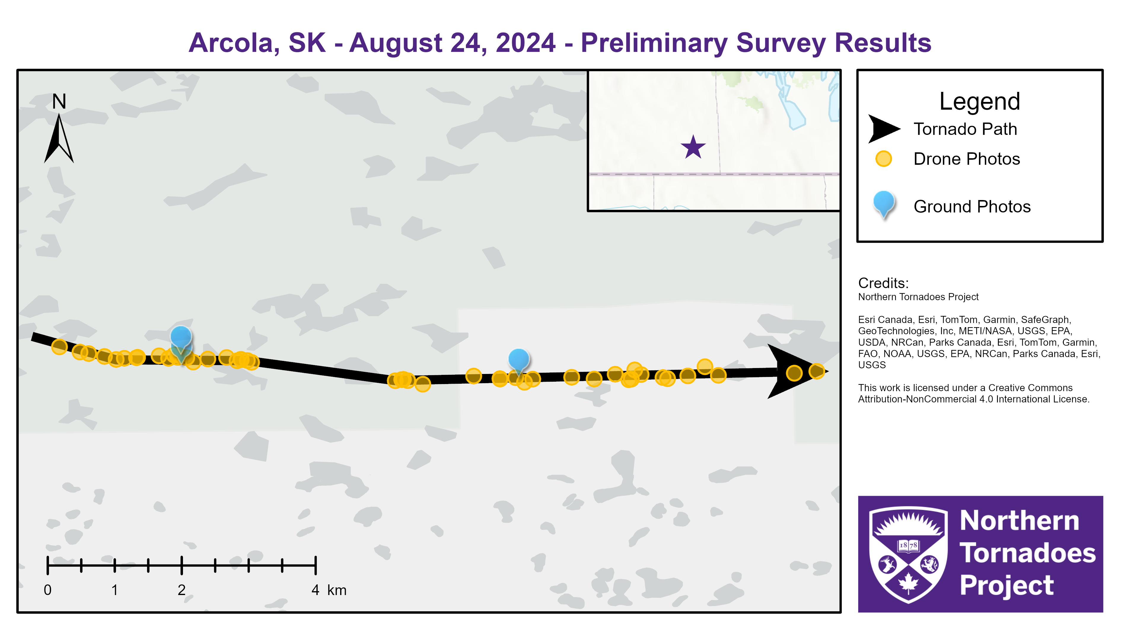
Survey map showing the track of the EF1 tornado as well as locations of ground and drone photos.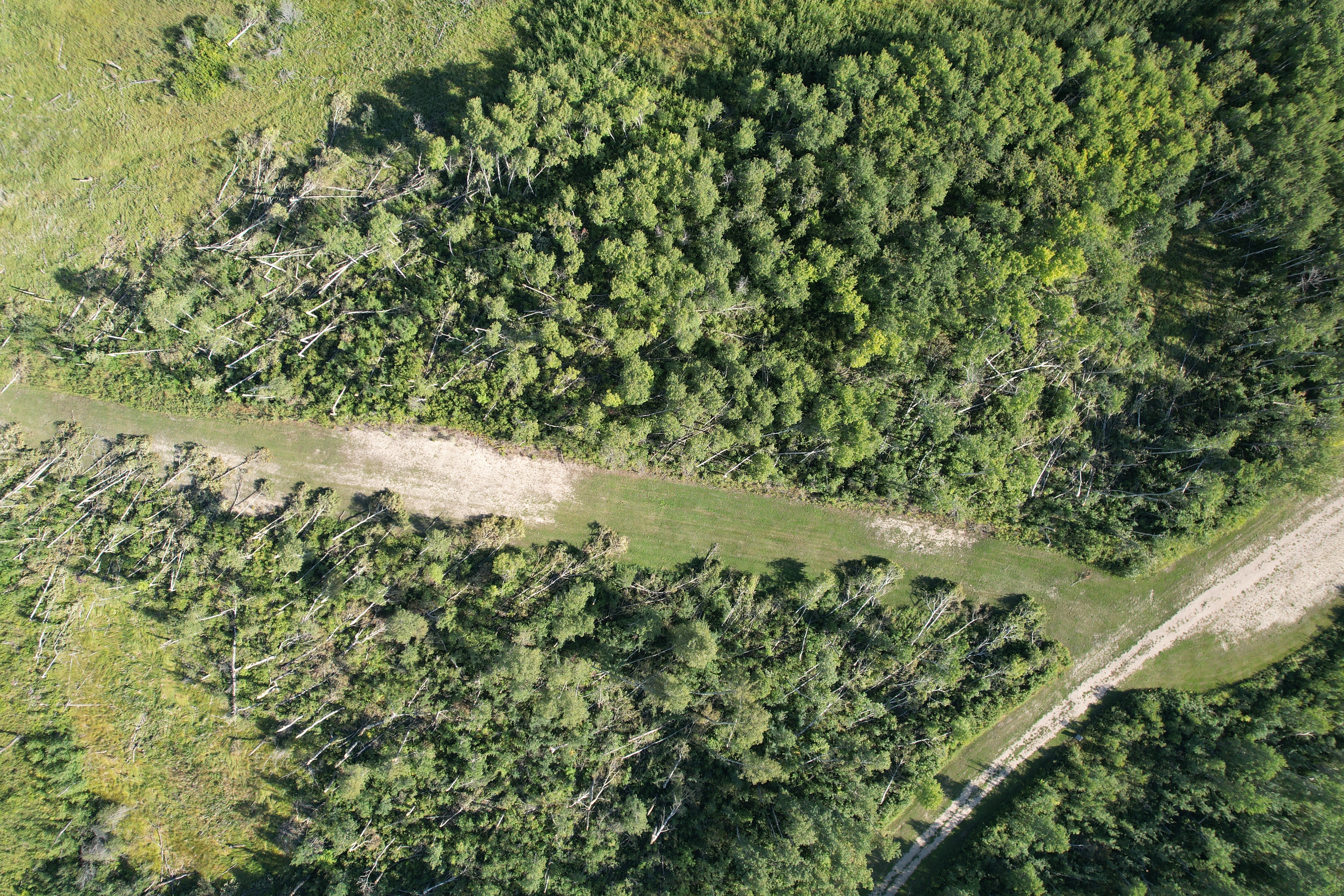
Drone photo showing the point along the tornado path with the worst tree damage.
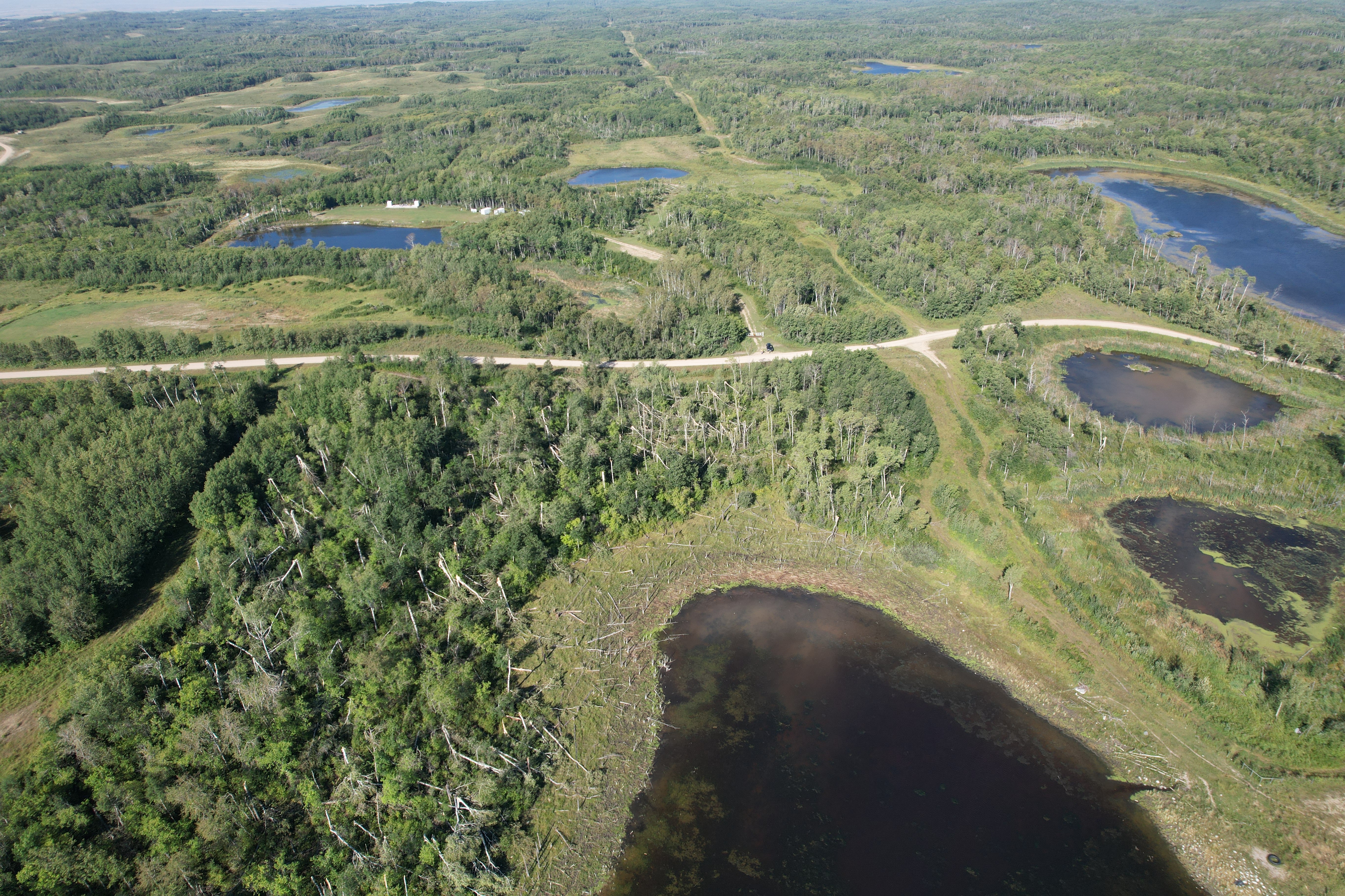
Drone oblique photo showing the tree damage along the widest part of the tornado path, just to the east of the worst recorded damage.
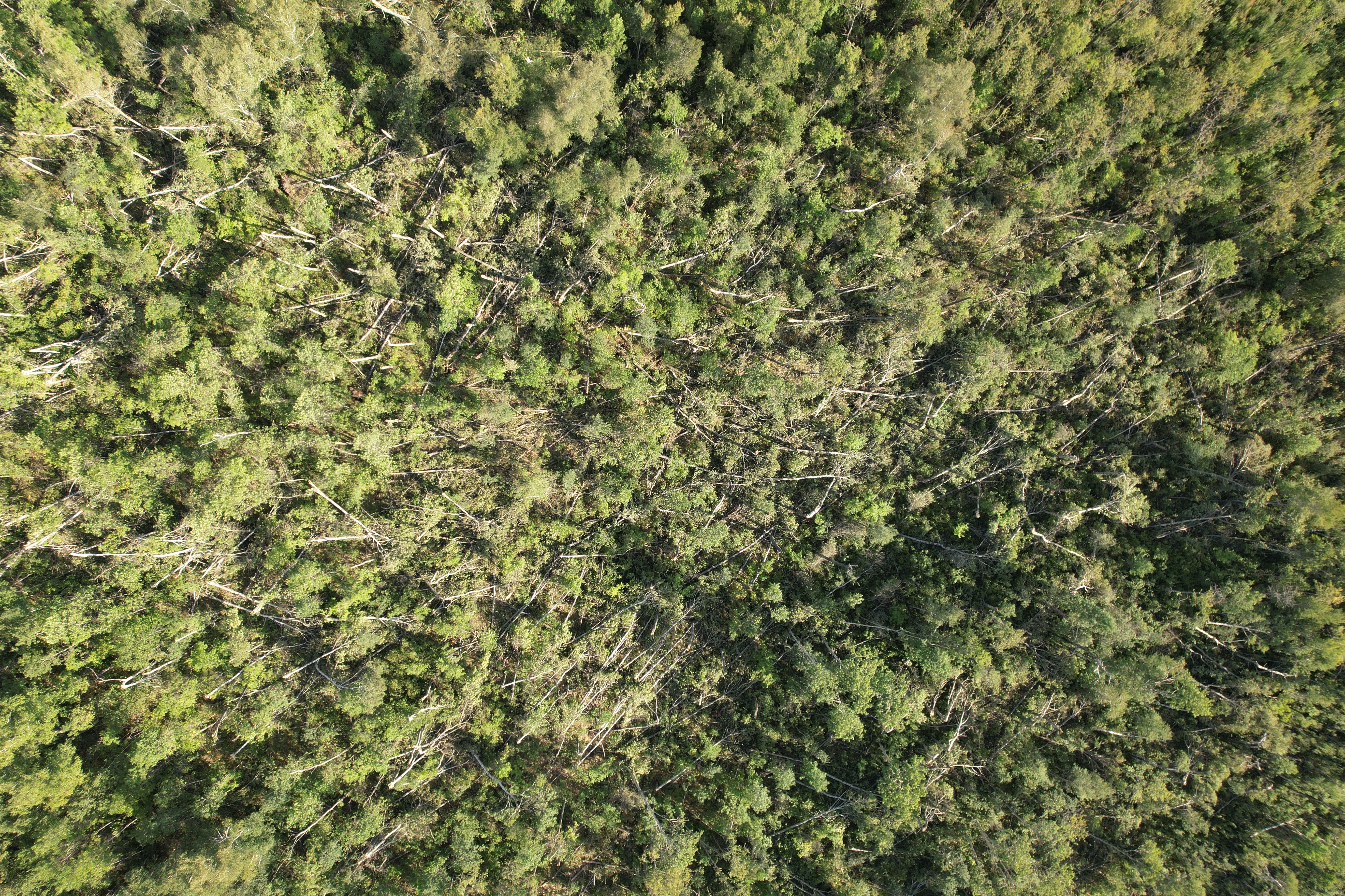
Drone nadir photo showing the convergent pattern in the downed trees.