EF2 Tornado in NW Ontario on June 4
An NTP investigation has found evidence of EF2 damage with a tornado in NW Ontario on June 4. Analysis of high-resolution satellite imagery revealed a long, narrow track of damage through the forest near Landings Lake, east of Ear Falls and well northeast of Dryden. At the moment, this is the only known damage from the numerous storms in NW Ontario that day. It appears that at least one of the other storms was most intense as it moved over water. Radar and satellite imagery analysis is ongoing.
The event summary for this tornado is provided below, along with a map, satellite imagery, and radar imagery. The tornado can also be plotted using the main NTP dashboard here.
====
Event Name: Landings Lake, ON
Date: June 4, 2024
Start Time: 6:35 PM CDT (2335 UTC)
Final Classification: Tornado (over land)
Final EF-Scale Rating: EF2
EF-Scale Damage Indicator / Degree of Damage: C-T/DOD-6
Start of damage track: 50.6402N, 92.3716W
End of damage track: 50.6911N, 92.3734W
Location of worst damage: 50.6782N, 92.3721W
Description: Satellite imagery review of a storm track of interest revealed tornado damage in forested areas near Landings Lake (north of Lac Seul). Tornado damage is assessed as EF2, with an estimated max. wind speed of 190 km/h, track length of 5.67 km and max. path width of 350 m. Tornado motion was from the S (approx. 180 degrees). Start time is radar estimated.
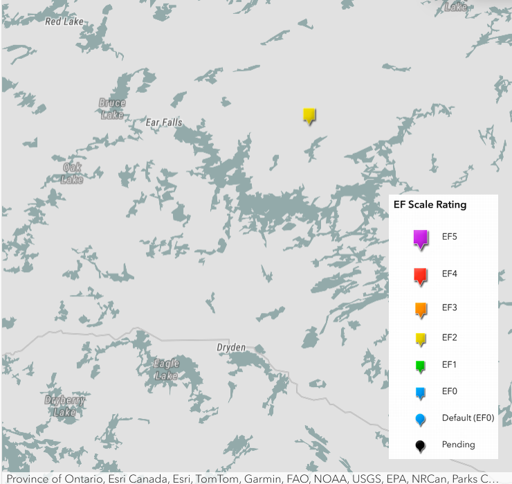
Regional map showing the location of the EF2 tornado.
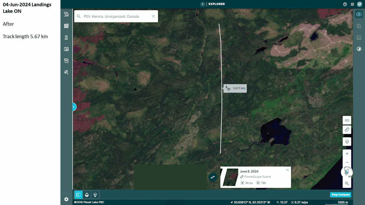
Satellite image loop showing the assessed tornado track, the 'after' image, then the 'before' image.
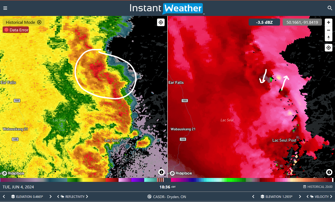
CASDR radar image showing QLCS with rotation embedded (white circle for reflectivity on left, arrows for velocity on right). A discrete cell out ahead of the line had just been absorbed by the line resulting in the area of rotation.