First QC tornado of 2024 at Rigaud
An NTP investigation has confirmed the first QC tornado of 2024 in the Rigaud area - just east of the ON border.
The tornado was initially confirmed based on video/photos plus radar. An NTP severe storm survey team began a ground / drone investigation starting the next afternoon and was able to document damage to a house, barns and farm silos over a 14.3 km path. The damage was consistent with a maximum wind speed of 155 km/h, which is the middle of the range for EF1 on the EF scale.
The event summary is included below, along with maps, survey photos and related radar imagery. The event can also be plotted using the NTP Dashboard here.
====
Event Name: Sainte-Justine-de-Newton, QC
Date: May 27, 2024
Start Time: 5:25 PM EDT (2125 UTC)
Final Classification: Tornado (Over Land)
Final EF-Scale Rating: EF1
EF-Scale Damage Indicator / Degree of Damage: FR12/DOD-4
Start of damage track: 45.4055N, 74.4248W
End of damage track: 45.5289N, 74.3728W
Location of worst damage: 45.4266N, 74.4181W
Description: Witnesses captured video and photos of a tornado in the Riguad area. Damage was reported at several properties, including roof damage to a home, damage to barns and a collapsed silo, and tree damage. No injuries were reported. An NTP ground and drone survey was completed on May 28-29, 2024, documenting a long narrow track of damage starting near Sainte-Justine-de-Newton. Damage assessed as EF1 tornado, with an estimated max. wind speed of 155 km/h, track length of 14.3 km and max. path width of 250 m. Tornado motion was from the SW (approx. 195 degrees). Start time is radar estimated. Satellite imagery review is pending.
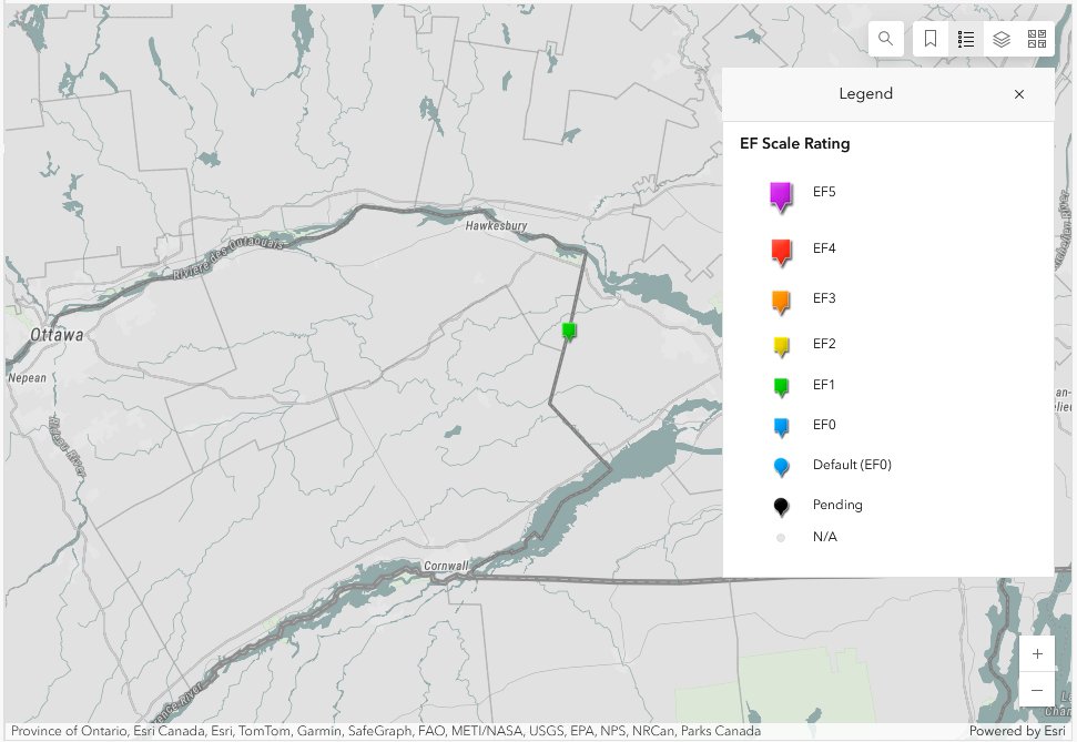
Map showing the start location of the EF1 tornado in Quebec just east of the Ontario border.
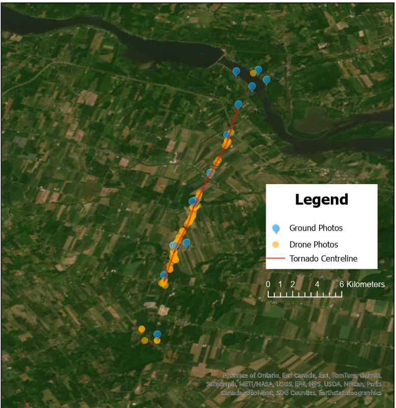
Survey map for the EF1 tornado.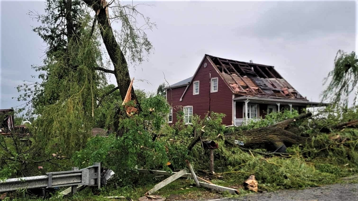
Photo of house damaged by tornado (submitted to NTP by homeowner)
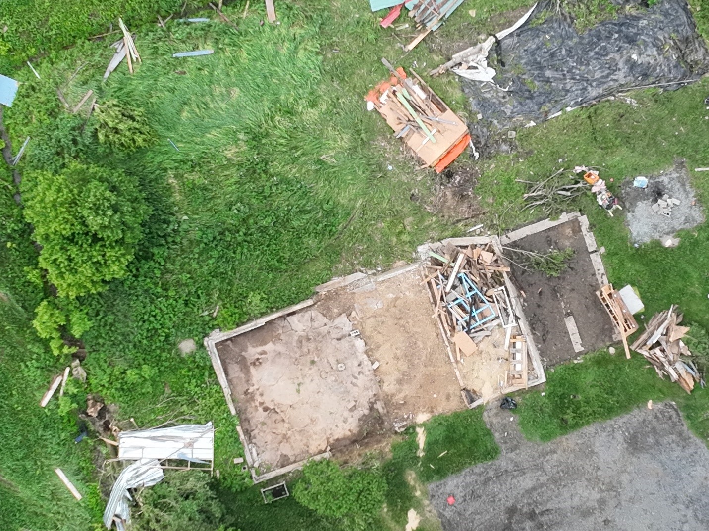
Drone image of farm outbuilding destroyed - SBO/DOD8 lower-bound wind speed used due to crumbling foundation.
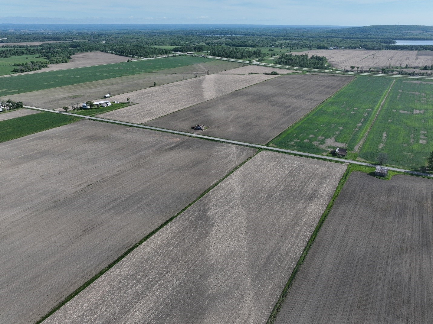
Ground scouring produced by the EF1 tornado as it moved across farm fields.
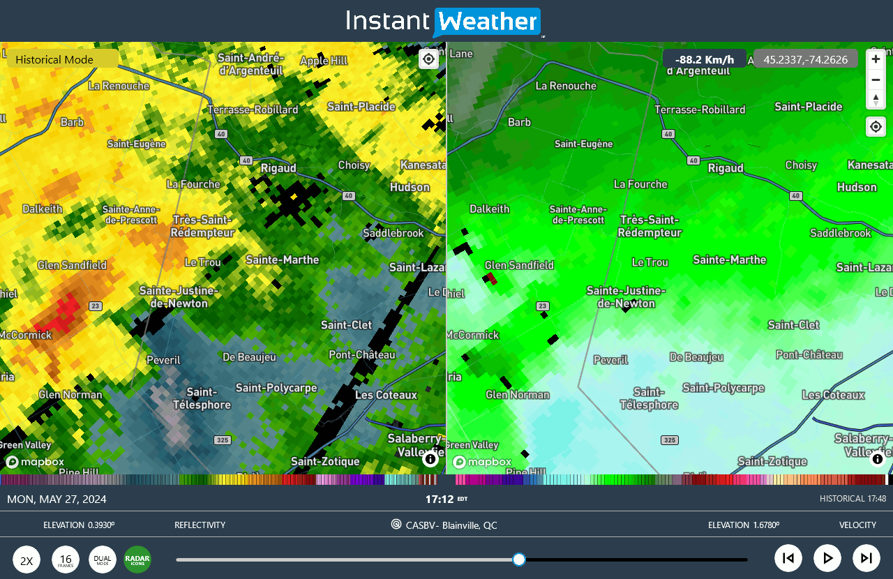
CASBV radar animation showing supercell storm moving toward the NNE that produced the EF1 tornado.