New 1980-2023 tornado data set and Advanced Dashboard
The Northern Tornadoes Project has completed work on both a new 1980-2023 tornado data set and a new Advanced Dashboard to view the data - two projects that have required lots of work by a dedicated group of people over the last several years.
First, the new data set. As has been reported here and in NTP Annual Reports, NTP staff have identified and assessed hundreds of tornadoes that had previously not been documented. Many of these occurred in forested areas of Canada and were found using historical satellite imagery, going all the way back to the early 1980s. NTP also revisited many significant tornadoes in the 1980-2016 period, before NTP began, in order to improve the assessment and documentation for these events using data not previously available.
Due to the large number of changes made, the original ECCC 30-year tornado database (1980-2009, found here) is now essentially obsolete, and the revised version will be published by NTP and viewable via the new Advanced Dashboard.
The NTP is also publishing a new 30-year tornado database that covers 1991 to 2020 (starting in 1991 rather than 1990 in order to match all other Canadian 30-year climatologies). This required the creation of event entries from scratch for the years 2010 to 2016. Records from ECCC forecast offices formed the basis of this new event documentation but, as mentioned previously, NTP also added many new records and revisited significant events - with historical satellite imagery being a key resource.
And of course, the NTP data set that has been available through our main dashboard (here) includes tornadoes from 2017 to 2023, and these have also been included in this larger historical database for completeness.
Later today, another blog post will look more closely at the new 1980-2009 database. Tomorrow, we'll focus on the new 1991-2020 database.
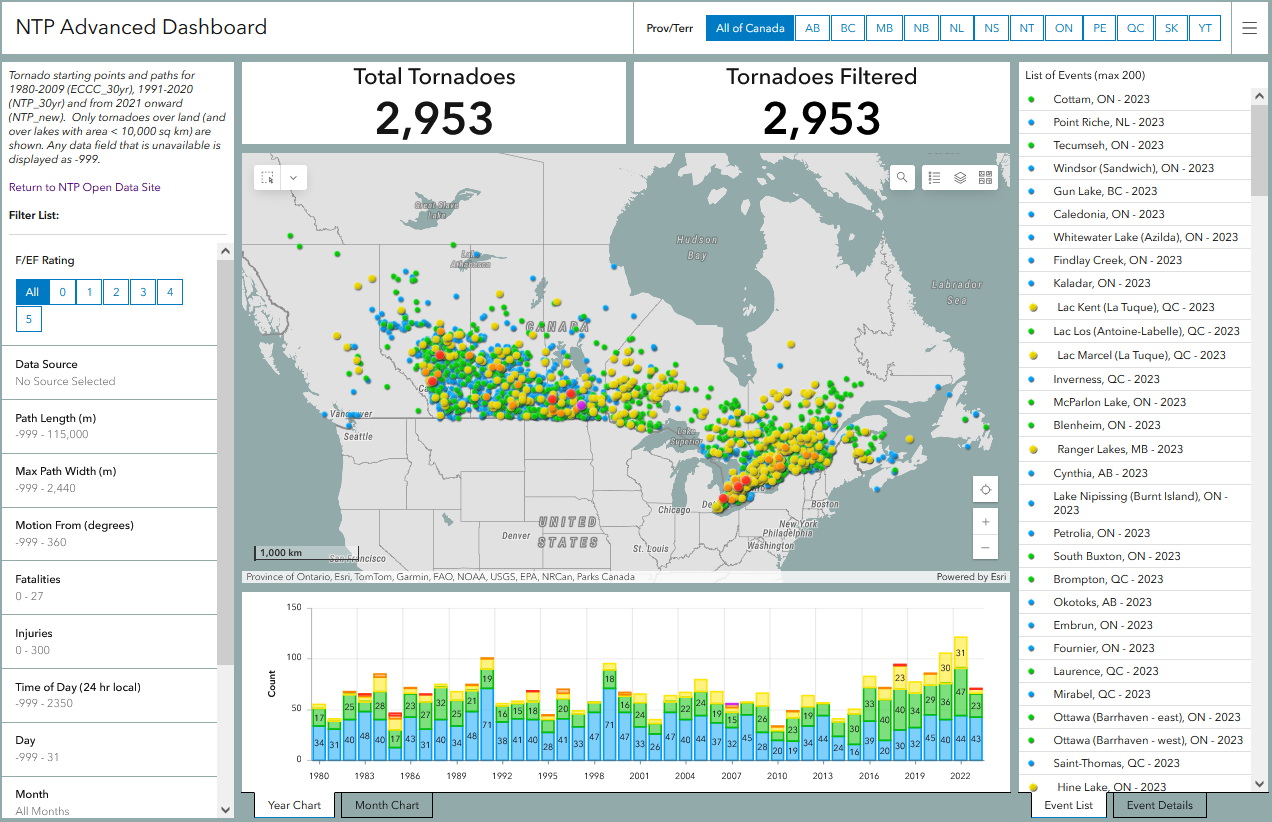
Second, the Advanced Dashboard. The NTP needed a second dashboard for viewing historical tornado data. But we've also added more features and funtionality - resulting in an Advanced Dashboard. This new Advanced Dashboard:
- plots the tornado starting point and the tornado path (where available)
- allows more complicated tornado paths to be rendered at a higher level of detail
- allows more extensive filtering of event data, including by tornado length, width, and related losses
- provides convenient charting to easily see changes over time and monthly averages
Unlike NTP's main dashboard, the Advanced Dashboard only plots Tornadoes (over land) and excludes Tornadoes (over water). This is done for consistency over the entire historical period since the NTP began including Tornadoes (over water) in tornado counts only since 2017.
Access to the Advanced Dashboard will require an account administered through Western University. Access will still be free and open, just managed a bit differently.
On Friday, we'll describe the Advanced Dashboard in more detail and provide instructions on how to create an account.
All this makes for a busy Emergency Preparedness Week!
See the image below for a preview of both the new data set and the Advanced Dashboard.
Now, on to the next blog post...
