ON/QC Waterspouts on June 26/27
The NTP has confirmed two Tornadoes (Over Water), also known as waterspouts. One waterspout occurred on Lake Erie off Port Burwell, ON on June 26. The other developed on the St. Lawrence River off Cap-Saint-Ignace, QC on June 27. Both have been assigned an EF0-Default rating.
Full details are provided in the event summaries below, as well as several maps. The events can also be plotted on a map using the NTP Dashboard here.
====
Event Name: L. Erie (Port Burwell), ON
Date: June 26, 2024
Estimated Start Time: 1:30 PM EDT (1730 UTC)
Final Classification: Tornado (Over Water)
Final EF-Scale Rating: EF0-Default
Estimated Tornado Location: 42.43N, 80.89W
Description: Witness in Port Burwell captured video of a waterspout over Lake Erie. No damage has been reported. Estimated start time is based on radar imagery.
Event Name: St. Lawrence River (Cap-Saint-Ignace), QC
Date: June 27, 2024
Estimated Start Time: 7:00 PM EDT (2300 UTC)
Preliminary Classification: Tornado (Over Water)
Preliminary EF-Scale Rating: EF0-Default
Estimated Tornado Location: 47.06N, 70.49W
Description: Witnesses captured video of a waterspout over the St. Lawrence River near Cap-Saint-Ignace. No damage has been reported. Further investigation pending, including satellite imagery review.
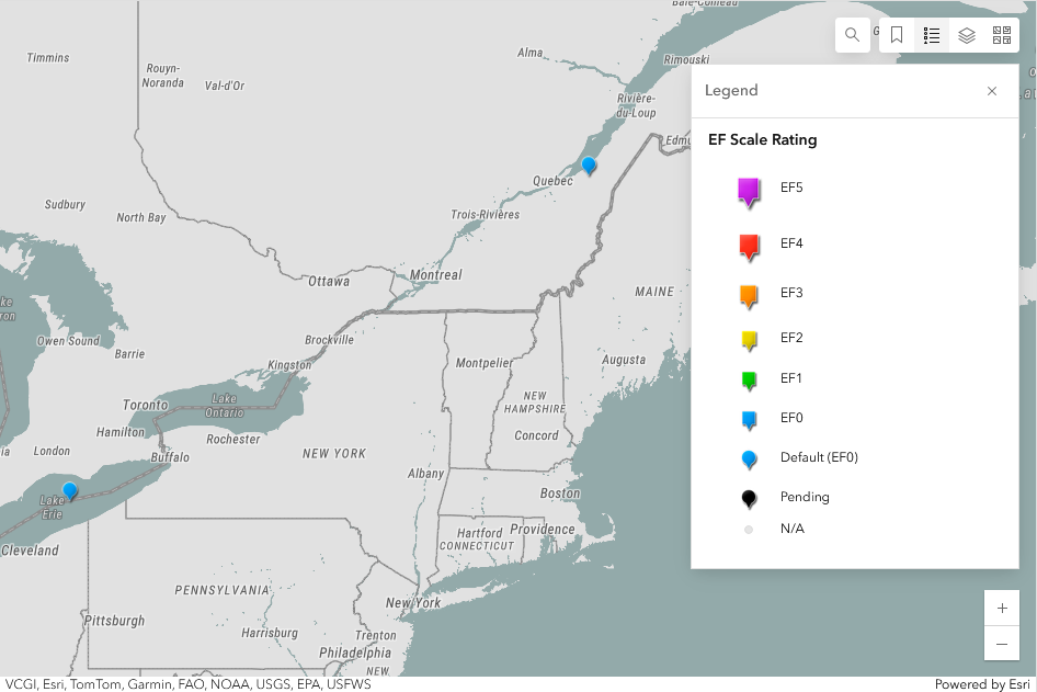
Zoomed out map of the two waterspouts in ON and QC.
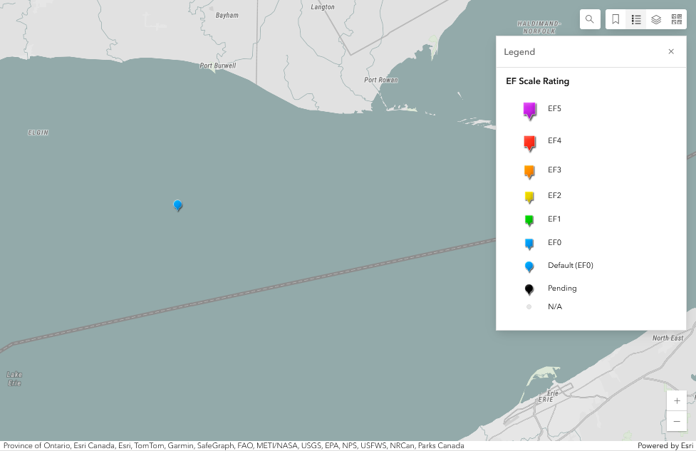
Regional map showing the estimated location of the waterspout over Lake Erie off Port Burwell, ON.
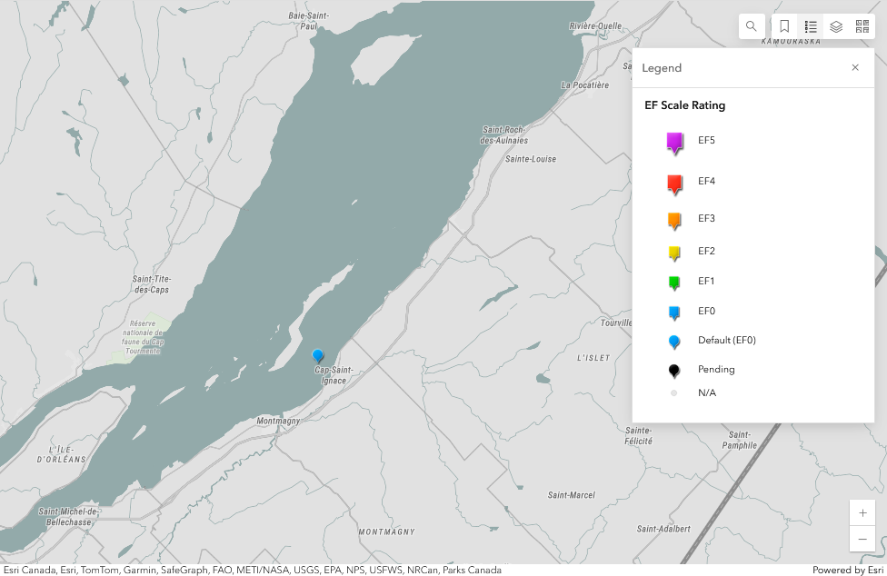
Regional map showin the estimated location of the waterspout over the St. Lawrence River off Cap-Saint-Ignace, QC.