Tornado at Chicoutimi, QC on July 17
NTP investigation, including a ground/drone survey, has resulted in the confirmation of a tornado at Chicoutimi, QC on the afternoon of July 17. Snapped power poles and significant roof damage led to a rating at the top end of EF1. There was also convergent treefall found.
Details are provided in the event summary below, along with regional and survey maps and various images from the investigation. The tornado can be plotted on a map using the NTP Dashboard here.
====
Event Name: Chicoutimi, QC
Date: July 17, 2024
Start Time: 2:25 PM EDT (1825 UTC)
Final Classification: Tornado (Over Land)
Final EF-Scale Rating: EF1
EF-Scale Damage Indicator / Degree of Damage: C-ETL/DOD-4
Start of damage track: 48.4222N, 71.1141W
End of damage track: 48.4146N, 71.0505W
Location of worst damage: 48.4186N, 71.0754W
Description: Structural and tree damage was reported in Chicoutimi (in the city of Saguenay) after a storm passed through the area. Security cameras also captured footage of the damage occurring. No injuries were reported. An NTP ground and drone survey team was deployed to the area on July 19, 2024, documenting the reported damage and additional damage along the track (including damage to some power poles). Damage assessed as EF1 tornado, with an estimated max. wind speed of 175 km/h, track length of 10.7 km and max. path width of 470 m. Tornado motion was from the W (approx. 280 degrees). Start time is based on video. Satellite imagery review is pending.
Regional map showing the location of the EF1 Chicoutimi, QC tornado.
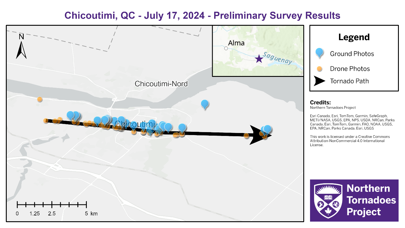
Survey map showing the path of the EF1 tornado through Chicoutimi, QC.
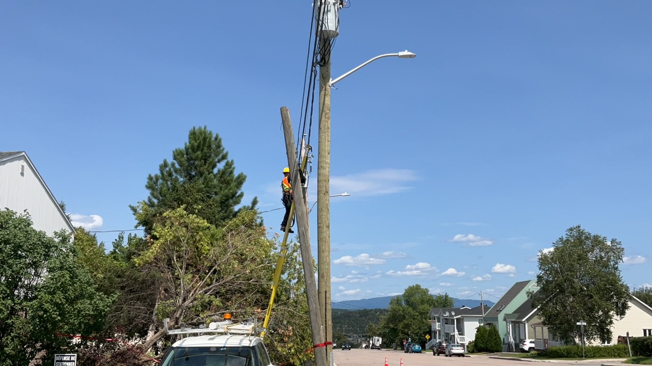
Photo of snapped power pole being replaced as well as tree damage (C-ETL/DOD4 EXP-20).
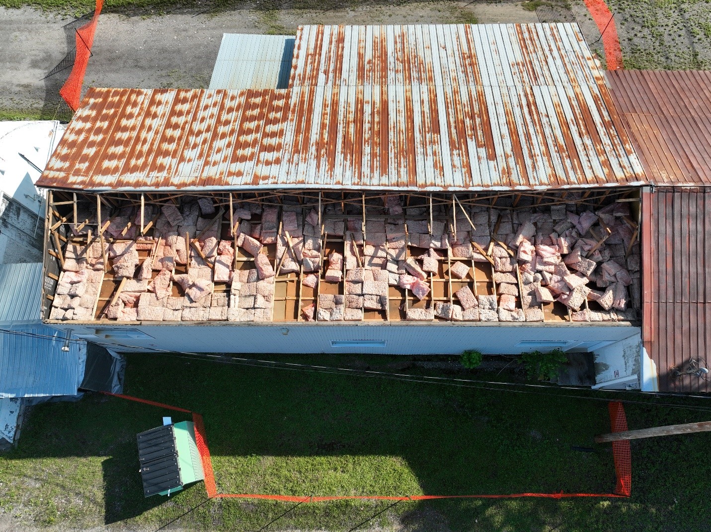
Drone photo of outbuilding roof that was observed being lofted in the air by the tornado (SBO/DOD5).
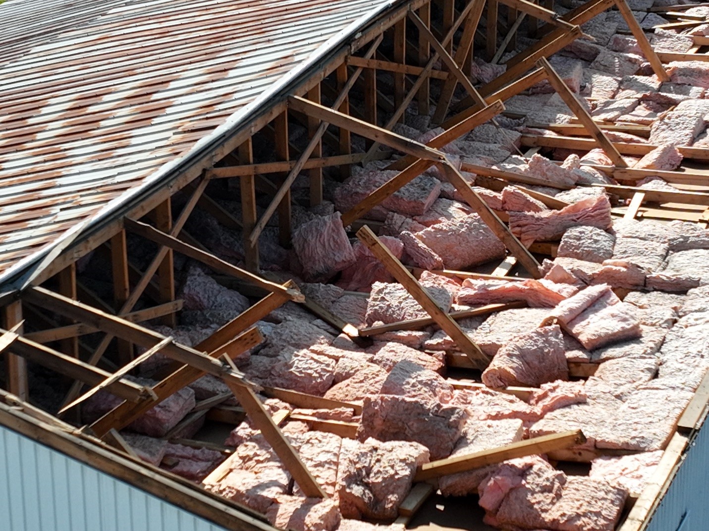
Close-up view of 50% roof covering loss for an outbuilding with damaged wooden roof trusses visible.
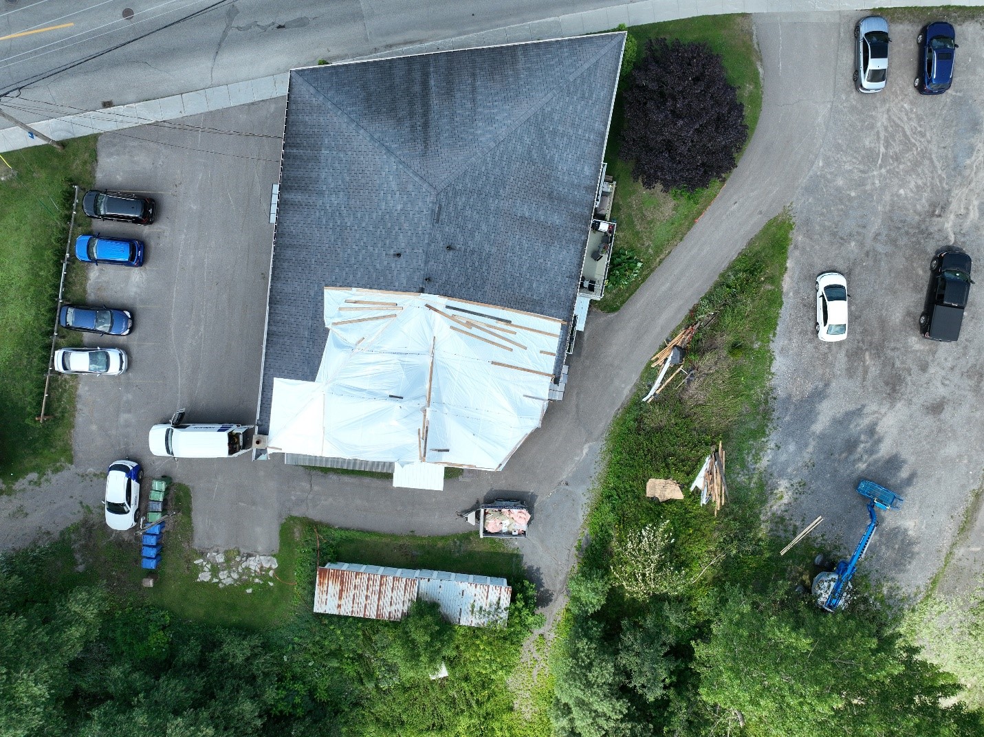
Drone photo of approximately 20% loss of roof covering for an apartment building (ACT/DOD2) as well as tree damage.