Tornado at Fort Erie, ON on August 5
NTP investigation, including a ground / drone survey, has confirmed that a tornado caused EF1 damage at Fort Erie, ON near noon on August 5. The tornado caused structural and tree damage and was recorded by a number of witnesses.
Full details are included below, including the event summary, maps, and photos from the survey. The tornado can be plotted on a map using the NTP Dashboard here.
Two other tornadoes have also been confirmed in the area from that day and the details for those will be made available shortly.
====
Event Name: Fort Erie (Crescent Park), ON
Date: August 5, 2024
Estimated Start Time: 12:05 PM EDT (1605 UTC)
Final Classification: Tornado (Over Land)
Final EF-Scale Rating: EF1
EF-Scale Damage Indicator / Degree of Damage: FR12/DOD-4
Start of damage track: 42.9052N, 78.9825W
End of damage track: 42.9108N, 78.9103W
Location of worst damage: 42.9053N, 78.9516W
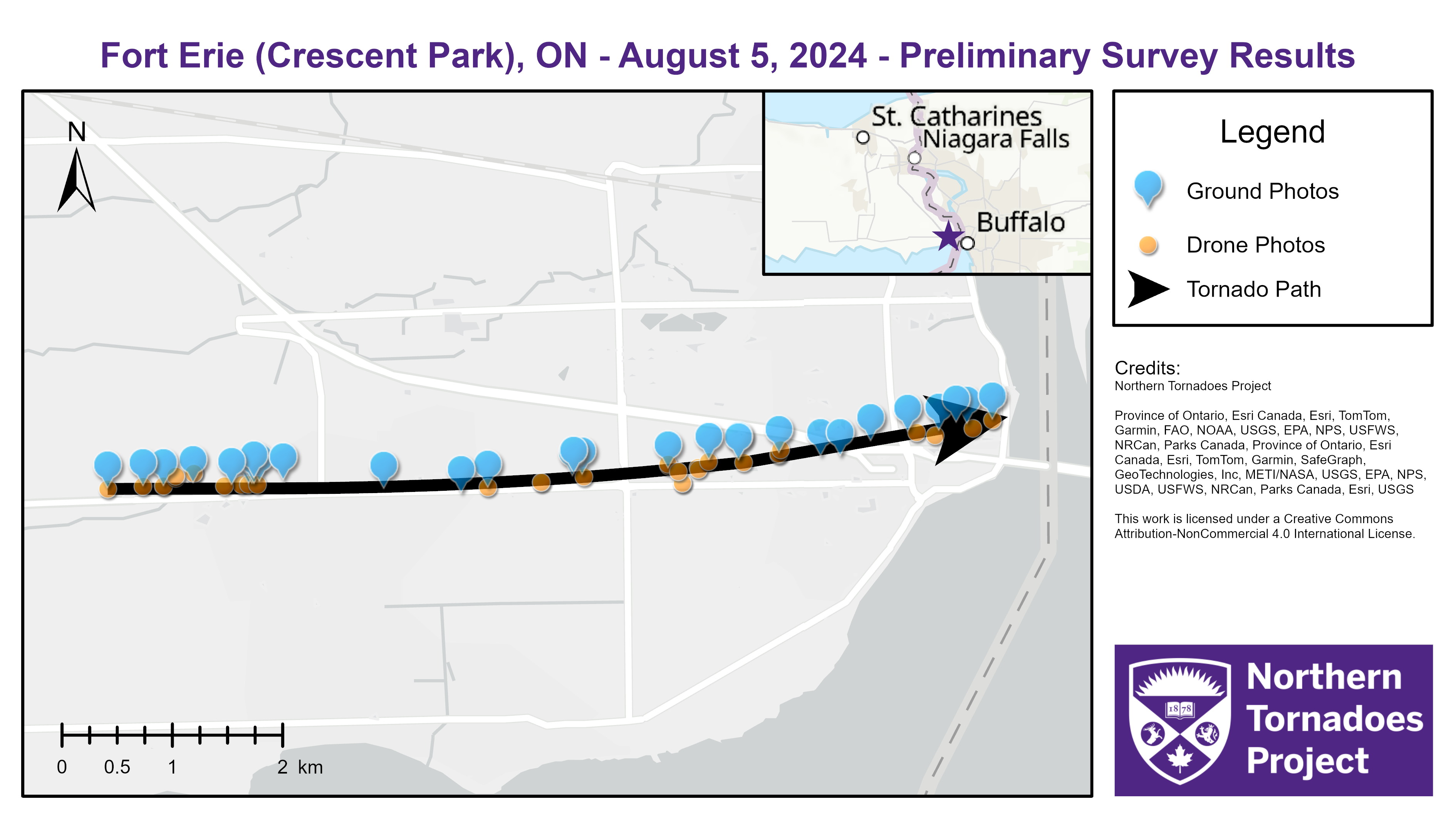
Description: Witnesses captured video of a tornado in Fort Erie, where structural and tree damage was reported. No injuries were reported. An NTP ground and drone survey was completed on August 6, 2024 documenting damage along the path through the community. Damage assessed as EF1 tornado, with an estimated max. wind speed of 155 km/h, track length of 5.94 km and max. path width of 190 m. Tornado motion was from the W (approx. 265 degrees). Start time based on radar and witness reports. Satellite imagery review is pending.

Regional map showing the location and rating for the first of the Fort Erie, ON tornadoes on August 25.
Survey map showing the track of the Fort Erie tornado as well as the locations of drone and ground photos.
Ground photo of decking/covering thrown from house roof.

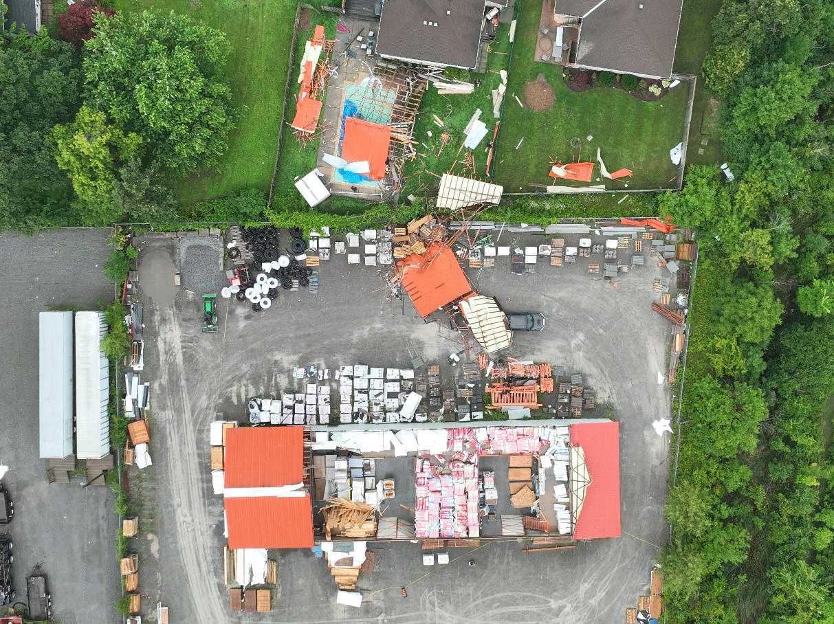
Nadir drone photo of roof removed from a hardware store warehouse and lofted toward the north.
