Two EF0 tornadoes near Trois-Rivières, QC on Sep 26
NTP investigation, including ground / drone surveys, has led to the confirmation of two EF0 tornadoes near Trois-Rivières, QC on September 26. While videos posted to social media allowed confirmation that the tornadoes occurred, the NTP storm surveys were able to document damage paths, mostly to trees and agricultural land.
Details are available in the event summaries below, including maps and drone photos. The tornadoes can be plotted on a map using the NTP Dashboard here.
====
Event Name: Saint-Stanislas-de-Champlain, QC
Date: September 26, 2024
Start Time: 5:00 PM EDT (2100 UTC)
Final Classification: Tornado (Over Land)
Final EF-Scale Rating: EF0
EF-Scale Damage Indicator / Degree of Damage: C-T/DOD-3
Start of damage track: 46.5746N, 72.4044W
End of damage track: 46.5734N, 72.3964W
Location of worst damage: 46.5729N, 72.3978W
Description: Witnesses captured video of a tornado south of Saint-Stanislas-de-Champlain. No injuries and no damage was reported. An NTP ground and drone survey was completed on September 28, 2024, discovering a short path of weak tree damage in a forested area. Satellite imagery review revealed isolated areas of tree damage. Damage assessed as EF0 tornado, with an estimated max. wind speed of 115 km/h, track length of 0.78 km and max. path width of 100 m. Tornado motion was from the WNW (approx. 285 degrees). Start time is radar estimated.
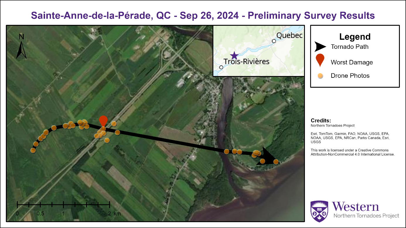
Event Name: Sainte-Anne-de-la-Pérade, QC
Date: September 26, 2024
Start Time: 5:35 PM EDT (2135 UTC)
Final Classification: Tornado (Over Land)
Final EF-Scale Rating: EF0
EF-Scale Damage Indicator / Degree of Damage: C-T/DOD-3
Start of damage track: 46.5584N, 72.2627W
End of damage track: 46.5545N, 72.1941W
Location of worst damage: 46.5621N, 72.2426W
Description: Witness captured video of a tornado south of Sainte-Anne-de-la-Pérade. Tree damage was reported. No injuries were reported. An NTP ground and drone survey was completed on September 28, 2024, documenting weak tree and crop damage. Damage assessed as EF0 tornado, with an estimated max. wind speed of 115 km/h, track length of 5.59 km and max. path width of 390 m. Tornado motion was from the W (approx. 275 degrees). Start time is radar estimated. Satellite imagery review is pending.
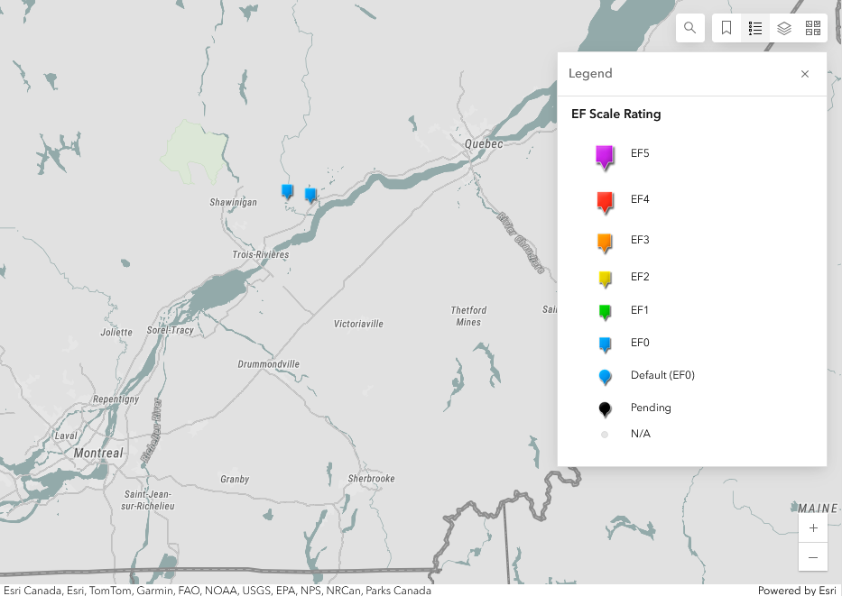
Regional map showing the locations of the two EF0 tornadoes.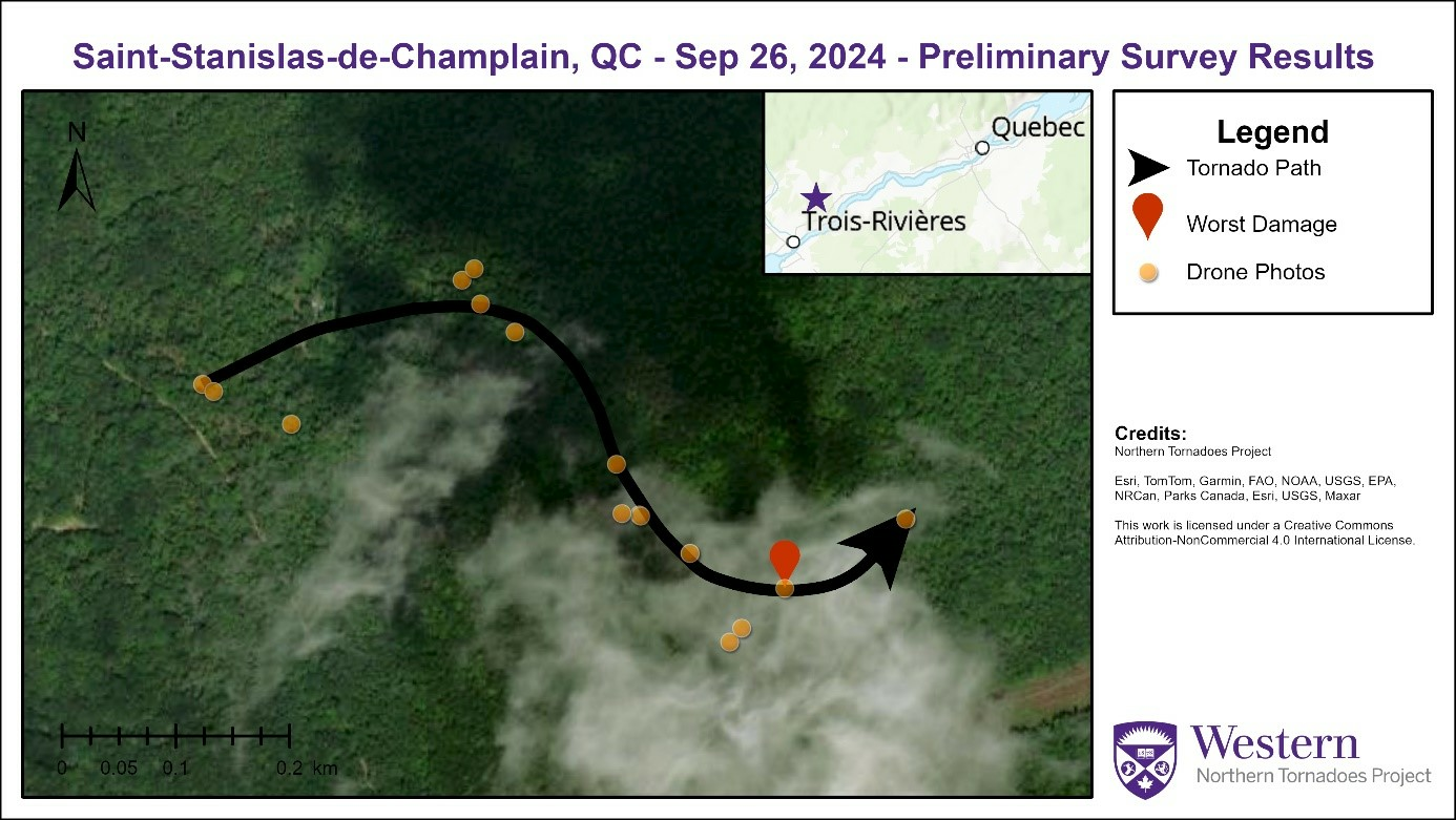
Survey map showing short, erratic track of the Saint-Stanislas-de-Champlain EF0 tornado, with the locations of drone photos.
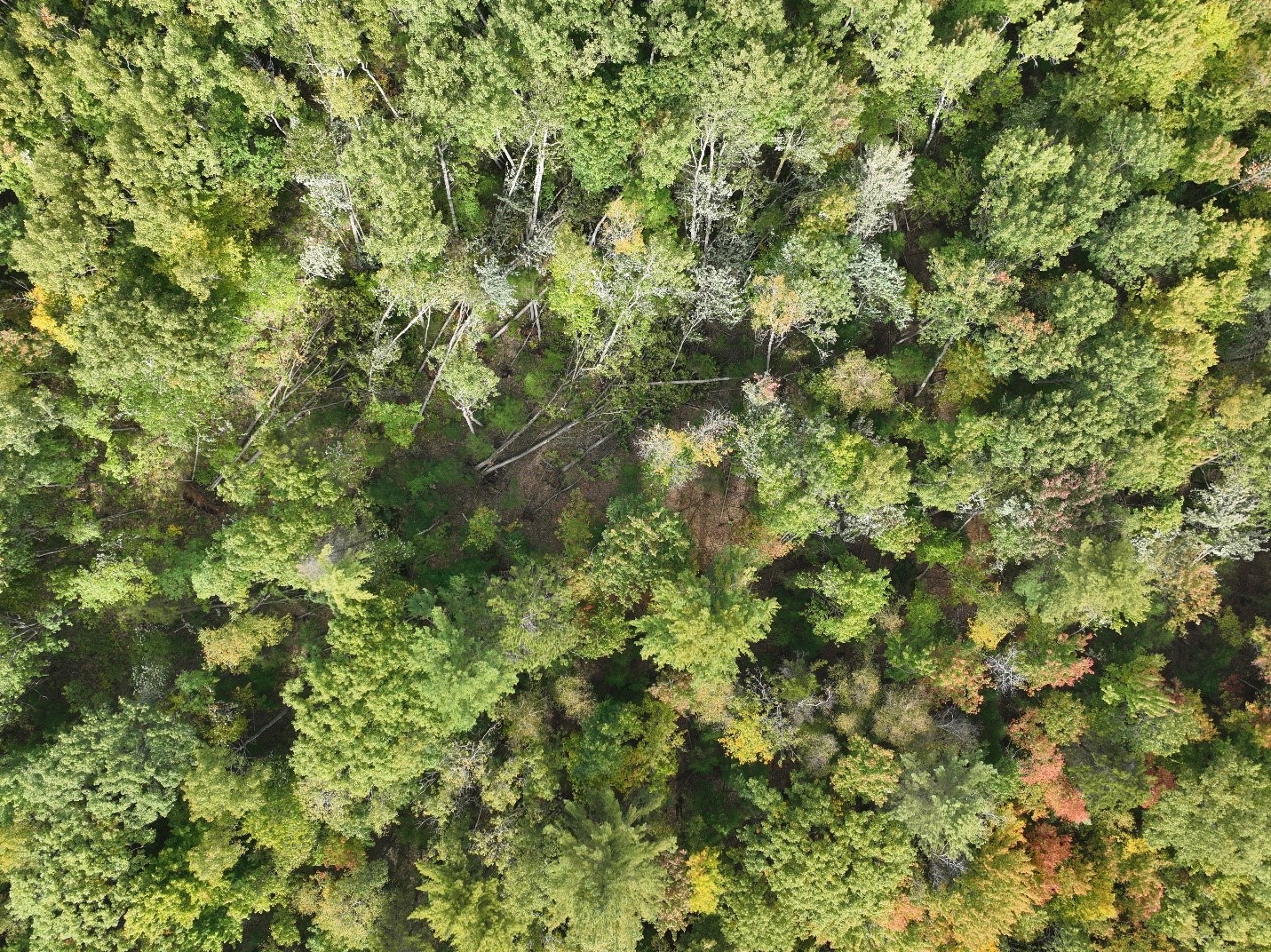
Location of worst damage for the Saint-Stanislas-de-Champlain tornado - some EF0 tree damage.
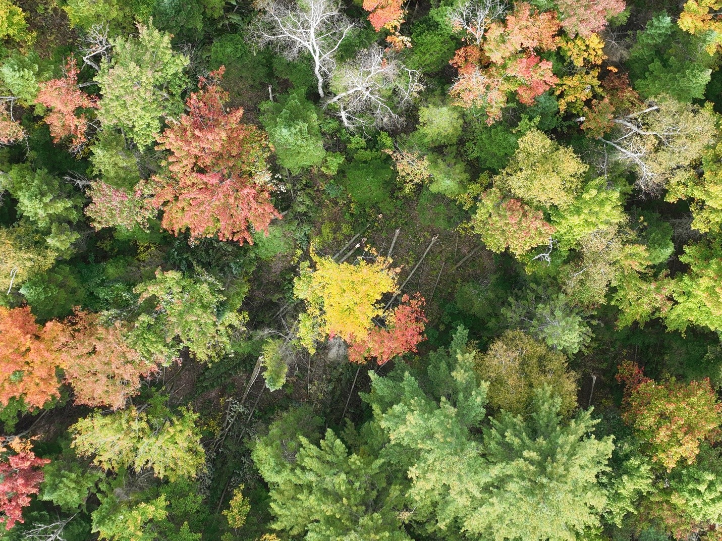
Drone photo showing treefall on the NW side of the damage area with trees down to the SSW (46.5752, -72.4012) with the Saint-Stanislas-de-Champlain tornado.
Survey map showing short, erratic track of the Sainte-Anne-de-la-Pérade EF0 tornado, with the locations of drone photos.
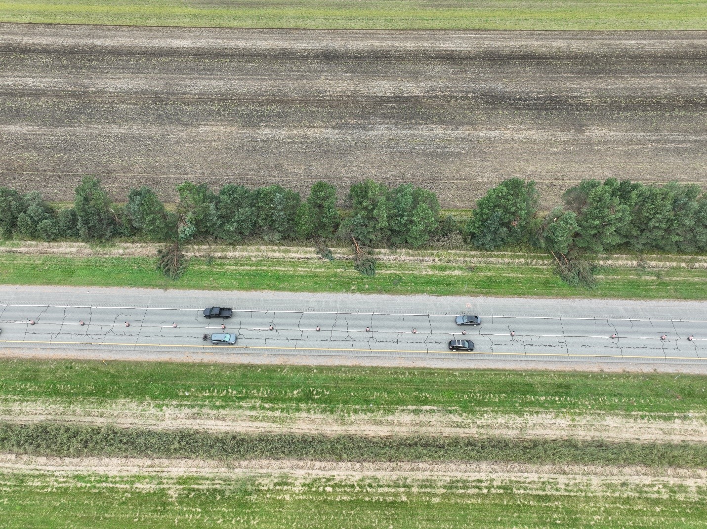
Drone image showing the location along the Sainte-Anne-de-la-Pérade track with the worst damage - trees down along Autoroute Félix-Leclerc (40).
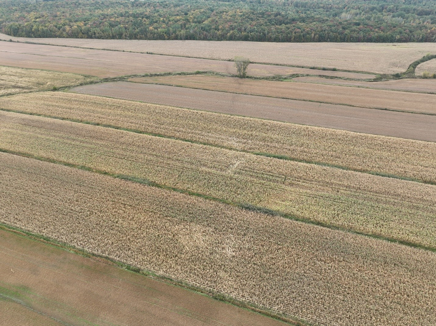
Drone image showing the path of the Sainte-Anne-de-la-Pérade tornado as it crossed agricultural land.