Two EF1 tornadoes in NW ON on June 24
NTP investigation has confirmed two EF1 tornadoes occurred with supercell thunderstorms in northwestern Ontario during the evening of June 24. Given the locations of these tornadoes are in remote forest areas, clear high-resolution satellite imagery was required for analysis in order to detect long, narrow paths of tree damage. Weak downburst damage was also detected near the tornado tracks.
The event summaries below provide full details, and are accompanied by a map and representative satellite imagery. The tornadoes may be plotted using the NTP Dashboard here.
====
Event Name: Apitu Lake, ON
Date: June 24, 2024
Start Time: 7:00 PM CDT (0000 UTC)
Final Classification: Tornado (Over Land)
Final EF-Scale Rating: EF1
EF-Scale Damage Indicator / Degree of Damage: C-T/DOD-5
Start of damage track: 52.5864N, 92.2636W
End of damage track: 52.5888N, 92.1871W
Location of worst damage: 52.5857N, 92.2095W
Description: Satellite imagery review of a storm track of interest revealed tornado damage in forested areas near Apitu Lake (southwest of Weagamow Lake). Tornado damage is assessed as EF1, with an estimated max. wind speed of 145 km/h, track length of 5.23 km and max. path width of 340 m. Tornado motion was from the W (approx. 270 degrees). Start time is radar estimated. Weak downburst damage was also visible in the area.
Event Name: Brunette Lake, ON
Date: June 24, 2024
Start Time: 7:30 PM CDT (0030 UTC)
Final Classification: Tornado (Over Land)
Final EF-Scale Rating: EF1
EF-Scale Damage Indicator / Degree of Damage: C-T/DOD-5
Start of damage track: 52.3010N, 91.6776W
End of damage track: 52.3370N, 91.5348W
Location of worst damage: 52.3263N, 91.5815W
Description: Satellite imagery review of a storm track of interest revealed tornado damage in forested areas near Brunette Lake (south of Weagamow Lake). Tornado damage is assessed as EF1, with an estimated max. wind speed of 145 km/h, track length of 10.6 km and max. path width of 520 m. Tornado motion was from the WSW (approx. 250 degrees). Start time is radar estimated. Weak downburst damage was also visible in the area.

Regional map showing the locations of the two EF1 tornadoes in northwestern Ontario.
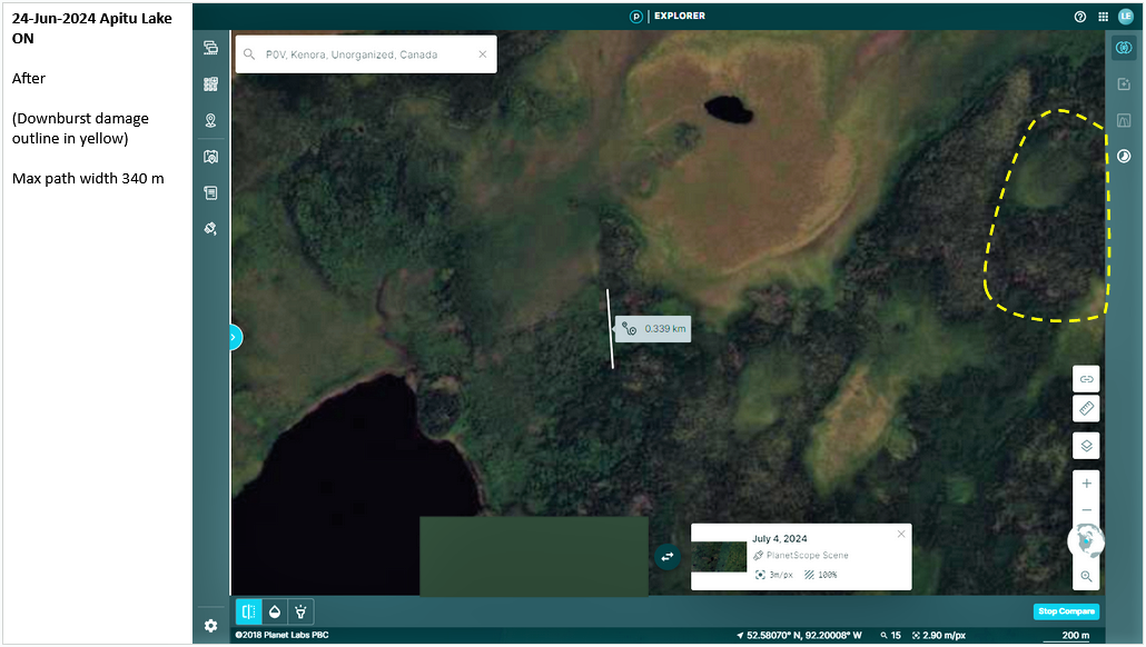
Satellite image show max width measurement along tornado track with weak downburst damage (dashed yellow) at end of the Apitu Lake tornado damage path.
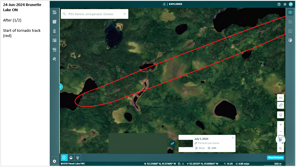
Satellite image showing first half of Brunette Lake tornado damage path.
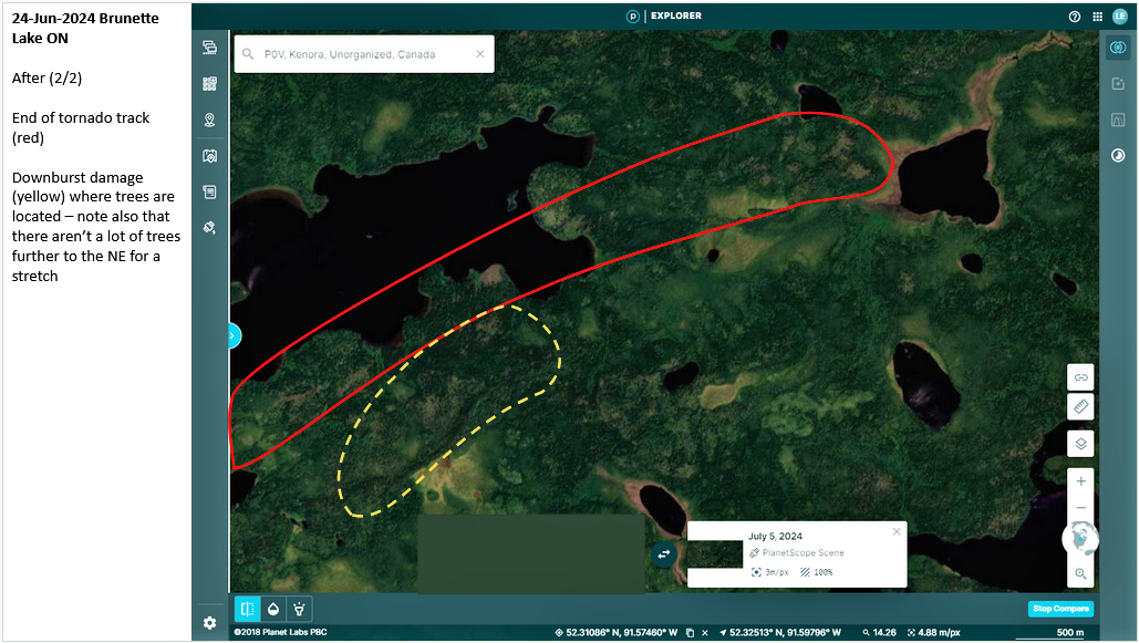
Satellite image showing the second half of the Brunette tornado damage path plus weak downburst damage to south (dashed yellow).