Two more ON tornadoes on August 5
NTP investigations, including ground/drone surveys, have confirmed two more tornadoes in the eastern part of Ontario's Niagara Region with the storms on August 5. One tornado moved through Stevensville and has been rated EF1. The other tornado - rated EF0 - occurred south of the already confirmed EF1 tornado in northern Fort Erie and crossed the Niagara River to cause EF1 damage in Buffalo, NY.
Details for both tornadoes are provided in the event summaries below, as well as maps and survey photos. The tornadoes can also be plotted on a map using the NTP Dashboard found here.
====
Event Name: Brookfield - Stevensville, ON
Date: August 5, 2024
Estimated Start Time: 11:20 AM EDT (1520 UTC)
Final Classification: Tornado (Over Land)
Final EF-Scale Rating: EF1
EF-Scale Damage Indicator / Degree of Damage: FR12/DOD-4
Start of damage track: 42.9408N, 79.1730W
End of damage track: 42.9450N, 79.0503W
Location of worst damage: 42.9447N, 79.0510W
Description: Witnesses in the greater Port Colborne area captured video of a tornado that developed near Brookfield (northeast of Port Colborne) and tracked eastward to Stevensville (northwest of Fort Erie), with structural and tree damage reported along the path. No injuries were reported, though one horse at a property where a barn was damaged later died. An NTP ground and drone survey was completed on August 6-7, 2024 documenting the reported damage and additional damage to trees and houses. Damage assessed as EF1 tornado, with an estimated max. wind speed of 155 km/h, track length of 10.0 km and max. path width of 150 m. Tornado motion was from the W (approx. 265 degrees). Start time based on radar and witness reports. Satellite imagery review is pending. Two additional tornadoes from different storms later developed in the Fort Erie area.
Event Name: Fort Erie (Fort Erie Beach), ON
Date: August 5, 2024
Estimated Start Time: 12:40 PM EDT (1640 UTC)
Final Classification: Tornado (Over Land)
Final EF-Scale Rating: EF0
EF-Scale Damage Indicator / Degree of Damage: FR12/DOD-2
Start of damage track: 42.8889N, 78.9303W
End of Canadian damage track (over land): 42.8895N, 78.9241W
Estimated end of Canadian tornado track (over water): 42.8892N, 78.9115W
Location of worst damage: 42.8894N, 78.9250W
Description: Witnesses captured video of a tornado in the neighbourhood of Fort Erie Beach in Fort Erie. The tornado crossed the Niagara River and came ashore in Buffalo, NY, where it caused EF1 damage (estimated max. wind speed of 145 km/h) before dissipating. In the Fort Erie Beach area, no damage and no injuries were reported. An NTP ground and drone survey was completed on August 7, 2024, discovering a narrow path of weak damage leading to the shoreline of the Niagara River. Damage in Fort Erie Beach assessed as EF0 tornado, with an estimated max. wind speed of 125 km/h, track length over land of 0.51 km (path length of 1.5 km to US waters) and max. path width of 120 m. Tornado motion was from the W (approx. 260 degrees). Start time based on radar and witness reports. The damage path length in Buffalo was 2.25 km, with the overall cross-border tornado track length approximately 5.2 km. An earlier tornado in Fort Erie caused EF1 damage, impacting the neighbourhoods of Crescent Park, Old Fort Erie and Fort Erie North.
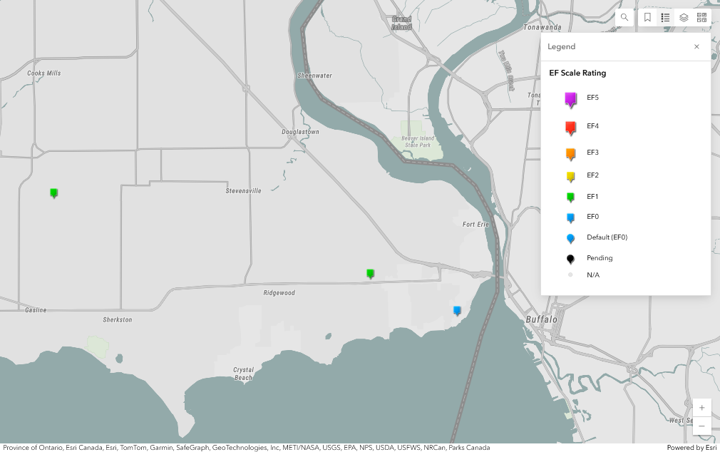
Regional map showing the start locations of the Brookfield - Stevensville EF1 tornado (left-most, green, start time 11:20 AM EDT) and Fort Erie (Fort Erie Beach) EF0 tornado (right-most, blue, 12:40 PM EDT). The EF1 tornado between these is the previously published Fort Erie (Crescent Park) EF1 tornado (centre, green, 12:05 PM EDT). 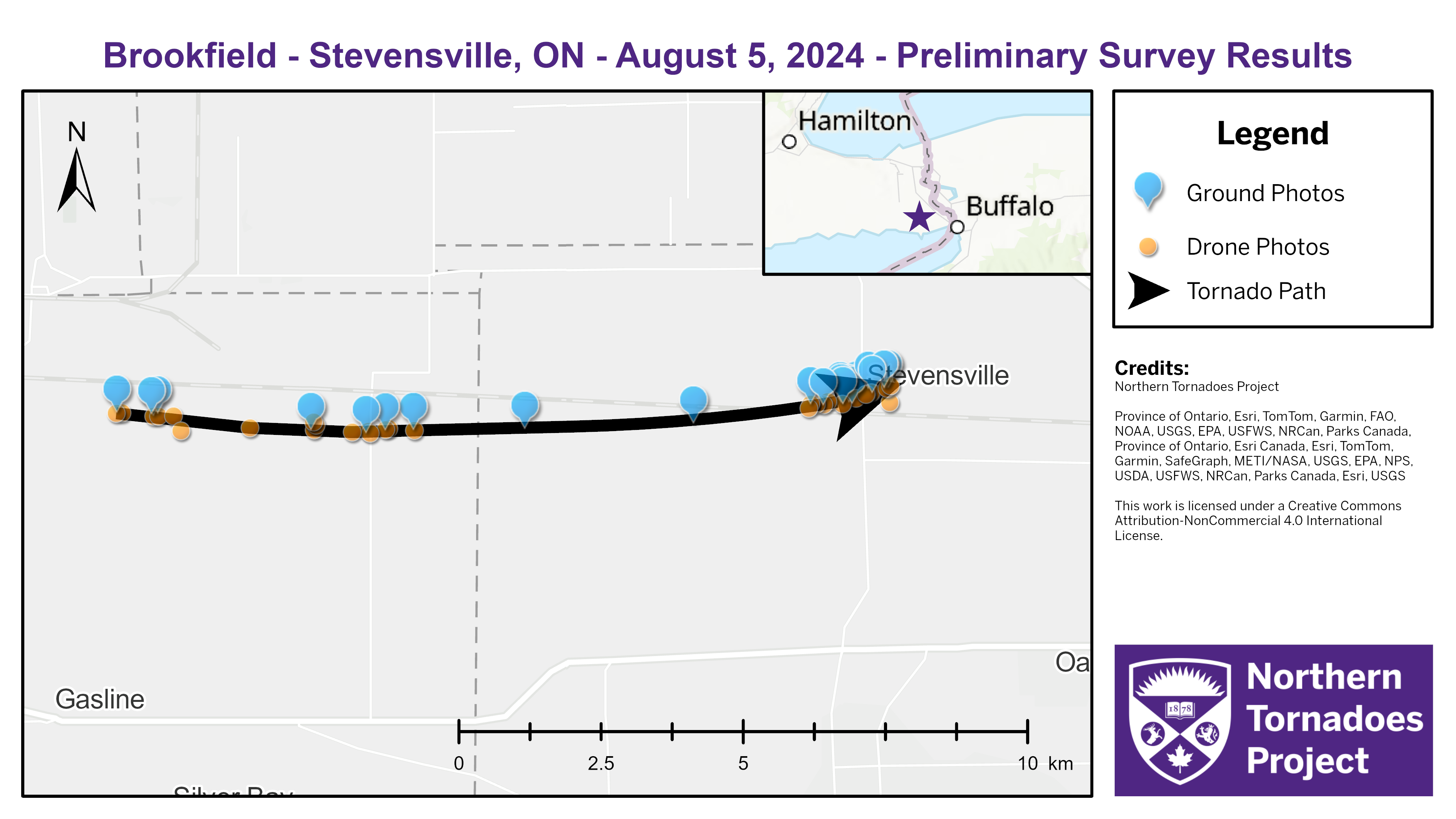
Survey map showing the track of the EF1 tornado and the locations of drone and ground photos.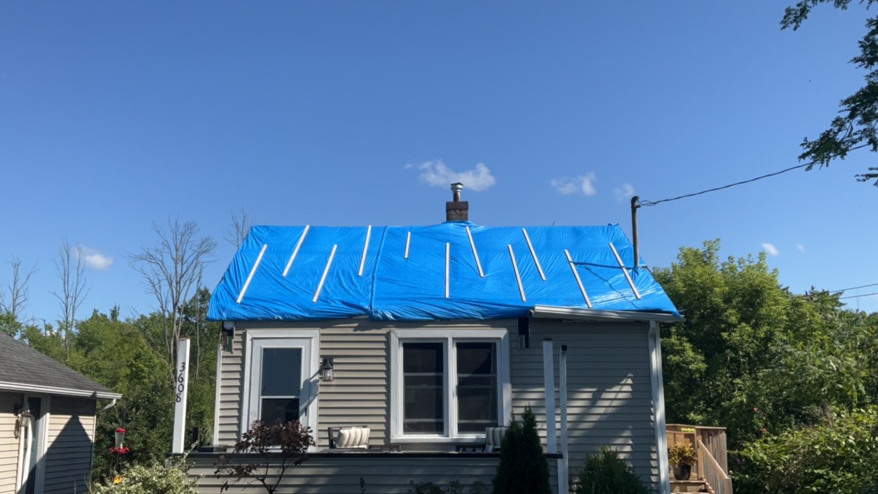
Ground photo of major loss of shingles and loss of wooden porch roof, which was lofted by the EF1 tornado over the house and into the backyard.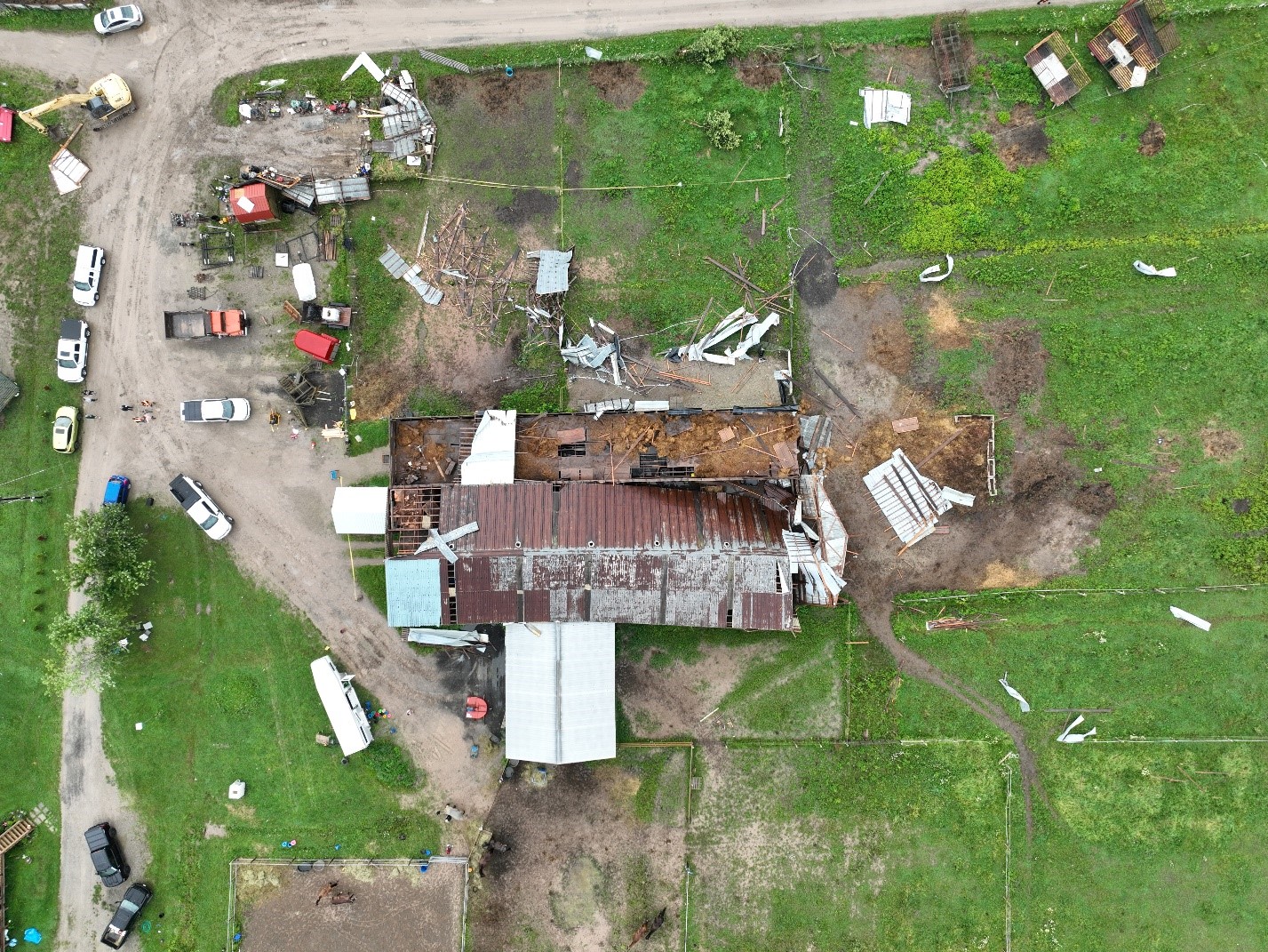
Drone photo of a small pole barn that was completely destroyed (top left) by the EF1 tornado and a larger barn (centre) that had major roof damage. Several horses here were injured and one did not survive.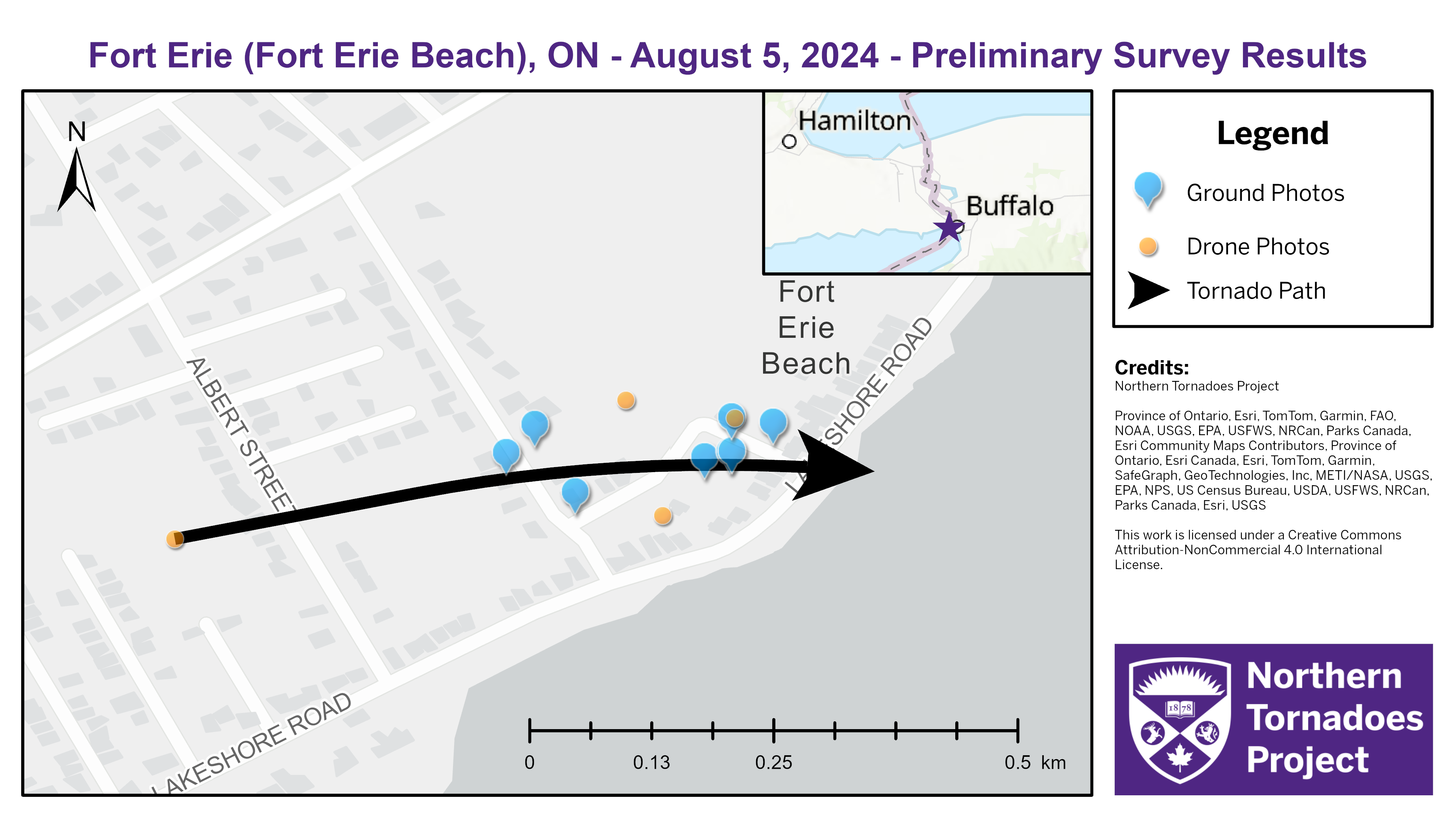
Survey map showing the EF0 tornado track and the locations of drone and ground photos.
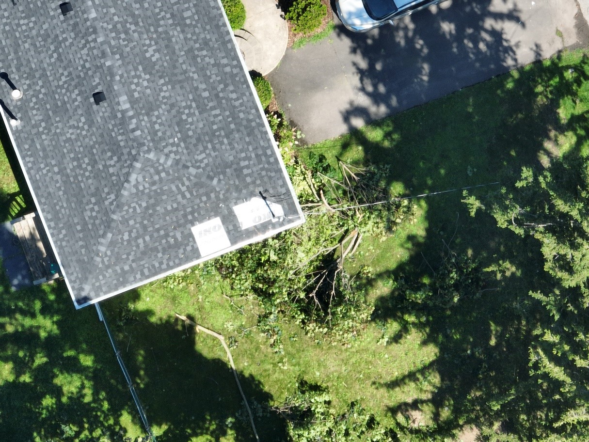
Nadir drone photo of shingle and tree damage along the track of the EF0 tornado.
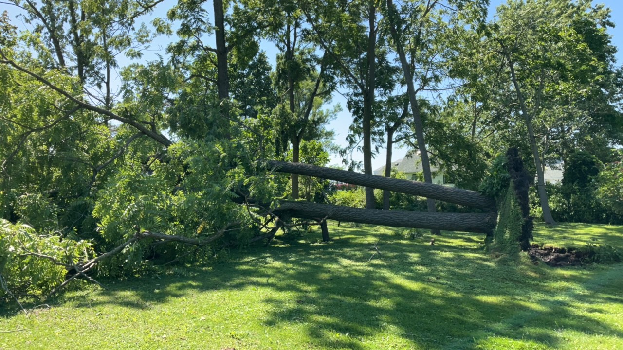
Ground photo of uprooted tree in a location near the photo above.
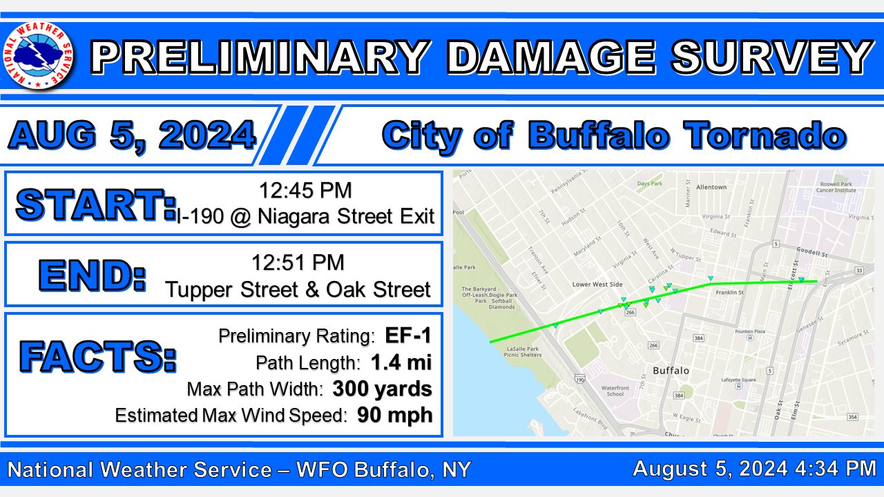
Social media graphic prepared by the Buffalo, NY forecast office showing the path of this tornado on the US side of the Niagara River and the assessed EF1 rating there.