Four EF2 tornadoes in western QC on Sep 5
The NTP has confirmed four EF2 tornadoes in western Quebec during the late afternoon and evening hours of September 5. In each case there was considerable tree damage. The strongest and widest of these tornadoes, at Lac Joannès (Rouyn-Noranda), had a maximum wind speed of 215 km/h and a maximum width of 520 m. The longest occurred in the Senneterre area with a track of 26.7 km.
Additional details are provided in the event summaries below, along with a regional map and satellite imagery. The tornadoes can also be plotted on a map using the NTP Dashboard here.
====
Event Name: Lac Joannès (Rouyn-Noranda), QC
Date: September 5, 2025
Start Time: 4:15 PM EDT (2015 UTC)
Final Classification: Tornado (Over Land)
Final EF-Scale Rating: EF2
EF-Scale Damage Indicator / Degree of Damage: C-T/DOD-6
Start of damage track: 48.1859N, 78.7437W
End of damage track: 48.2777N, 78.6423W
Location of worst damage: 48.2014N, 78.7306W
Description: Satellite imagery review of a storm track of interest revealed a tornado damage path through forested areas near Lac Joannès (east of Rouyn-Noranda). Damage assessed as EF2 tornado, with an estimated max. wind speed of 215 km/h, track length of 12.8 km and max. path width of 530 m. Tornado motion was from the SW (approx. 215 degrees). Start time is radar estimated.
Event Name: Lac Disson (Abitibi), QC
Date: September 5, 2025
Start Time: 4:45 PM EDT (2045 UTC)
Final Classification: Tornado (Over Land)
Final EF-Scale Rating: EF2
EF-Scale Damage Indicator / Degree of Damage: C-T/DOD-6
Start of damage track: 48.9038N, 78.7509W
End of damage track: 48.9344N, 78.7292W
Location of worst damage: 48.9172N, 78.7414W
Description: Satellite imagery review of a storm track of interest revealed a tornado damage path through forested areas near Lac Disson (northeast of Authier-Nord). Damage assessed as EF2 tornado, with an estimated max. wind speed of 215 km/h, track length of 3.77 km and max. path width of 280 m. Tornado motion was from the SSW (approx. 205 degrees). Start time is radar estimated.
Event Name: Senneterre, QC
Date: September 5, 2025
Start Time: 5:50 PM EDT (2150 UTC)
Final Classification: Tornado (Over Land)
Final EF-Scale Rating: EF2
EF-Scale Damage Indicator / Degree of Damage: C-T/DOD-6
Start of damage track: 48.3590N, 77.1333W
End of damage track: 48.5520N, 76.9266W
Location of worst damage: 48.5269N, 76.9571W
Description: Satellite imagery review of a storm track of interest revealed a tornado damage path through forested areas east of Senneterre. Damage assessed as EF2 tornado, with an estimated max. wind speed of 190 km/h, track length of 26.7 km and max. path width of 490 m. Tornado motion was from the SW (approx. 215 degrees). Start time is radar estimated.
Event Name: Lac Twin Sud (Senneterre), QC
Date: September 5, 2025
Start Time: 6:15 PM EDT (2215 UTC)
Final Classification: Tornado (Over Land)
Final EF-Scale Rating: EF2
EF-Scale Damage Indicator / Degree of Damage: C-T/DOD-6
Start of damage track: 48.6170N, 76.8510W
End of damage track: 48.6400N, 76.8190W
Location of worst damage: 48.6256N, 76.8407W
Description: Satellite imagery review of a storm track of interest revealed a tornado damage path through forested areas south of Lac Twin Sud (northeast of Senneterre). Damage assessed as EF2 tornado, with an estimated max. wind speed of 190 km/h, track length of 3.48 km and max. path width of 390 m. Tornado motion was from the SW (approx. 215 degrees). Start time is radar estimated. An area of unclassified wind damage at Lac Twin was also visible northeast of this tornado track.
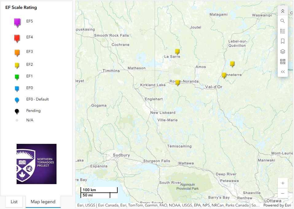
Regional map showing the start locations of the four EF2 tornadoes in western Quebec.
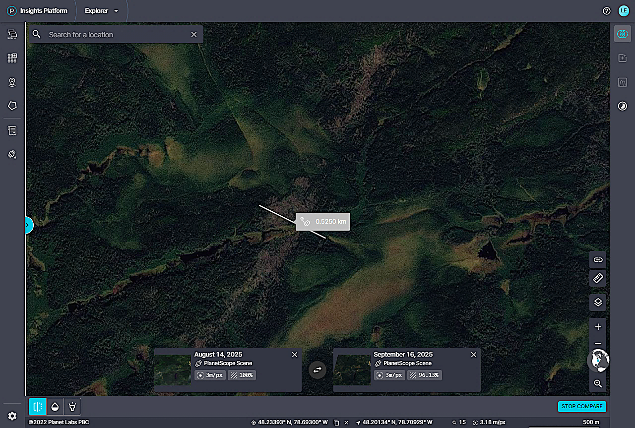
Planet.com satellite image of tornado damage in the Lac Joannès area with max width measurement superimposed.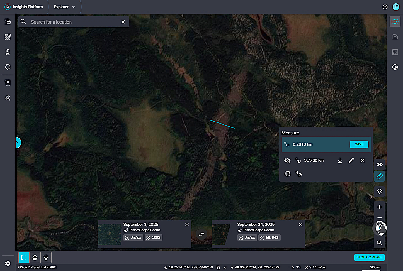
Planet.com satellite image of tornado damage in the Lac Disson area with max width measurement superimposed.
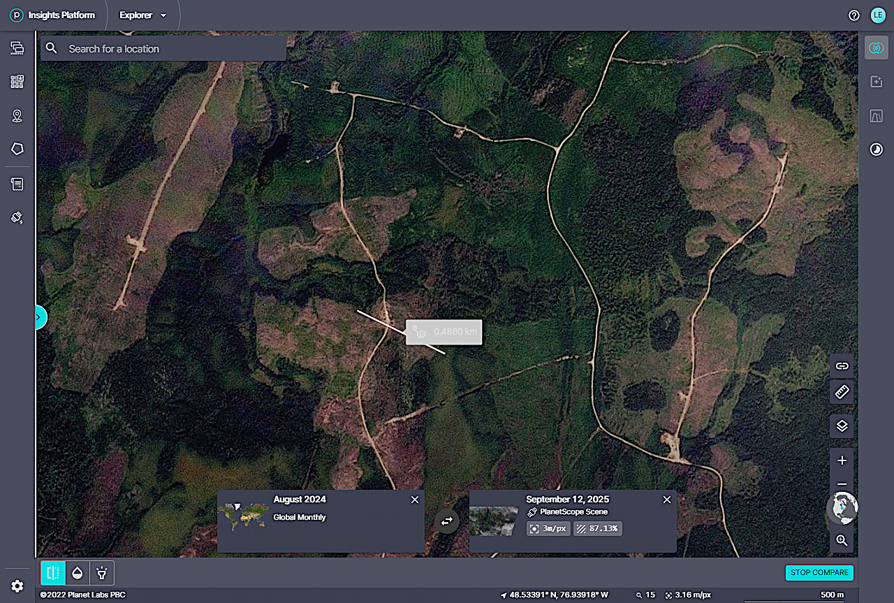
Planet.com satellite image of tornado damage in the Senneterre area with max width measurement superimposed. The extent of the damage is more difficult to see in this area given the heavy logging activity.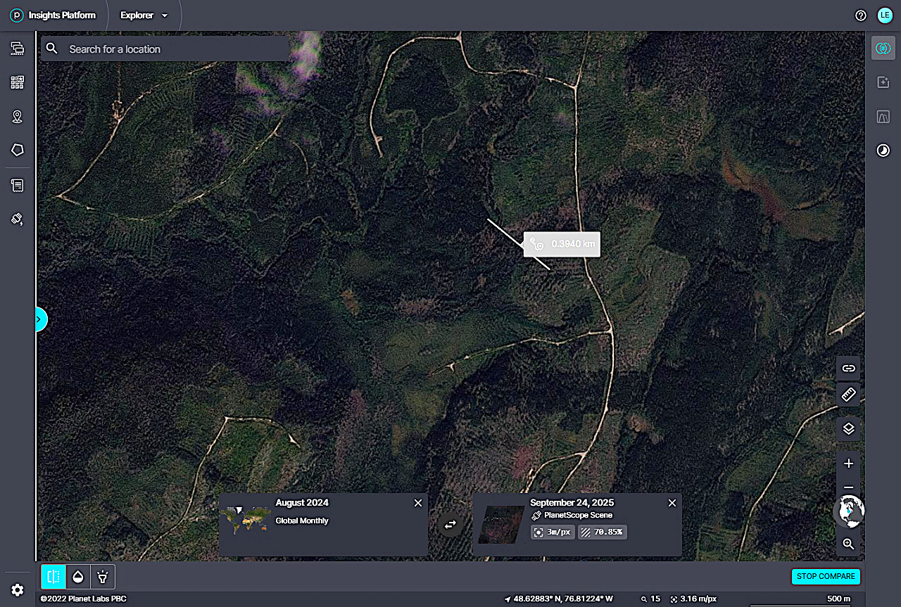
Planet.com satellite image of tornado damage in the Lac Twin area with max width measurement superimposed. The extent of the damage is more difficult to see in this area given the heavy logging activity.