Multiple wind events from Aug 20 storm cluster in central SK
Based on witness reports, an NTP damage survey, and analysis of radar and satellite imagery, the NTP is confirming multiple wind events from a long-lived cluster of supercell thunderstorms that affected central SK on August 20. While supercells developed near North Battleford around 5:30 pm CST, it was when the supercells merged into a cluster that significant wind (and hail) damage began to occur, passing Saskatoon to the north.
Confirmed are an EF1 microburst near Mennon, an EF1 downburst in the Gruenthal area, and an EF0 tornado in the Buffer Lake area. A short-lived gustnado was also documented in the Aberdeen area. The storms continued as far east as the Middle Lake area, giving a total length approaching 250 km.
Details are provided in the event summaries below (listed chronologically), along with regional and survey maps and selected images from the damage survey. The events can be plotted on a map using the NTP Dashboard here.
Note that there may be additional wind events added later. Analysis of this extensive track of wind and hail damage will continue.
====
Event Name: Mennon, SK
Date: August 20, 2025
Start Time: 8:15 PM CST (0215 UTC)
Final Classification: Downburst (microburst)
Final EF-Scale Rating: EF1
EF-Scale Damage Indicator / Degree of Damage: C-FSGB/DOD-2
Location of worst damage: 52.4486N, 106.7796W
Description: Damage to grain bins, trees and roof damage to a home and farm building was reported in the Mennon area after a storm passed through. Significant hail damage was also reported. No injuries were reported. An NTP ground and drone survey was completed on August 22, 2025, documenting damage over an area approximately 2 km long and up to 2 km wide. Satellite imagery review did not reveal any additional visible wind damage. Damage assessed as EF1 downburst (microburst), with an estimated max. wind speed of 150 km/h. Start time is radar estimated.
Event Name: Gruenthal, SK
Date: August 20, 2025
Start Time: 8:35 PM CST (0235 UTC)
Final Classification: Downburst
Final EF-Scale Rating: EF1
EF-Scale Damage Indicator / Degree of Damage: SBO/DOD-6
Location of worst damage: 52.4580N, 106.5572W
Description: Damage to several farm buildings, grain bins, and trees was reported in the Gruenthal, Neuanlage and Blumenthal areas after a storm passed through. Significant hail damage was also reported. No injuries were reported, though several farm animals were reportedly killed. An NTP ground and drone survey was completed on August 22, 2025, documenting intermittent damage over an area approximately 22 km long and up to 7 km wide. Satellite imagery review did not reveal any additional visible wind damage. Damage assessed as EF1 downburst, with an estimated max. wind speed of 155 km/h. Start time is radar estimated.
Event Name: Aberdeen, SK
Date: August 20, 2025
Start Time: 9:00 PM CST (0300 UTC)
Final Classification: Non-tornadic vortex (gustnado)
Final EF-Scale Rating: EF0-default
Start of damage track: 52.3087N, 106.3821W
End of damage track: 52.3066N, 106.3700W
Description: Satellite imagery review of a storm track of interest revealed a short narrow path of crop damage southwest of Aberdeen. An NTP ground and drone survey was completed on August 23, 2025, documenting the path of weak crop damage. NTP review of survey results and radar imagery has led to a final assessment of EF0-default gustnado as the cause of the crop damage, with a track length of 0.86 m and max. path width of 30 m. Event time is radar estimated.
Event Name: Buffer Lake, SK
Date: August 20, 2025
Start Time: 9:15 PM CST (0315 UTC)
Final Classification: Tornado (over land)
Final EF-Scale Rating: EF0
EF-Scale Damage Indicator / Degree of Damage: C-FSGB/DOD-1
Start of damage track: 52.4352N, 105.9812W
End of damage track: 52.4374N, 105.9710W
Location of worst damage: 52.4366N, 105.9728W
Description: Numerous reports of wind and hail damage along a storm track north of Saskatoon prompted an NTP ground and drone survey team to visit the area on August 22-24, 2025. On August 23, the team discovered an area of damage to grain bins, trees and a visible narrow path of crop damage near Buffer Lake. Weak intermittent downburst damage was also documented in the wider region. Satellite imagery review did not reveal any additional visible wind damage. Damage at Buffer Lake assessed as EF0 tornado, with an estimated max. wind speed of 105 km/h, track length of 0.74 km and max. path width of 150 m. Tornado motion was from the WSW (approx. 250 degrees). Start time is radar estimated.
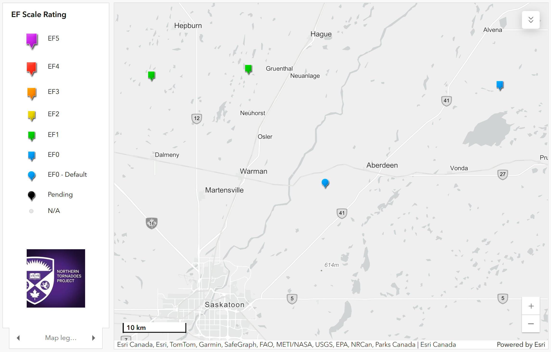
Regional map showing the locations of the four confirmed events from August 20 in the Saskatoon area of Saskatchewan.
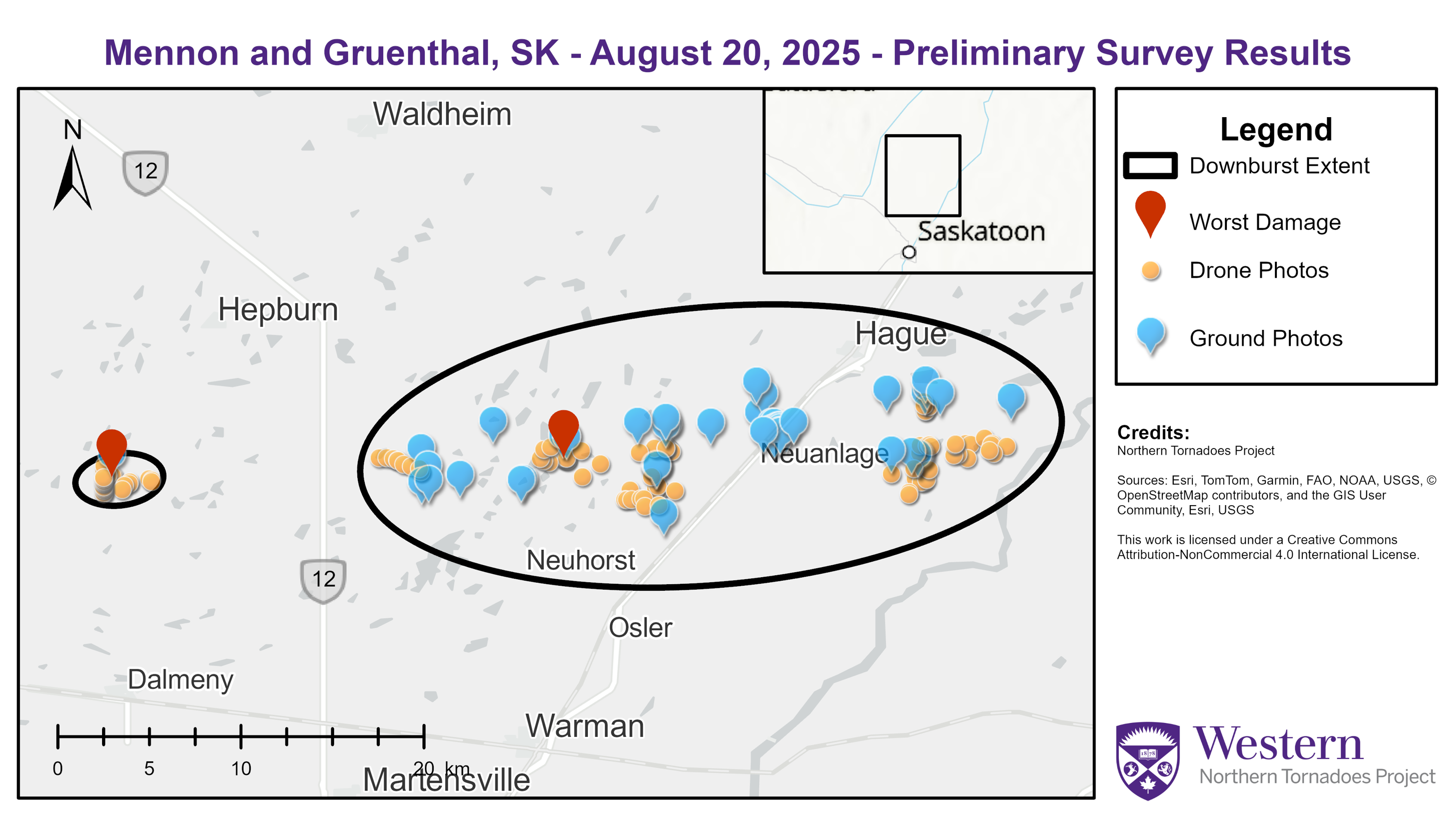
Survey map showing the locations of the Mennon-area EF1 microburst and the Gruenthal-area EF1 downburst.
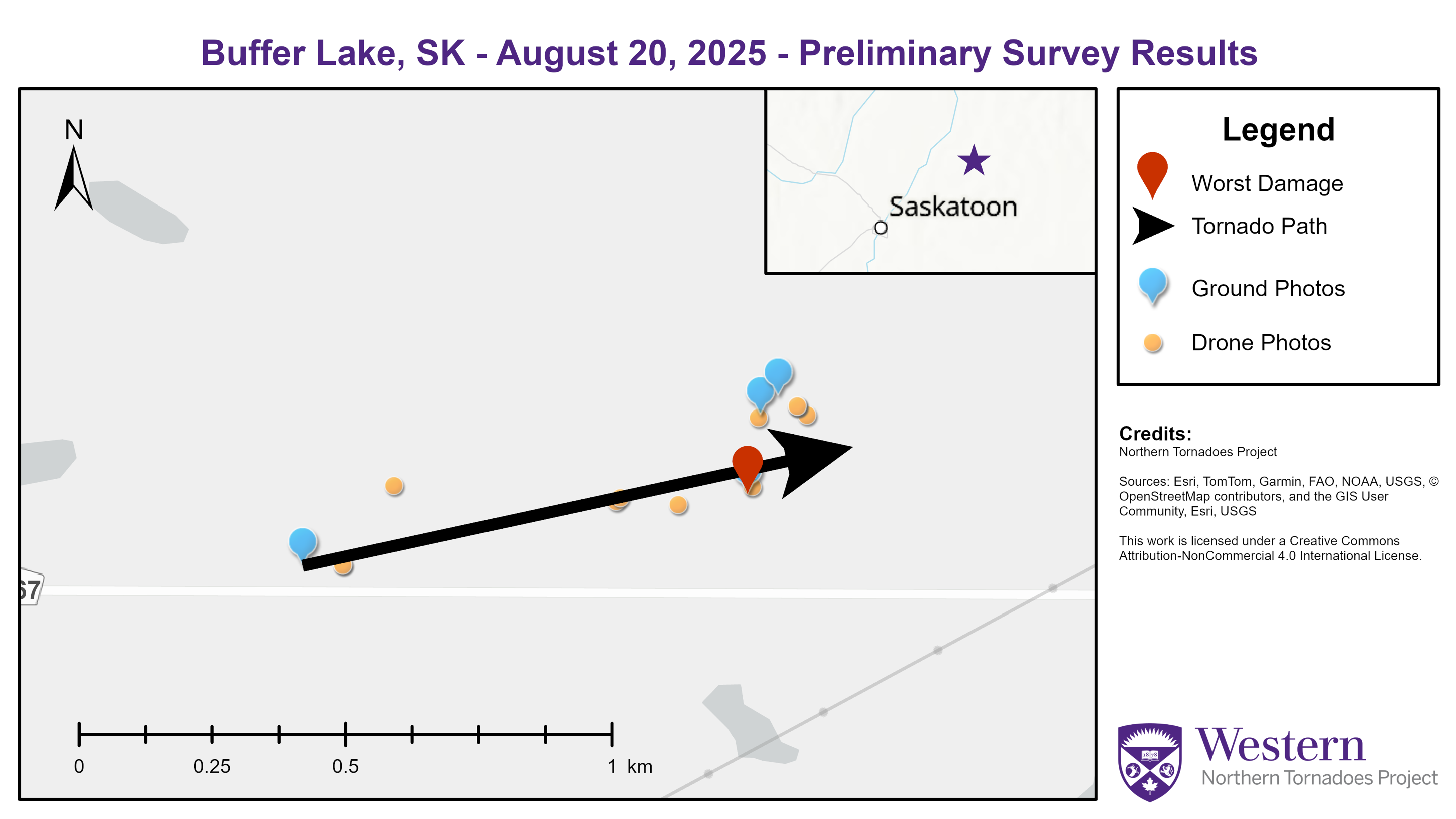
Survey map showing the location of the Buffer Lake-area EF1 tornado.
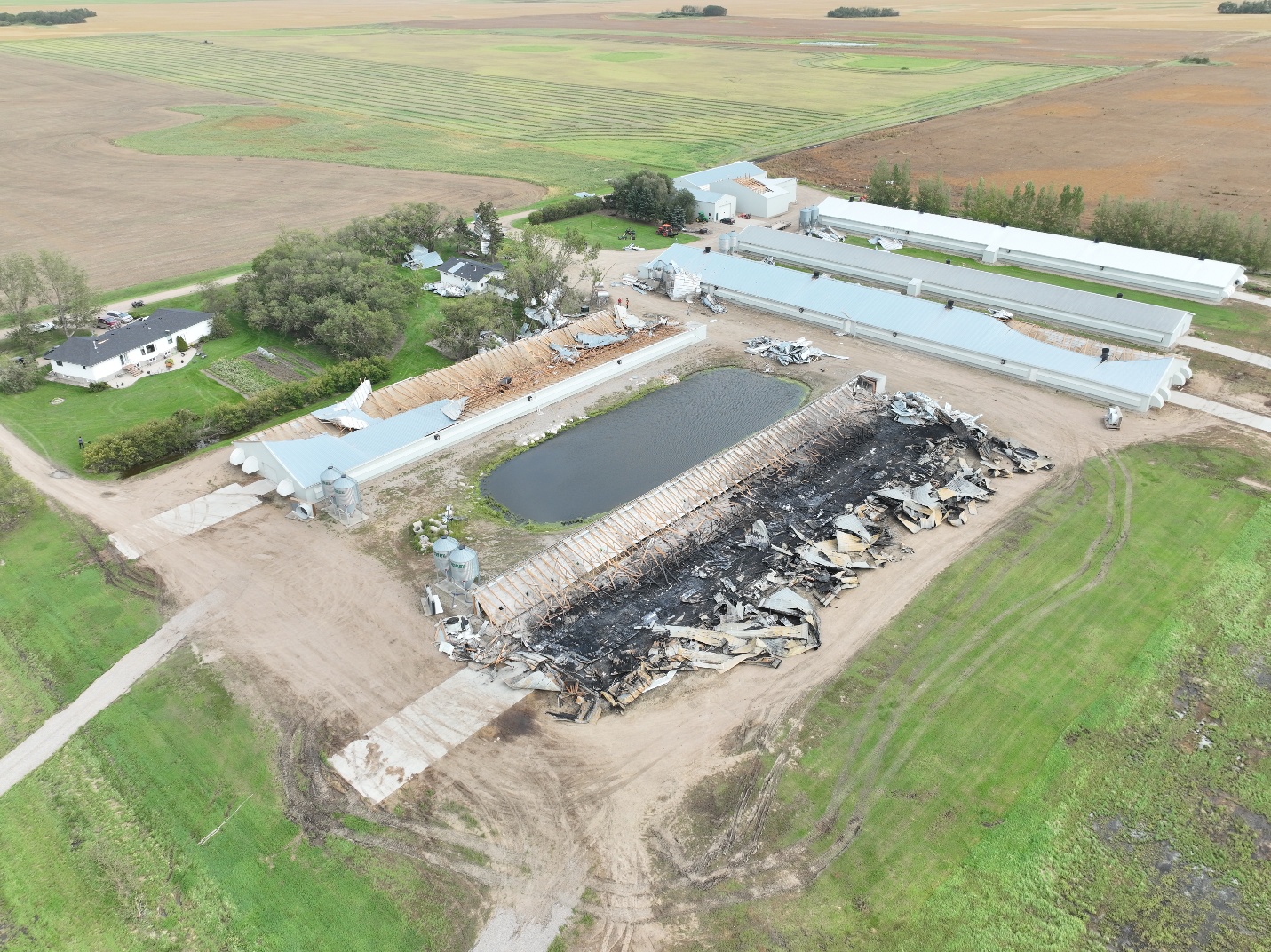
The EF1 downburst caused mulitple barns to collaps (one caught fire) as well as other building and tree damage at this farm in the Gruenthal area. This is the location with the highest-rated damage for the downburst.
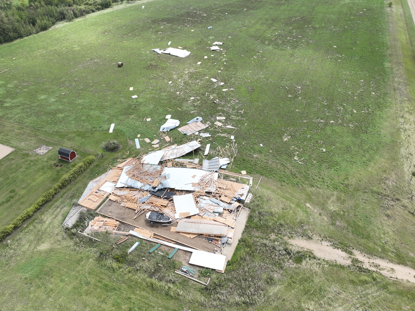
Outbuilding destroyed and debris carried downwind by the EF1 downburst at a Gruenthal-area farm.
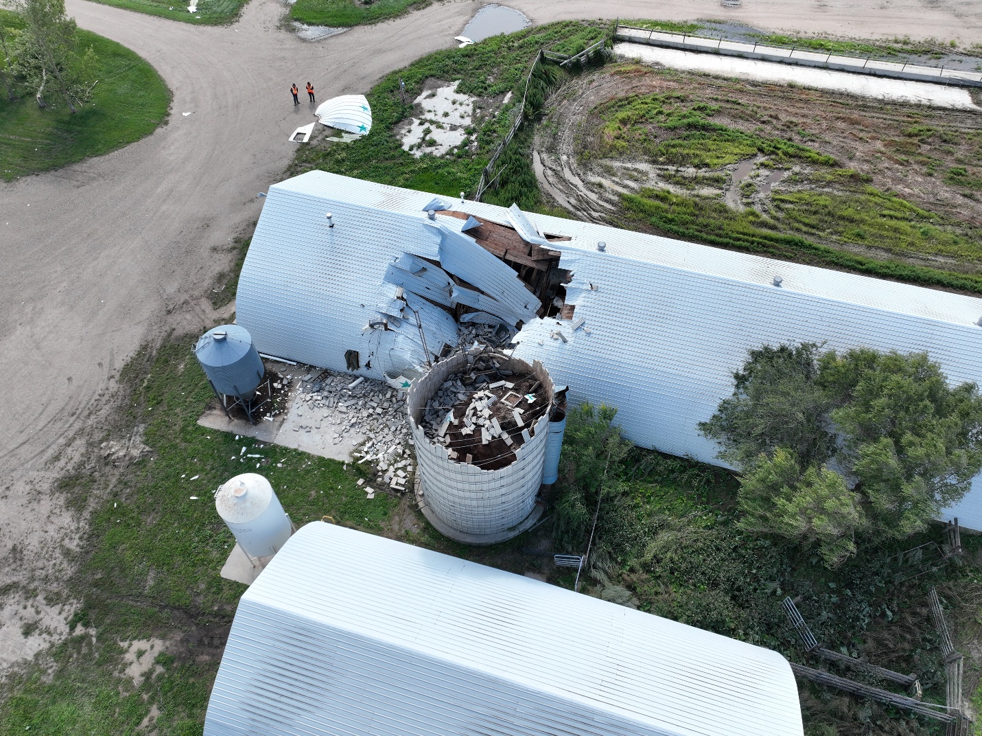
Concrete-stave silo toppled at a Gruenthal-area farm by the EF1 downburst.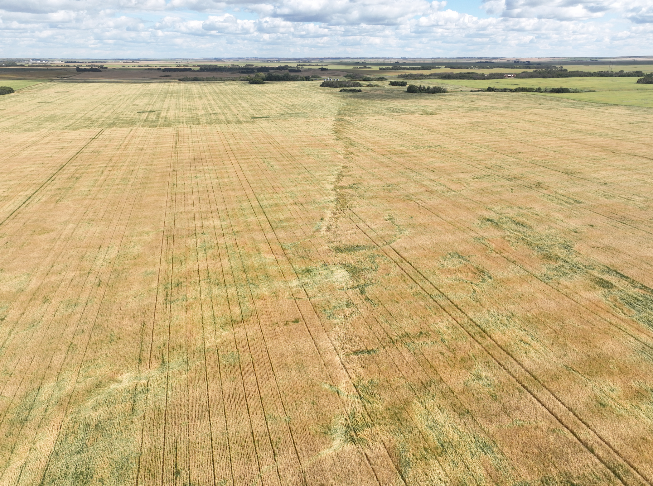
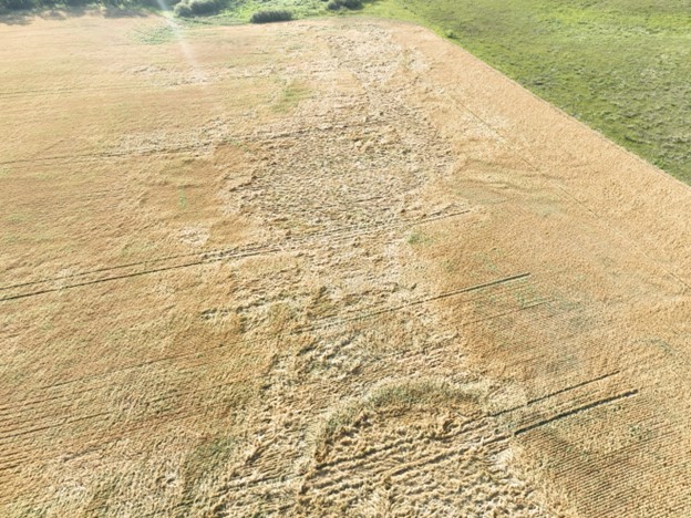
Short, narrow path of a crop damage caused by a gustnado near Aberdeen.
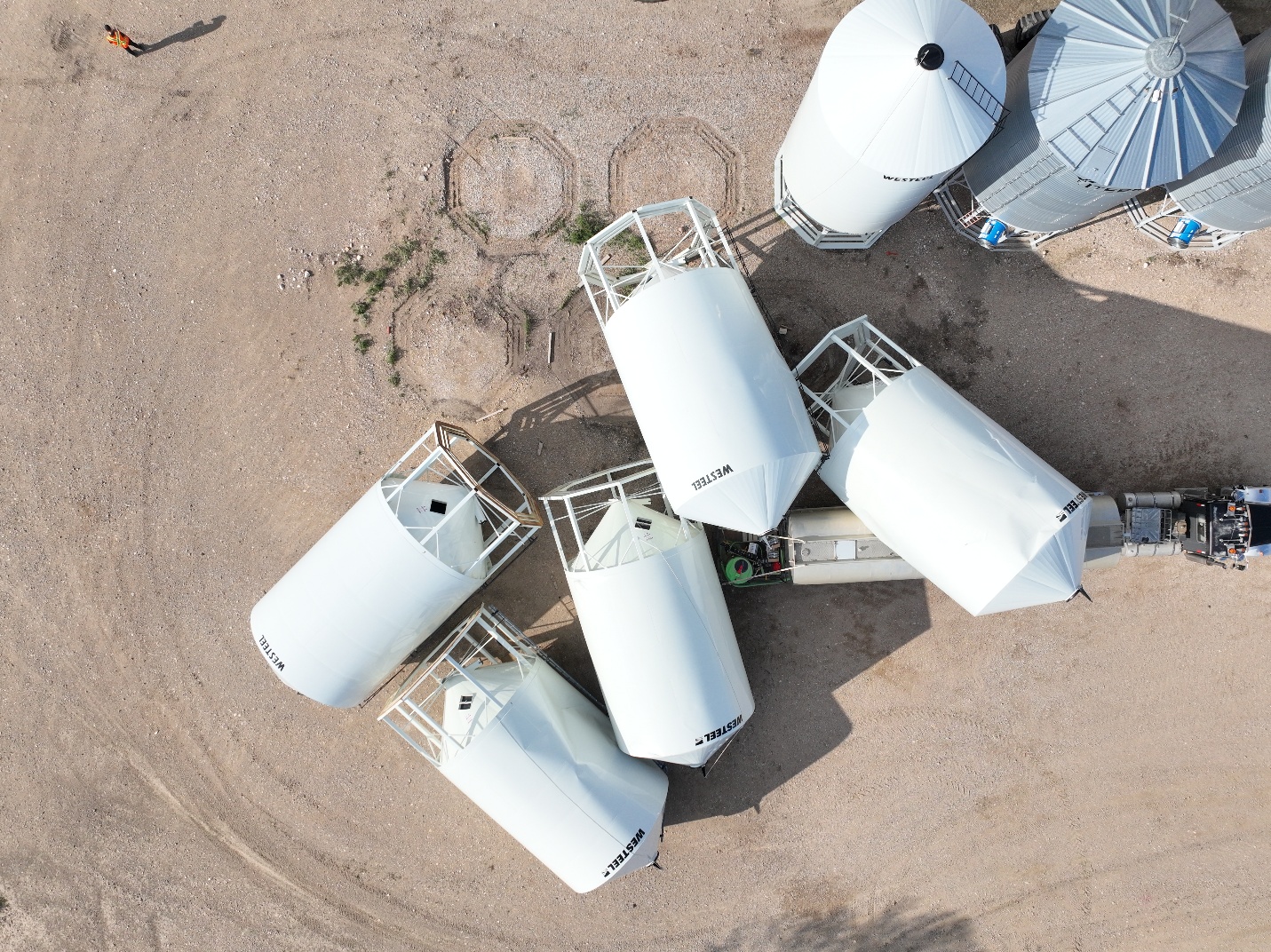
Empty, unanchored grain bins toppled by the Buffer Lake-area EF0 tornado.
Narrow path of crop damage to west of farm with grain bins toppled near Buffer Lake.