Three weak tornadoes in southern MB from Aug 5-6
The NTP has confirmed three weak tornadoes in southern MB from storms on August 5 and 6.
The first on August 5 occurred in southwest MB near Melita and was assigned a Default-EF0 rating given no damage was reported.
The second and third tornadoes on August 6 occurred northeast of Winnipeg and were assigned EF0 ratings after a damage survey was conducted.
Details are provided in the event summaries below, along with a regional map and survey maps, as well as survey images. The tornadoes can be plotted using the NTP Dashboard here.
====
Event Name: Grande-Clairière, MB
Date: August 5, 2025
Start Time: 8:45 PM CDT (0145Z)
Final Classification: Tornado (Over Land)
Preliminary EF-Scale Rating: EF0-Default
Estimated Tornado Location: 49.50N, 100.70W
Description: Witness captured video of a tornado near Grande-Clairière. No injuries were reported, and no damage has been reported. Start time estimated based on witness report and radar. Satellite imagery review is pending.
Event Name: Birds Hill Provincial Park, MB
Date: August 6, 2025
Start Time: 5:06 PM CDT (2206Z)
Final Classification: Tornado (Over Land)
Preliminary EF-Scale Rating: EF0
Preliminary EF-Scale Damage Indicator / Degree of Damage: : C-T/DOD-3
Estimated Tornado Location: 49.9969N, 96.8999W
Description: Witness reported tornado near Birds Hill Provincial Park. No injuries were reported. An NTP ground and drone survey was completed on August 7, 2025. Damage assessed as EF0 tornado, with an estimated max. wind speed of 115 km/h, with narrow path of minor tree damage found over an area 4.1 km long and up to 270 m wide. Start time is radar estimated. Satellite imagery review is pending.
Event Name: Dugald, MB
Date: August 6, 2025
Start Time: 5:30 PM CDT (2230Z)
Final Classification: Tornado (Over Land)
Preliminary EF-Scale Rating: EF0
Preliminary EF-Scale Damage Indicator / Degree of Damage: : C-T/DOD-3
Estimated Tornado Location: 49.9007N, 96.8575W
Description: Video and photos of possible tornado near Dugald. No injuries were reported. An NTP ground and drone survey was completed on August 7, 2025. Damage assessed as EF0 tornado, with an estimated max. wind speed of 115 km/h, with narrow path of crop and minor tree damage found over an area 4.24 km long and up to 70 m wide. Start time is estimated based on video and radar. Satellite imagery review is pending.
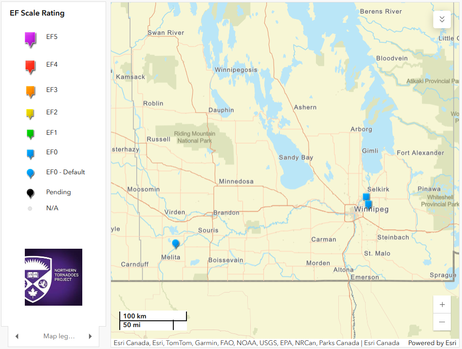
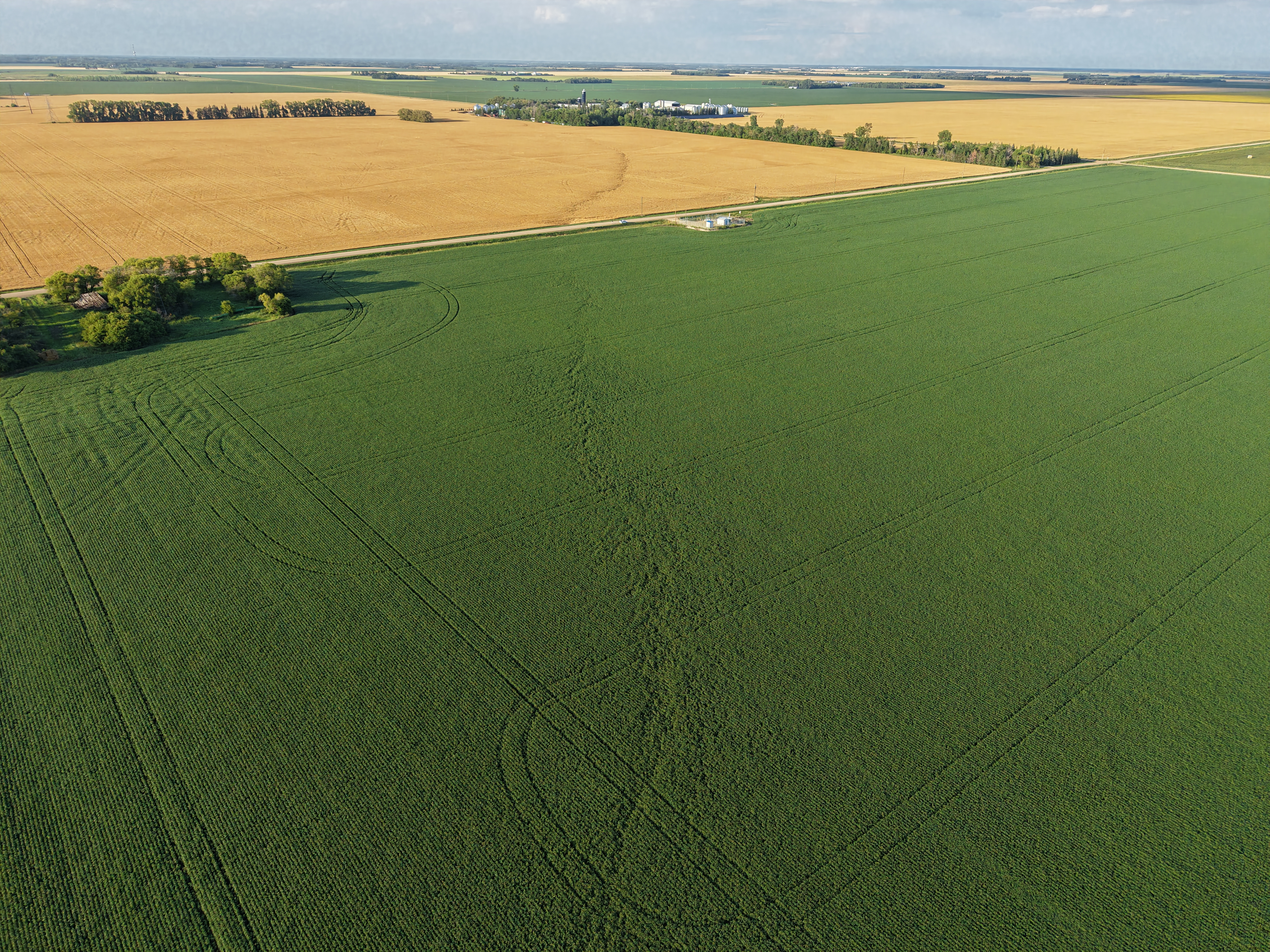
Regional map showing the locations of the three Manitoba tornadoes.
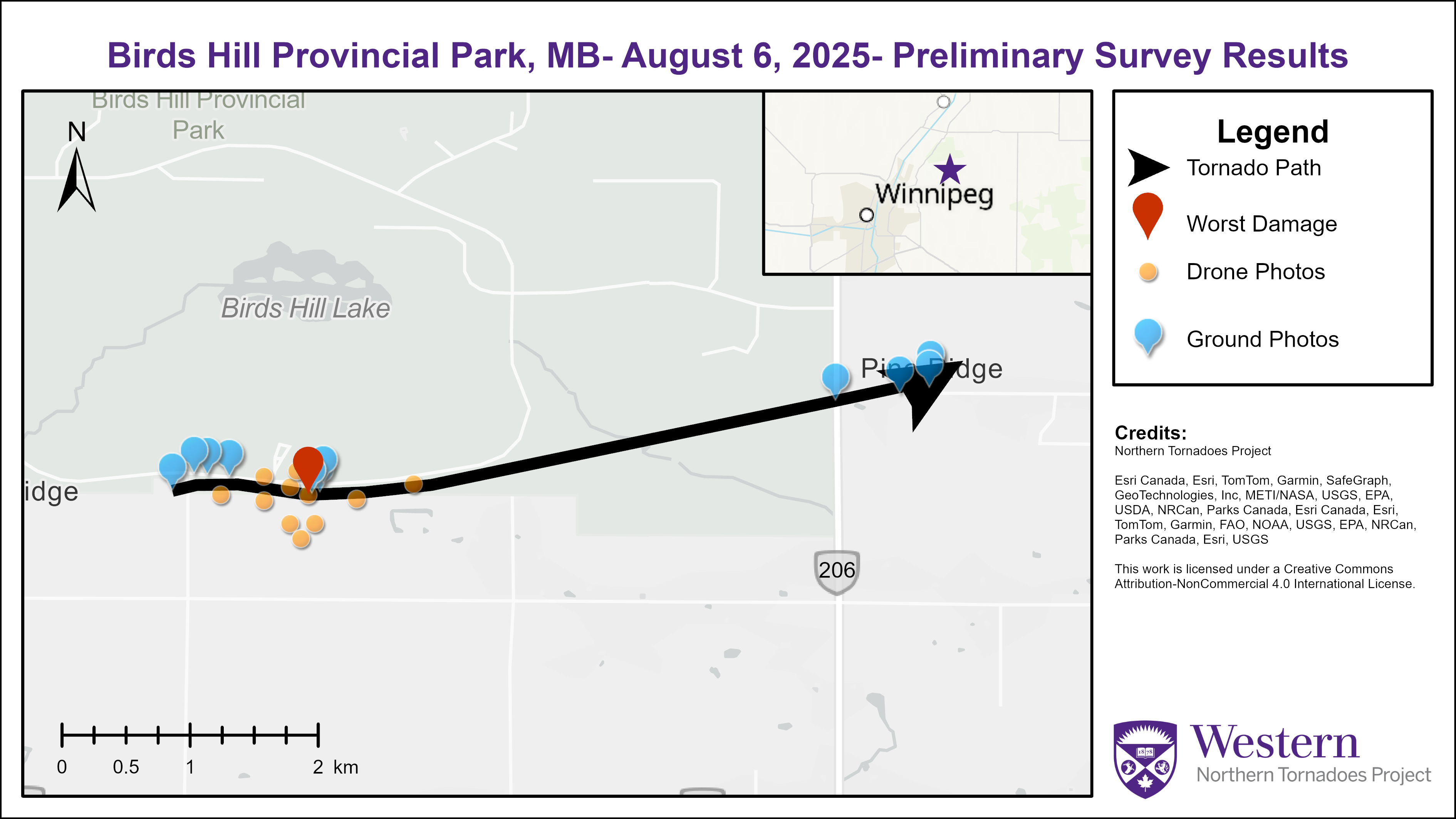
Survey map for the Birds Hill Provincial Park EF0 tornado.
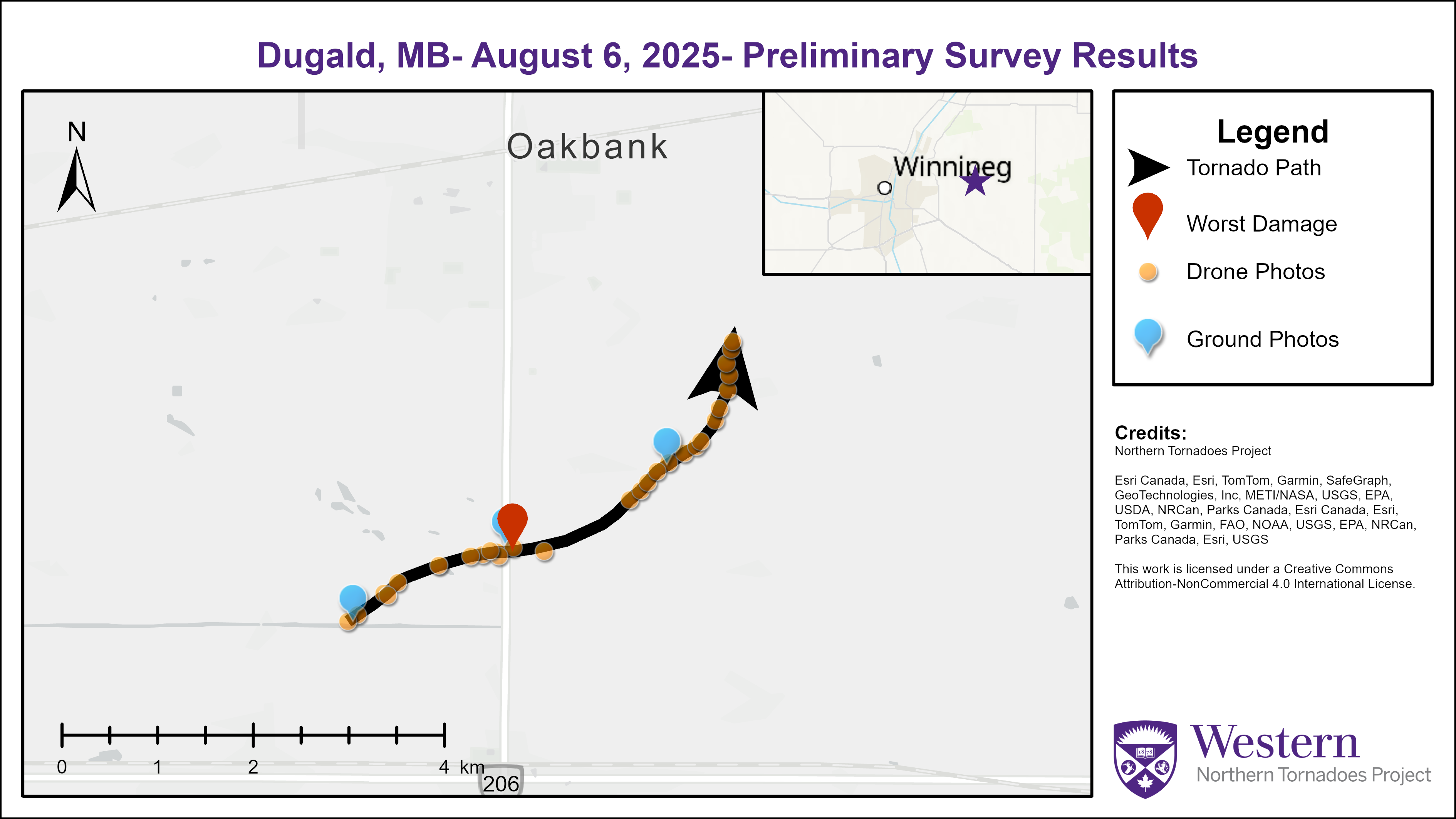
Survey map for the Dugald EF0 tornado.
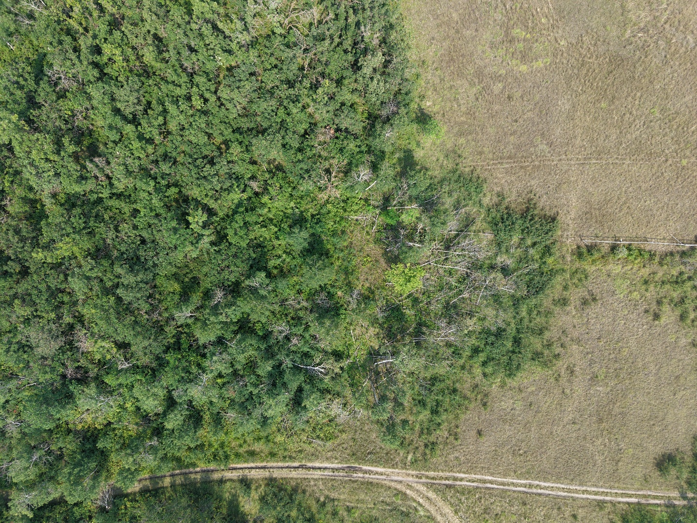
The worst tree damage along the path of the Birds Hill tornado.
A clear long, narrow damage path through crops from the Dugald tornado.
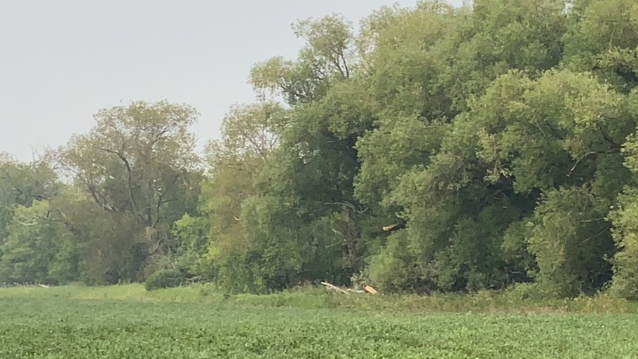
Tree damage along the Dugald tornado track.