Weak tornado at Lucan, ON on June 30
The NTP has confirmed that a tornado occurred just south of Lucan, ON on the afternoon of June 30. It caused minor damage rated at EF0. Details are provided in the event summary below, along with regional and event maps and images from the survey. The tornado can be plotted on a map using the NTP Dashboard here.
====
Event Name: Lucan, ON
Date: June 30, 2025
Start Time: 3:23 PM EDT (1923 UTC)
Final Classification: Tornado (Over Land)
Final EF-Scale Rating: EF0
EF-Scale Damage Indicator / Degree of Damage: C-T/DOD-2
Start of damage track: 43.1711N, 81.3937W
End of damage track: 43.1774N, 81.3719W
Location of worst damage: 43.1756N, 81.3760W
Description: Witnesses captured video and photos of a tornado south of Lucan. Damage to a farm property, trees and crops was reported. No injuries were reported. An limited NTP ground survey was completed on June 30, 2025, and a full ground and drone survey was completed on July 1. Damage assessed as EF0 tornado, with an estimated max. wind speed of 110 km/h, track length of 1.91 km and max. path width of 100 m. Tornado motion was from the WSW (approx. 250 degrees). Start time is based on witness reports. Satellite imagery review is pending.
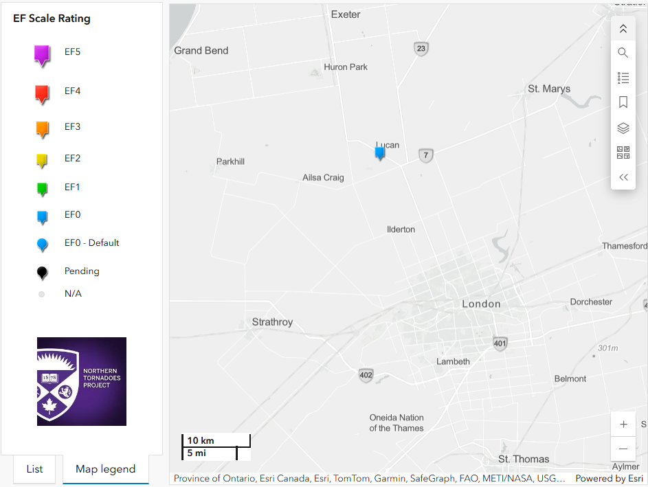
Regional map showing the location of the Lucan, ON EF0 tornado.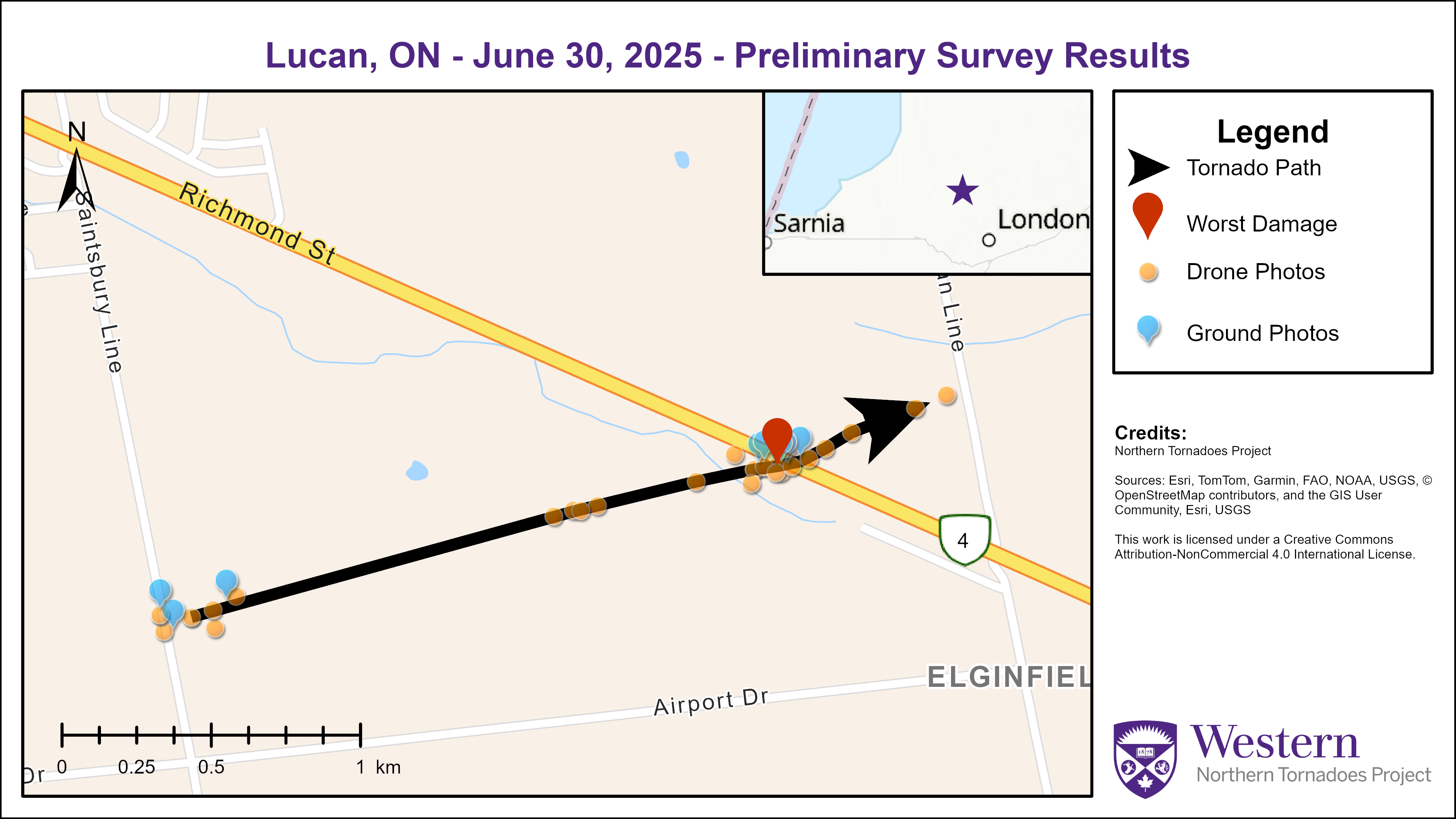
Survey summary map for the Lucan, ON tornado.
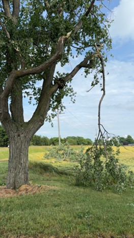
Photo of worst damage location where several large branches were snapped off a couple trees and lofted short distances in multiple directions, with one thrown 30 m. (43.1756, -81.3760)
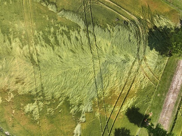
Drone photo of worst crop damage from tornado, located just west of worst damage location. (81.3767304°W 43.1755199°N)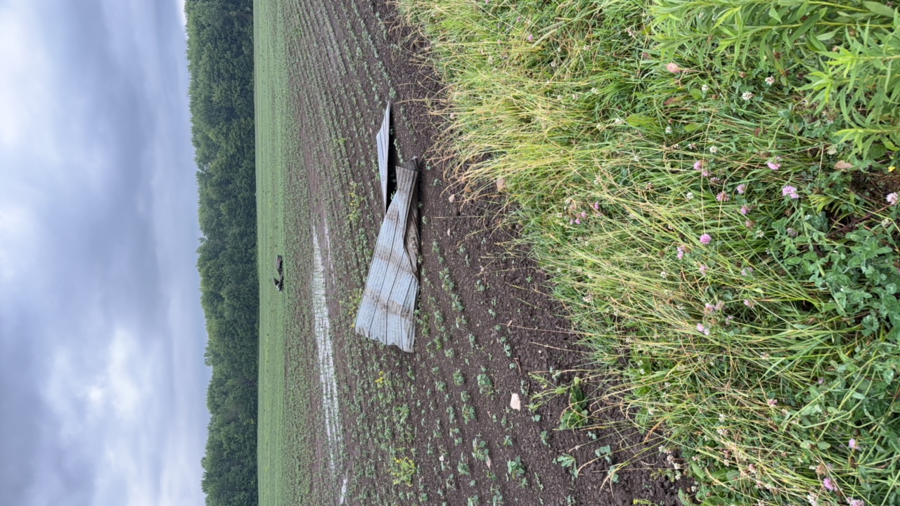
Sections of metal roofing thrown downwind from farm outbuilding near start of tornado damage path.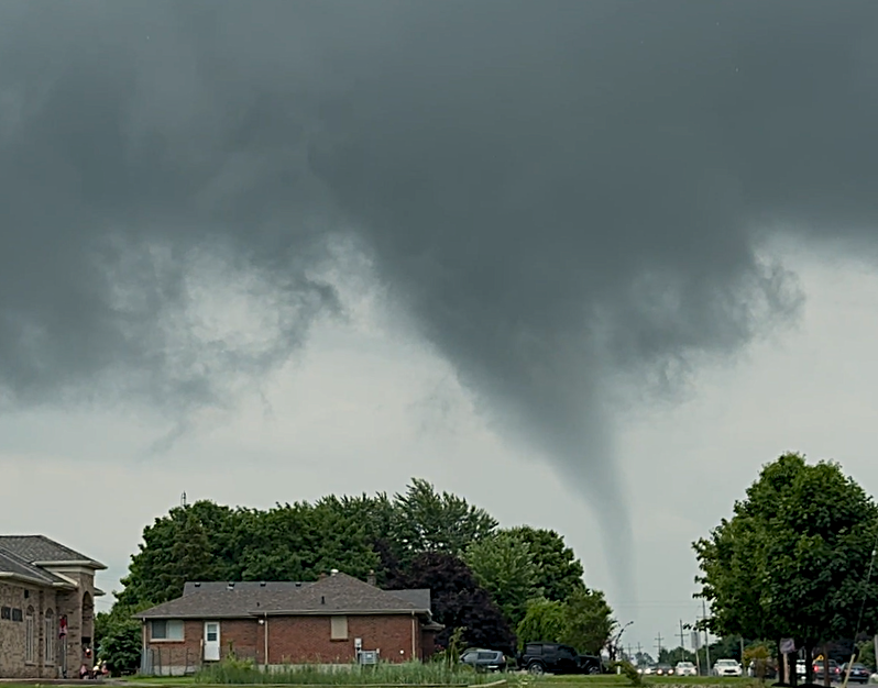
Photo of tornado south of Lucan taken by NTP Director Dave Sills
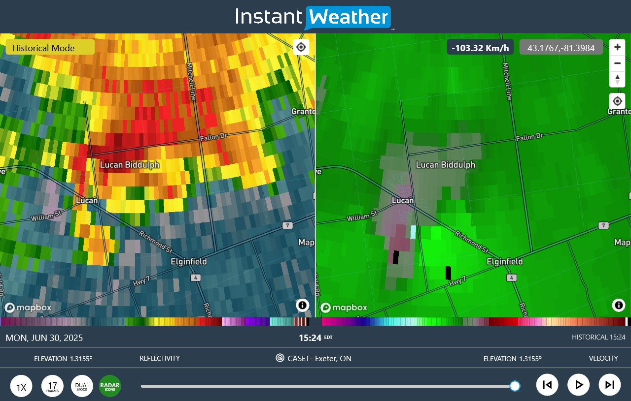
Radar image showing reflectivity (left) and radial velocity (right) at time of the Lucan tornado.