A third tornado on May 19 in SW Ontario
The NTP has confirmed a third tornado related to the storms of May 19 in southwestern Ontario. Additional damage was reported to the east of London, ON in the Salford area. Following an NTP damage survey conducted in this area on May 26, it was concluded that an EF0 tornado caused the long, narrow path of damage.
Additional details are provided in the event summaries below, along with a regional map, a survey summary map, and two survey photos. The event can also be plotted on a map using the NTP Dashboard here.
====
Event Name: Salford, ON
Date: May 19, 2026
Start Time: 6:10 PM EDT (2210 UTC)
Final Classification: Tornado (over land)
Final EF-Scale Rating: EF0
EF-Scale Damage Indicator / Degree of Damage: FR12/DOD-2
Start of damage track: 42.9874N, 80.8983W
End of damage track: 43.0214N, 80.6992W
Location of worst damage: 42.9917N, 80.8692W
Description: Damage to trees and minor damage to a house and barn was reported in the Salford area after a storm passed through. No injuries were reported. An NTP ground and drone survey was completed on May 26, 2026, documenting the reported damage. Damage assessed as an EF0 tornado, with an estimated max. wind speed of 125 km/h, track length of 16.7 km and max. path width of 400 m. Tornado motion was from the WSW (approx. 255 degrees). Start time is radar estimated. Satellite imagery review is pending. The same storm had earlier produced an EF1 tornado that started in southwest London (Lambeth area) and ended near Mossley.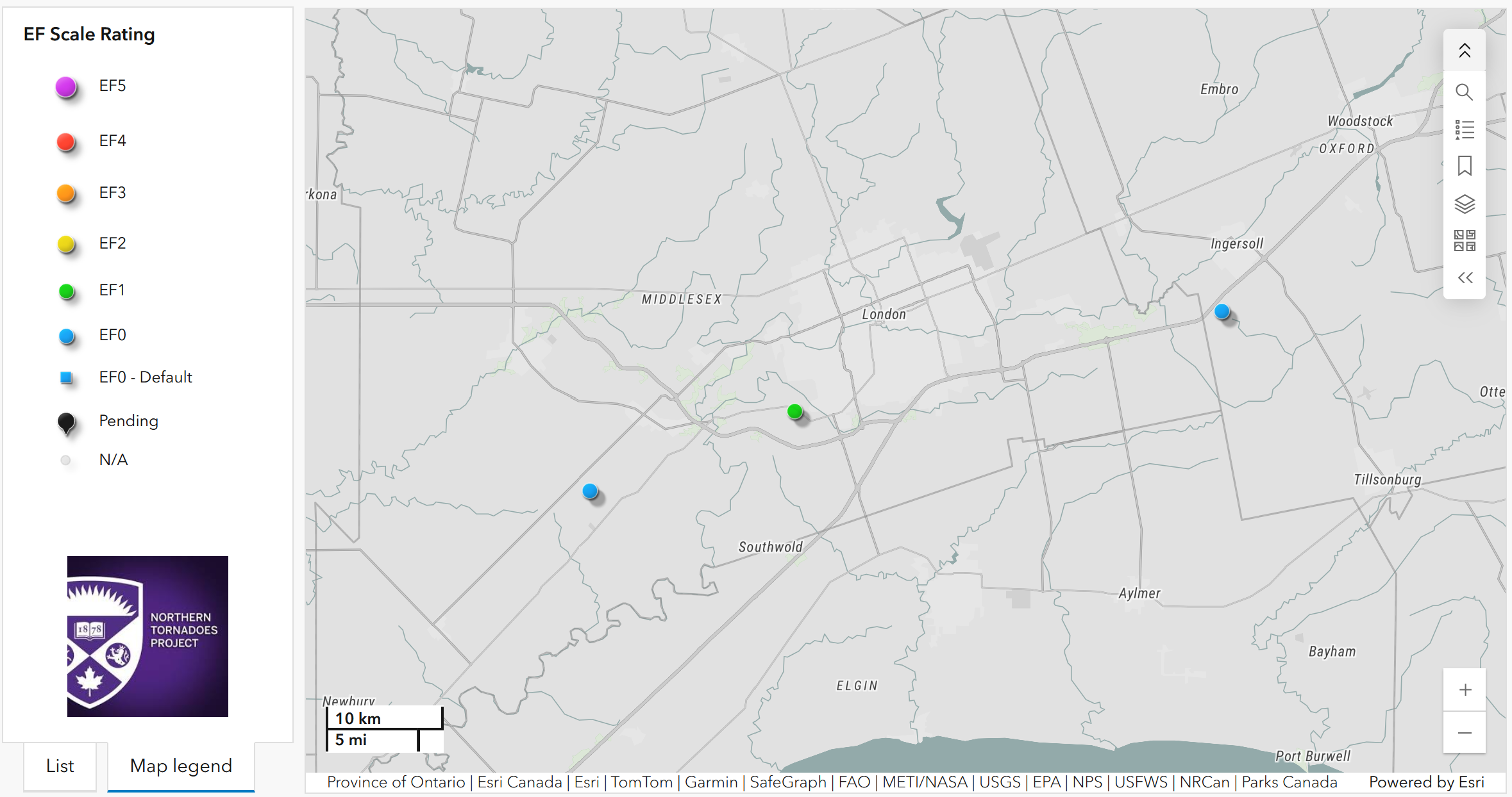
Regional map showing the start locations of the three May 19 tornadoes confirmed in the London area, with the Salford EF0 tornado shown at far right.
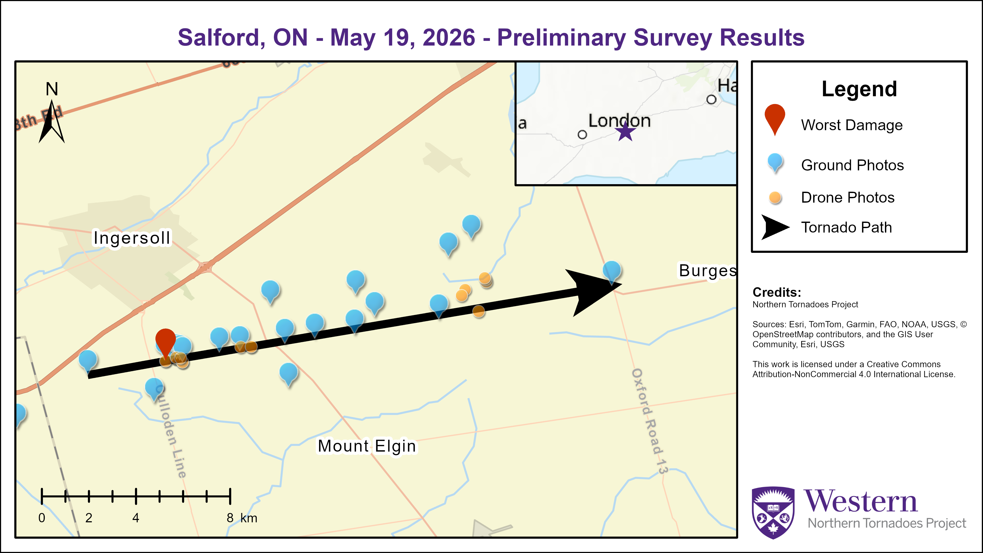
Survey summary map showing the track of the Salford EF0 tornado east of London, ON and south of Ingersoll, ON.
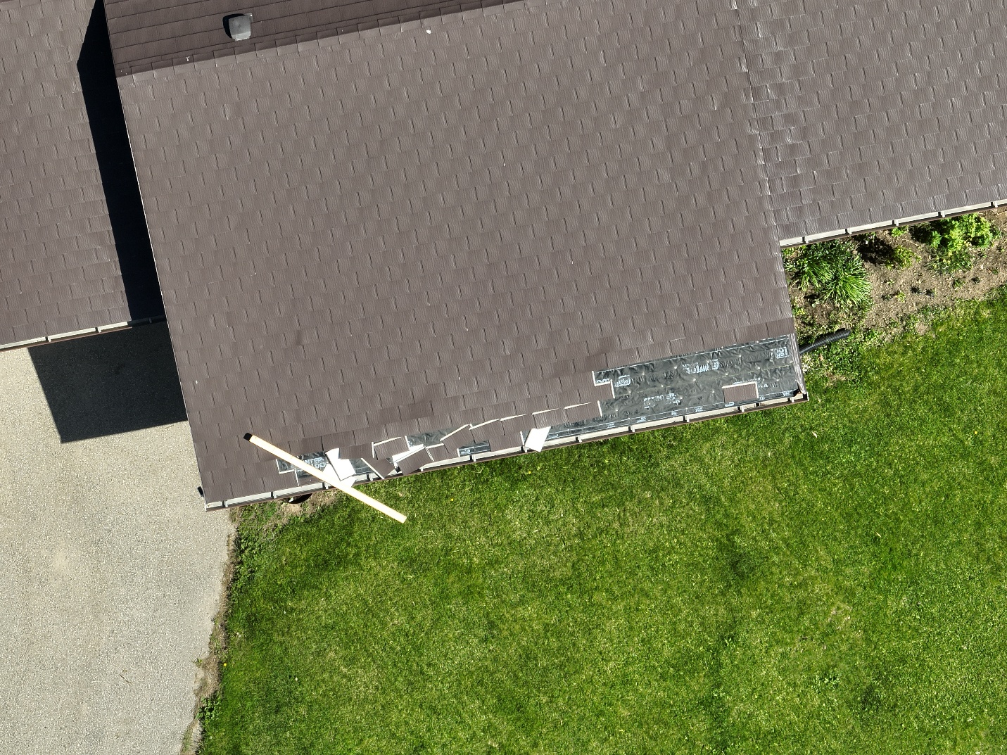
Drone photo of roof damage to a residential home in the location with the worst damage along the track of the Salford tornado (FR12 / DOD2).
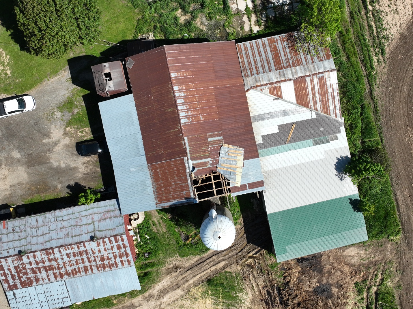
Drone photo of barn roof damage in a location along the track of the Salford EF0 tornado.





