Details on June 9 tornadoes in SK and MB
The NTP can now provide additional details for the June 9 tornadoes in Saskatchewan and Manitoba that have been confirmed so far.
The damage survey for the EF3 tornado in the Oxbow, SK area has been completed. This tornado began near the US border and travelled northeast for 32 km before 'roping out' and dissipating near Oxbow. The event summary is provided below, along with a regional map, a survey summary map and survey photos.
For the Ste Anne and Dufrost tornadoes, the confirmations were based on video evidence and no damage has thus far been reported. We have assigned a preliminary rating of EF0-Default for each, though a survey team will visit each site to confirm that no damage occurred. The event summaries are provided below with a regional map.
The tornadoes can also be plotted on a map using the NTP Dashboard here.
====
Event Name: North Portal - Oxbow, SK
Date: June 9, 2026
Start Time: 6:55 PM CST (0055 UTC)
Final Classification: Tornado (over land)
Final EF-Scale Rating: EF3
EF-Scale Damage Indicator / Degree of Damage: FR12/DOD-8
Start of damage track: 49.0000N, 102.4565W
End of damage track: 49.2182N, 102.1725W
Location of worst damage: 49.1346N, 102.2802
Description: Witnesses captured video and photos of a tornado that tracked from North Portal area northeastward to south of Oxbow. Significant damage to a farm property was reported, including the destruction of a home and an outbuilding, and damage to grain bins, multiple vehicles and trees. No injuries were reported, though a family pet was killed. An NTP ground and drone survey was completed on June 10-11, 2026, documenting the reported damage and additional damage along the track including snapped power poles, pump jack damage at a battery site and additional tree and minor structural damage. Damage was found along the US border, through the survey team could not investigate further into North Dakota. Damage assessed as an EF3 tornado, with an estimated max. wind speed of 245 km/h, track length of 32.0 km and max. path width of 560 m. Tornado motion was from the SW (approx. 220 degrees). Start time is radar estimated. Further investigation pending, including satellite imagery review.
Event Name: Dufrost, MB
Date: June 9, 2026
Start Time: 3:40 PM CDT (2040 UTC)
Final Classification: Tornado (Over Land)
Preliminary EF-Scale Rating: EF0-Default
Estimated Tornado Location: 49.38N, 97.14W
Description: Witnesses captured video of a tornado northwest of Dufrost. No injuries were reported, and no damage has been reported. Start time is based on witness report. Further investigation pending.
Event Name: Ste. Anne, MB
Date: June 9, 2026
Start Time: 6:15 PM CDT (2315 UTC)
Final Classification: Tornado (Over Land)
Preliminary EF-Scale Rating: EF0-Default
Estimated Tornado Location: 49.715N, 96.650W
Description: Witnesses captured video of a tornado north of Ste. Anne. No injuries were reported, and no damage has been reported. Start time is based on witness report. Further investigation pending.
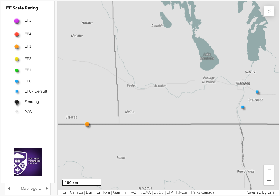
Regional map showing the locations of the North Portal - Oxbow EF3 tornado (left) and the Dufrost and Ste Anne tornadoes (right)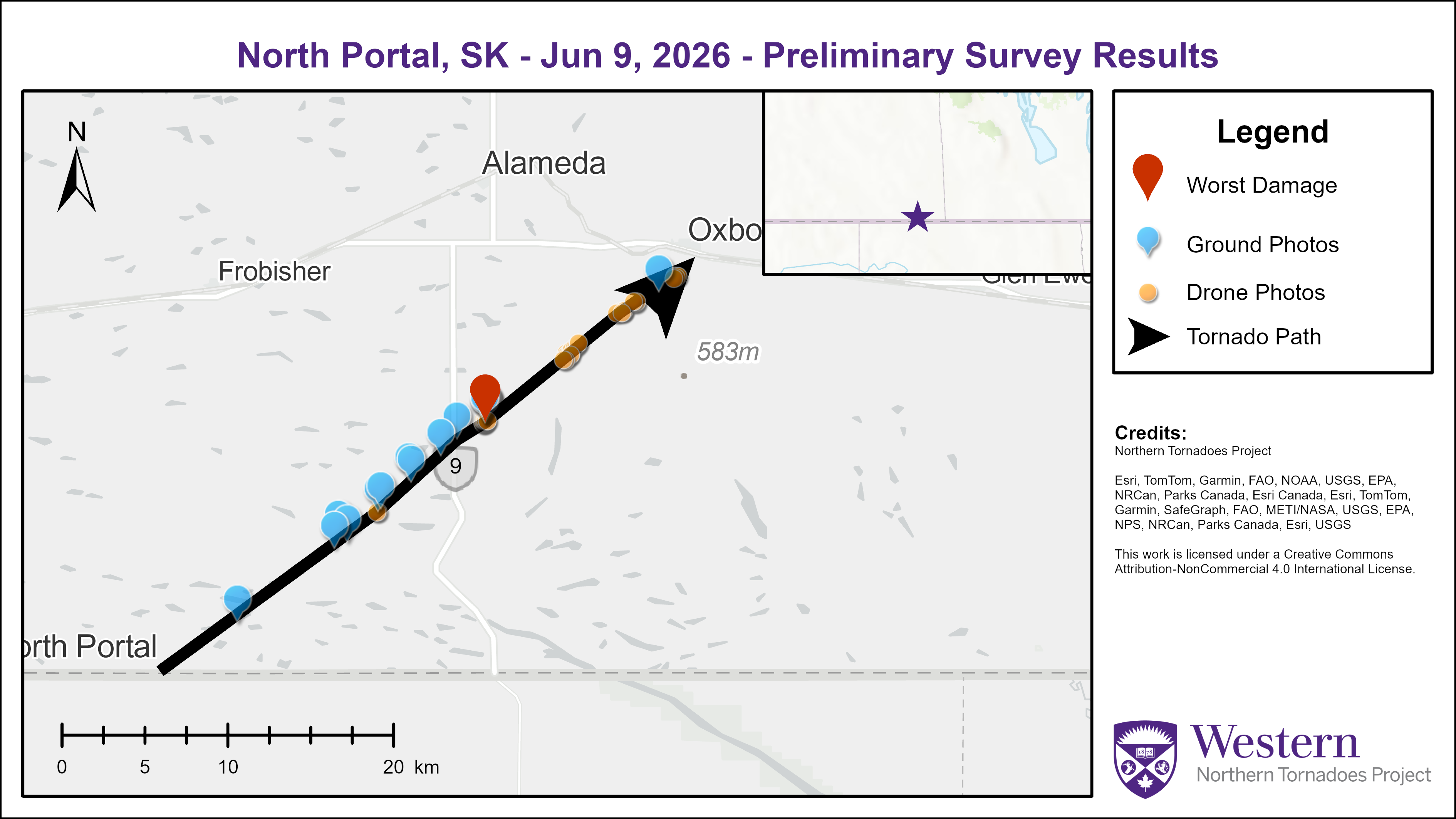
Survey summary map for the North Portal - Oxbow EF3 tornado
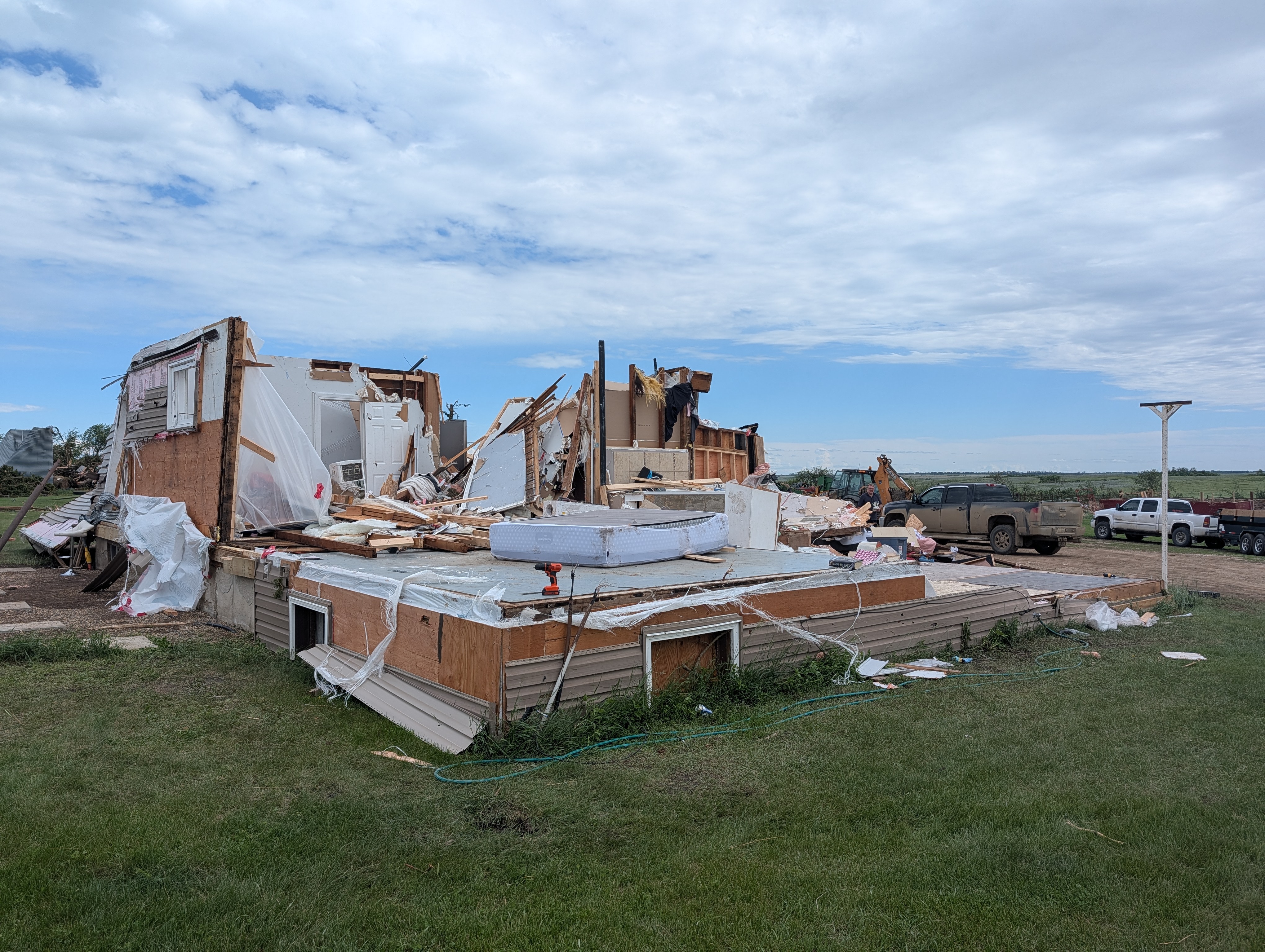
Worst damage point for the EF3 tornado (FR12 DOD8). Most walls collapsed with few left standing.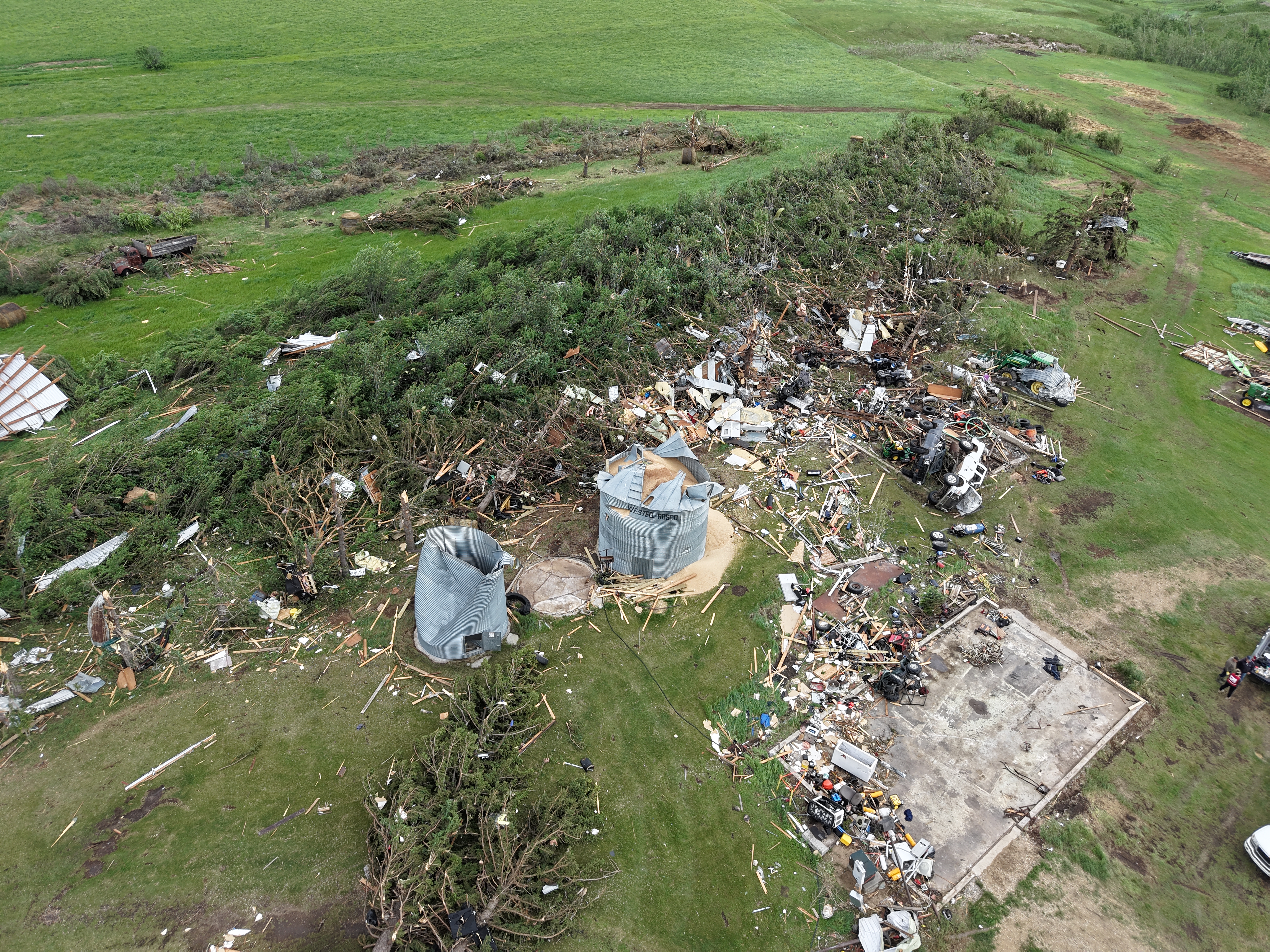
Drone image of farm outbuilding that was swept away, with two grain bins damaged and one grain bit not found, and many trees snapped or uprooted.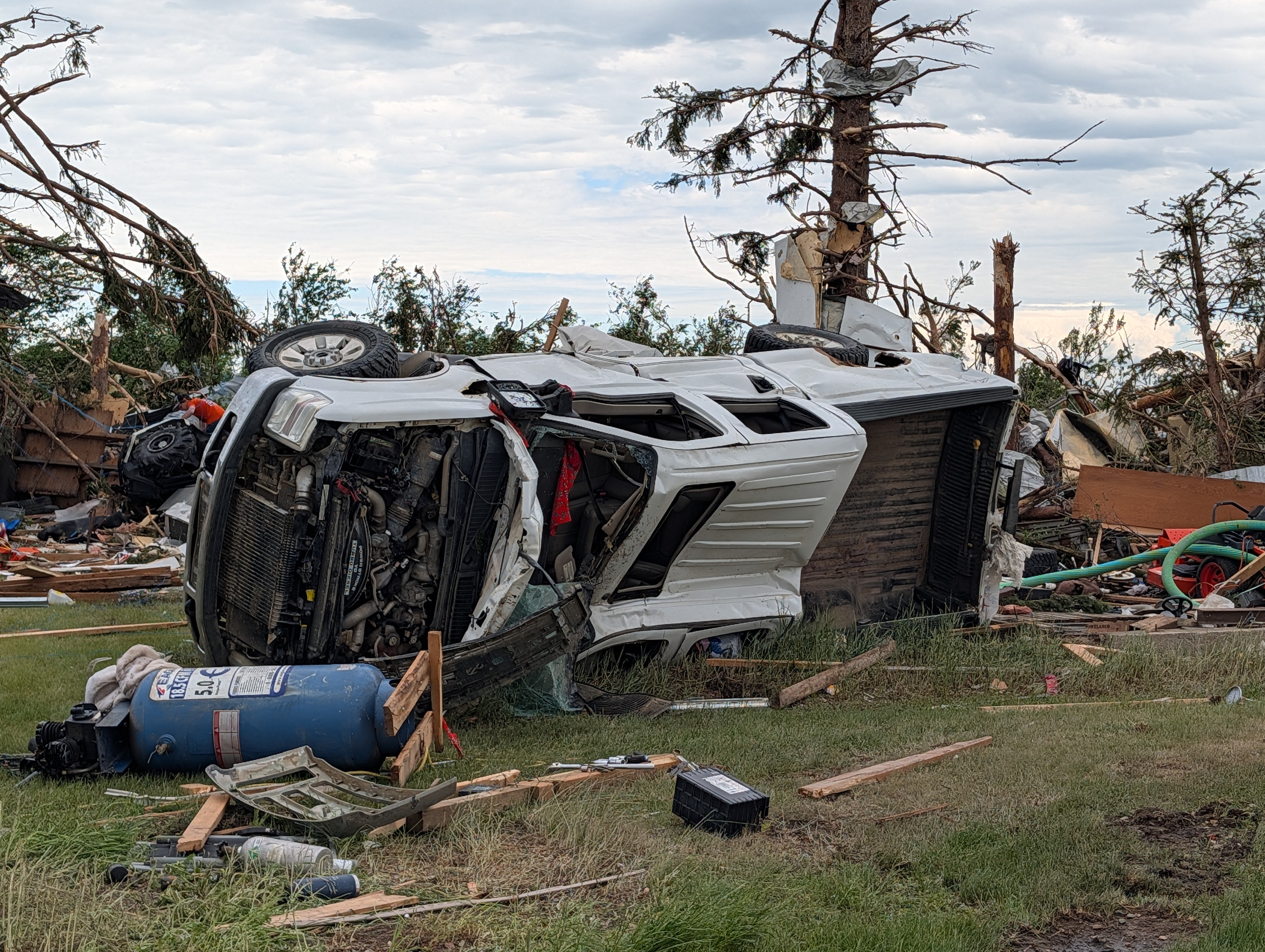
One of two trucks at the farmstead that were tossed/rolled.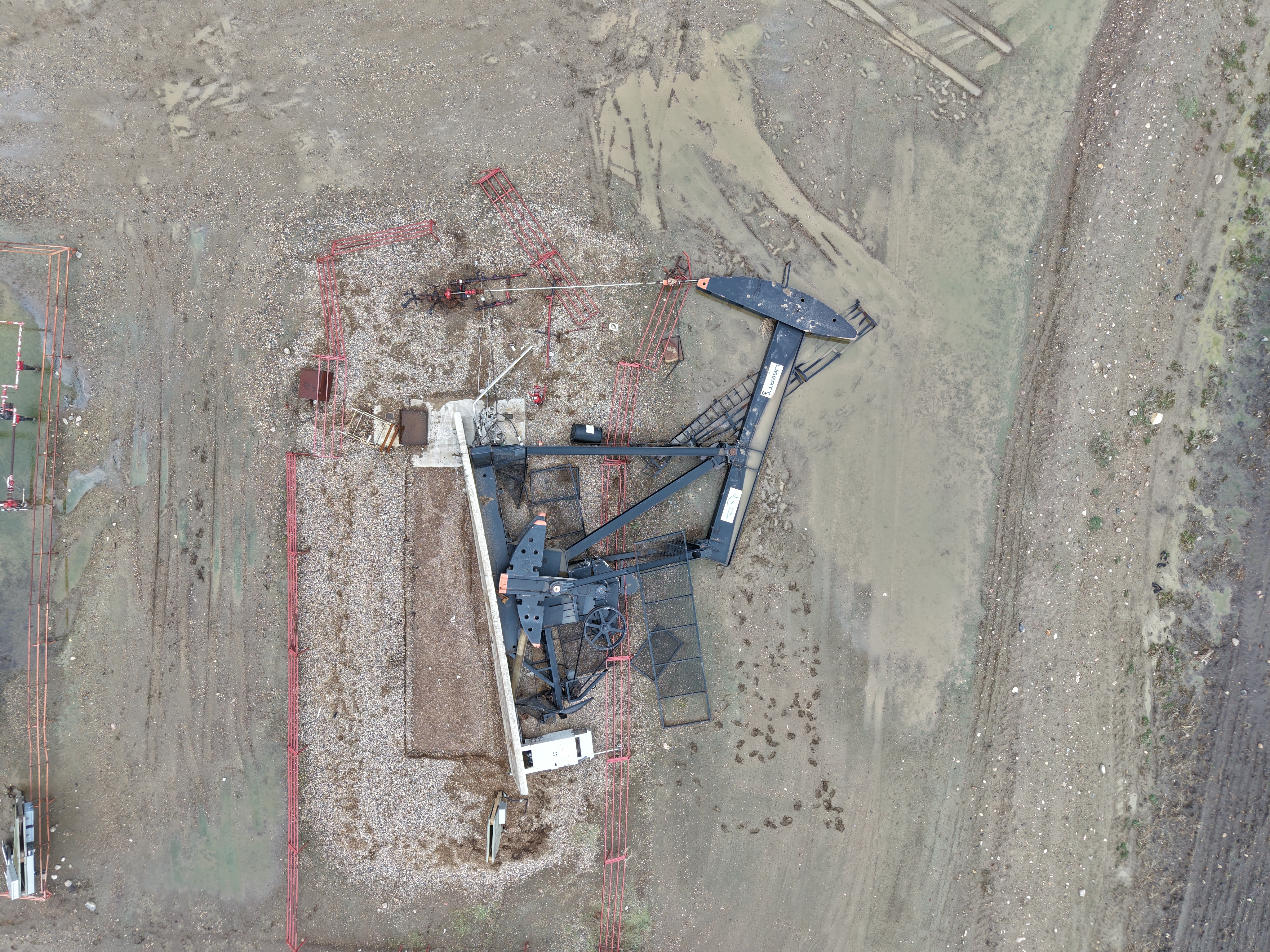
One of two pump jacks that were blown over and shifted at an oil facility.