Tornado in southwestern ON on June 25
The NTP has confirmed an EF1 tornado at Glencoe in southwestern Ontario on June 25. This supercell tornado had a path length nearly 10 km long and caused damage mainly to barns, trailers, and trees. No injuries were reported.
Note that this is an upgrade from the preliminary EF0 rating.
Full details are provided in the event summary below, along with a regional map, a survey summary map, survey photos, an image of the tornado, and related radar imagery. The event can also be plotted on a map using the NTP Dashboard here.
====
Event Name: Glencoe, ON
Date: June 25, 2026
Start Time: 5:47 PM EDT (2147 UTC)
Final Classification: Tornado (over land)
Final EF-Scale Rating: EF1
EF-Scale Damage Indicator / Degree of Damage: SBO/DOD-4
Start of damage track: 42.7605N, 81.7604W
End of damage track: 42.6898N, 81.6970W
Location of worst damage: 42.7264N, 81.7269W
Description: Witnesses captured video and photos of a tornado in the Glencoe area. Damage to several older barns, trees, recreational trailers and minor damage to homes was reported. An NTP ground and drone survey was completed on June 25-26, 2026, documenting the reported damage. Damage assessed as an EF1 tornado, with an estimated max. wind speed of 145 km/h, track length of 9.60 km and max. path width of 250 m. Tornado motion was from the NW (approx. 325 degrees). Start time is radar estimated. Satellite imagery review is pending.
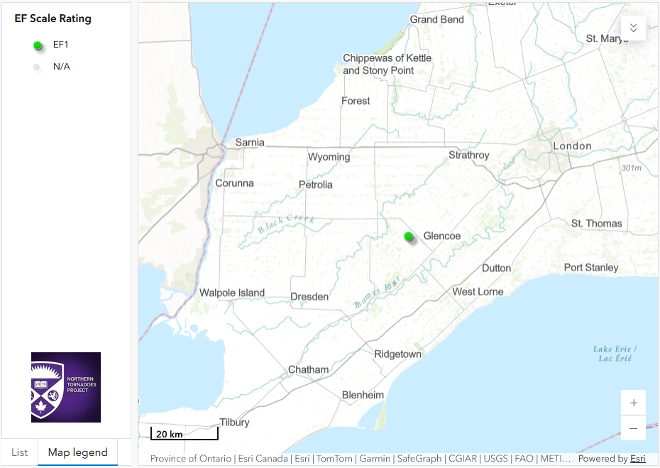
Regional map showing the location of the EF1 tornado in southwestern ON.
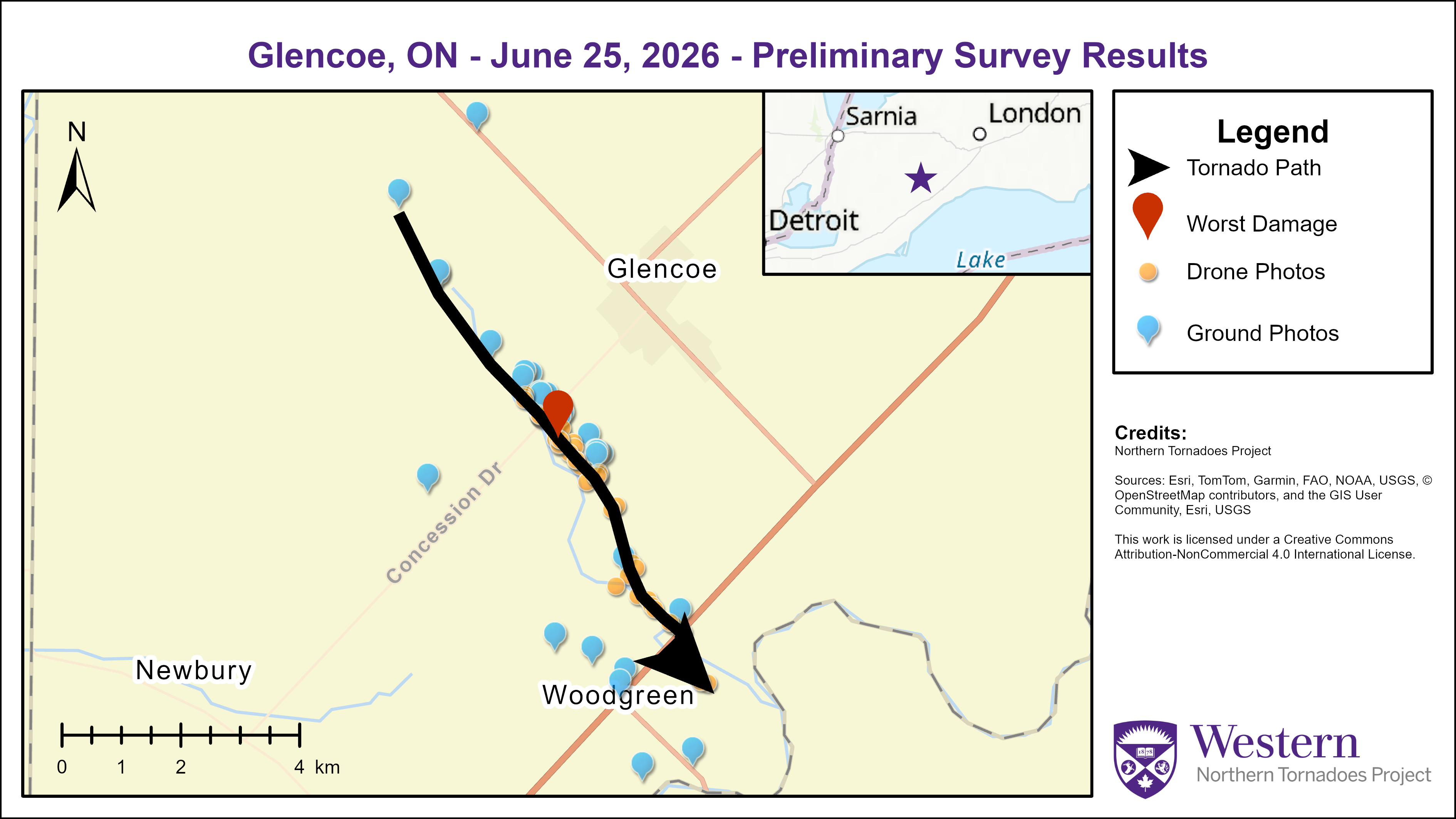
Survey summary map showing the path of the Glencoe EF1 tornado and related damage points.
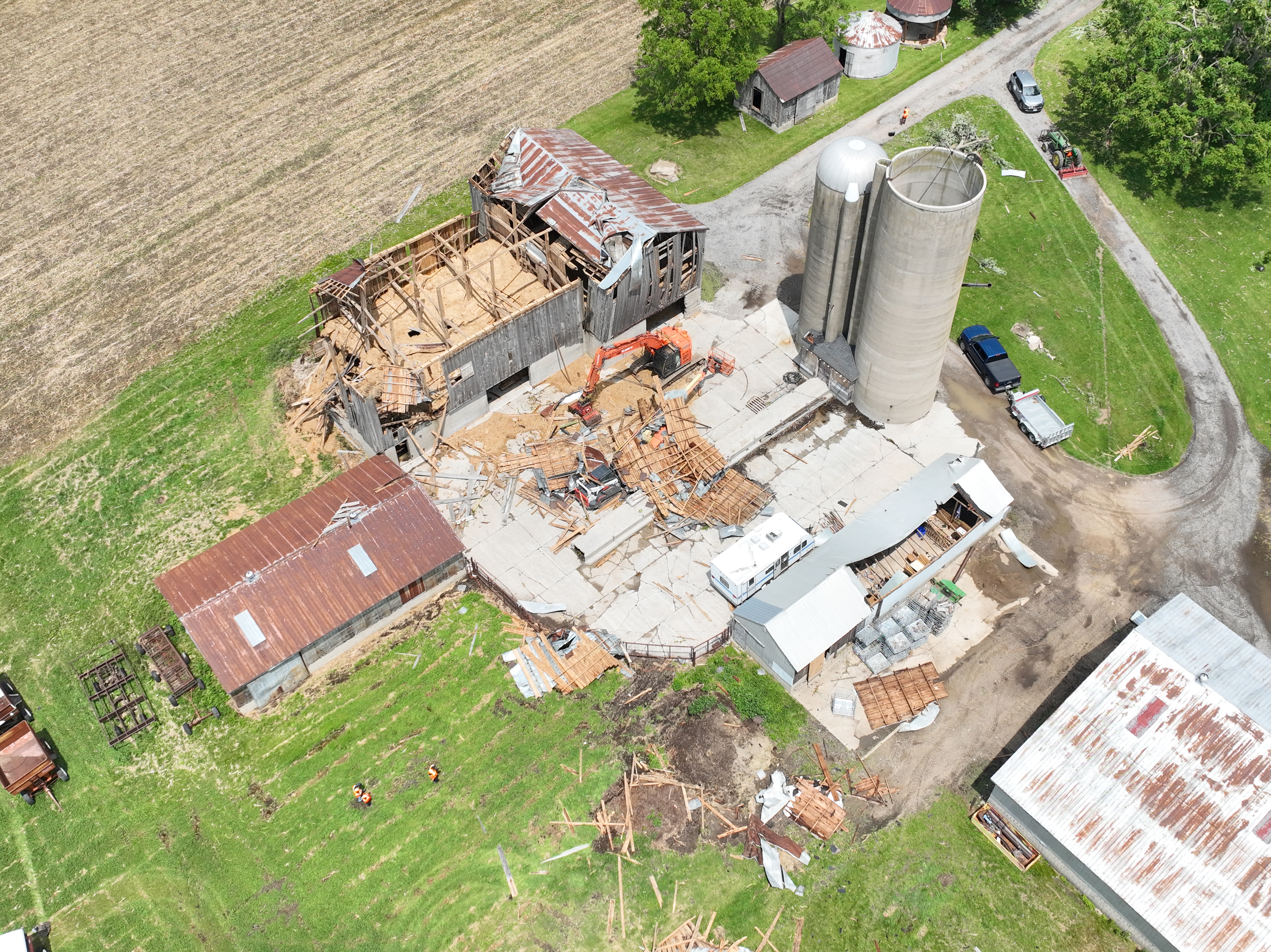
Drone image showing tornado damage to two barns with parts of roof being thrown tens of metres. The EF1 rating is based on the damage to the second, smaller barn given it was in better condition i.e. SBO/DOD4 EXP giving 145 km/h.
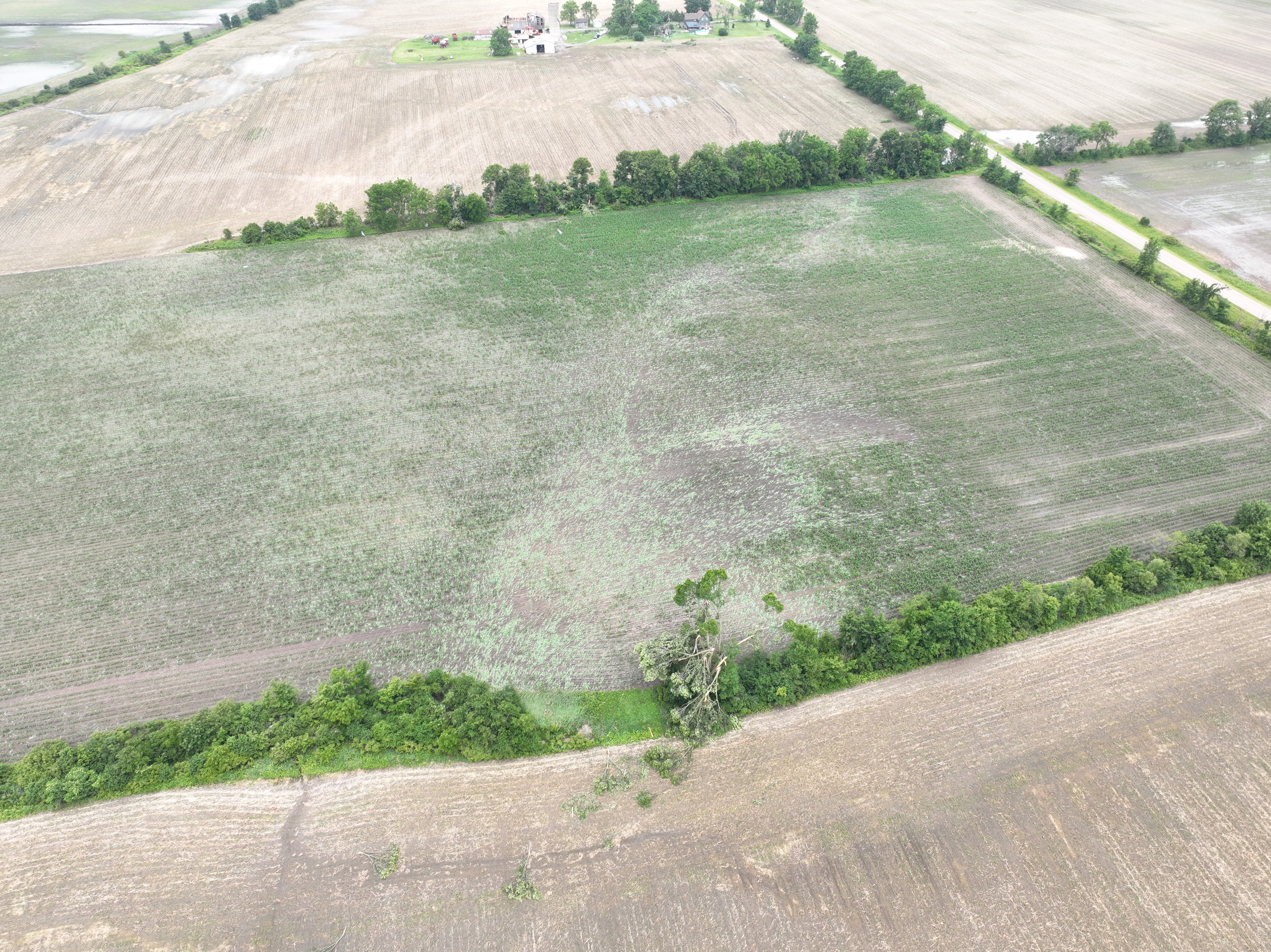
Drone photo showing the farm with the damaged barns in the background and vortex marks and tree damage in the foreground.
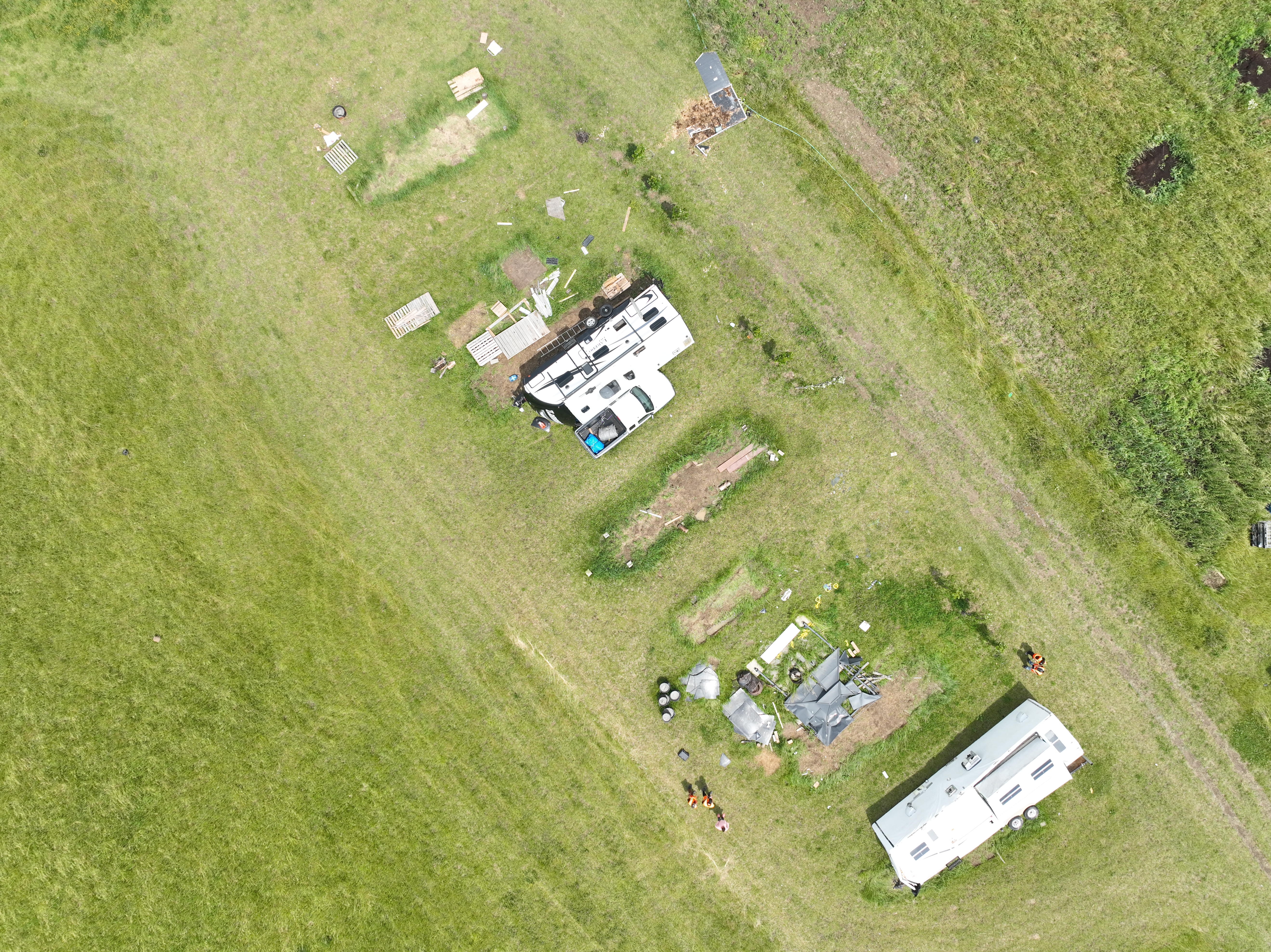
Drone image showing one trailer tipped (top) and another trailer rolled (bottom). Note there is no EF-scale damage indicator for this type of damage so this damage could not be used for rating purposes.
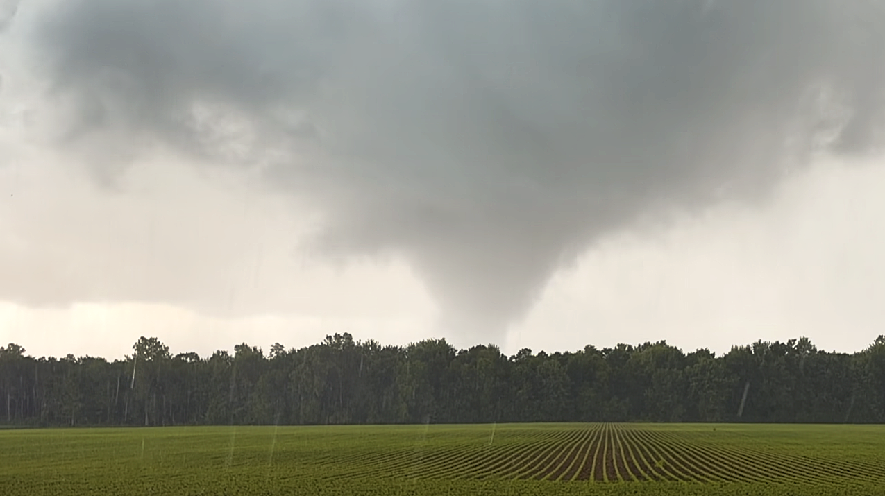
Video capture image of the Glencoe EF1 tornado at or near maximum intensity taken by Mark Robinson of The Weather Network (used with permission).
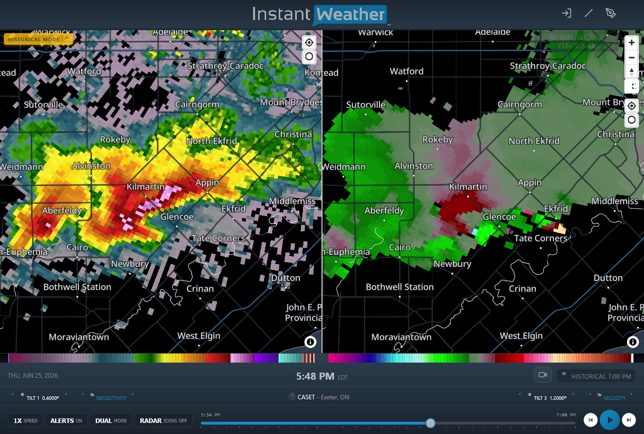
CASET radar image showing the supercell thunderstorm near the start time of the EF1 tornado at Glencoe. Tilt3 at this time is used to best see the radial velocity couplet (right).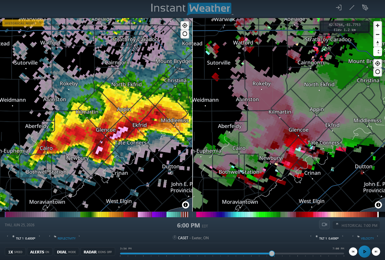
CASET radar image showing the supercell thunderstorm near the time of maximum intensty of the EF1 tornado at Glencoe. Tilt1 is shown - noise and dropouts nearly obscure the area of interest in radial velocity at right, making it difficult to identify the velocity couplet.