Two tornadoes and a downburst on May 19 in the London, ON area
Following multiple damage surveys, the NTP has confirmed two tornadoes and a downburst associated with the storms on May 19 in the London, ON area. The downburst caused up to EF1 damage from east London to Dorchester. One tornado caused EF1 damage from Lambeth across south London to the Mossley area. A second brief tornado caused EF0 damage in the Melbourne area, southwest of London.
Additional details are provided in the event summaries below, along with a regional map, a survey summary map, and several photos. A radar image is also included. The events can also be plotted on a map using the NTP Dashboard here.
====
Event Name: Melbourne, ON
Date: May 19, 2026
Start Time: 5:30 PM EDT (2130 UTC)
Final Classification: Tornado (over land)
Final EF-Scale Rating: EF0
EF-Scale Damage Indicator / Degree of Damage: C-T/DOD-3
Start of damage track and location of worst damage: 42.8518N, 81.5513W
End of damage track: 42.8572N, 81.4554W
Description: Witnesses captured video and photos of a tornado near Melbourne, southwest of London. Damage to trees and a farm structure was reported. No injuries were reported. An NTP ground survey was completed over May 19-20 and May 22, 2026, documenting the reported damage and additional tree damage. Damage assessed as an EF0 tornado, with an estimated max. wind speed of 115 km/h, track length of 7.87 km and max. path width of 300 m. Tornado motion was from the W (approx. 265 degrees). Start time is radar estimated. Satellite imagery review is pending.
Event Name: London (Lambeth) - Mossley, ON
Date: May 19, 2026
Start Time: 5:45 PM EDT (2145 UTC)
Final Classification: Tornado (over land)
Final EF-Scale Rating: EF1
EF-Scale Damage Indicator / Degree of Damage: C-ETL/DOD-4
Start of damage track: 42.9117N, 81.3402W
End of damage track: 42.9568N, 81.0262W
Location of worst damage: 42.9230N, 81.2293W
Description: Witnesses captured video and photos of a tornado in southern London, from Sharon Creek and Lambeth areas eastward to the Mossley area. Damage to power poles, trees, houses and several farm buildings was reported, along with a toppled transport truck. No injuries were reported. An NTP ground and drone survey was completed on May 21-22, 2026, documenting the reported damage. Damage assessed as an EF1 tornado, with an estimated max. wind speed of 145 km/h, track length of 26.2 km and max. path width of 600 m. Tornado motion was from the W (approx. 260 degrees). Start time is radar estimated. Satellite imagery review is pending.
Event Name: London (Argyle) - Dorchester, ON
Date: May 19, 2026
Start Time: 5:55 PM EDT (2155 UTC)
Final Classification: Downburst
Final EF-Scale Rating: EF1
EF-Scale Damage Indicator / Degree of Damage: C-ETL/DOD-4
Location of worst damage: 42.9982N, 81.0927W
Description: Damage to power poles, trees, houses and an apartment building was reported in east London and eastward to north of Dorchester after a storm passed through. No injuries were reported. An NTP ground and drone survey was completed on May 20, 2026, documenting the reported damage. Damage assessed as EF1 downburst, with an estimated max. wind speed of 145 km/h, with intermittent damage found over an area approximately 9.9 km long and up to 1.1 km wide. Start time is based on radar imagery and witness reports. Satellite imagery review is pending.
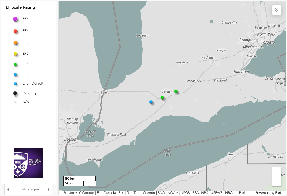
Regional map showing the start locations of the EF0 tornado and EF1 tornado shown southwest of London and the worst damage location of the EF1 downburst shown east of London.
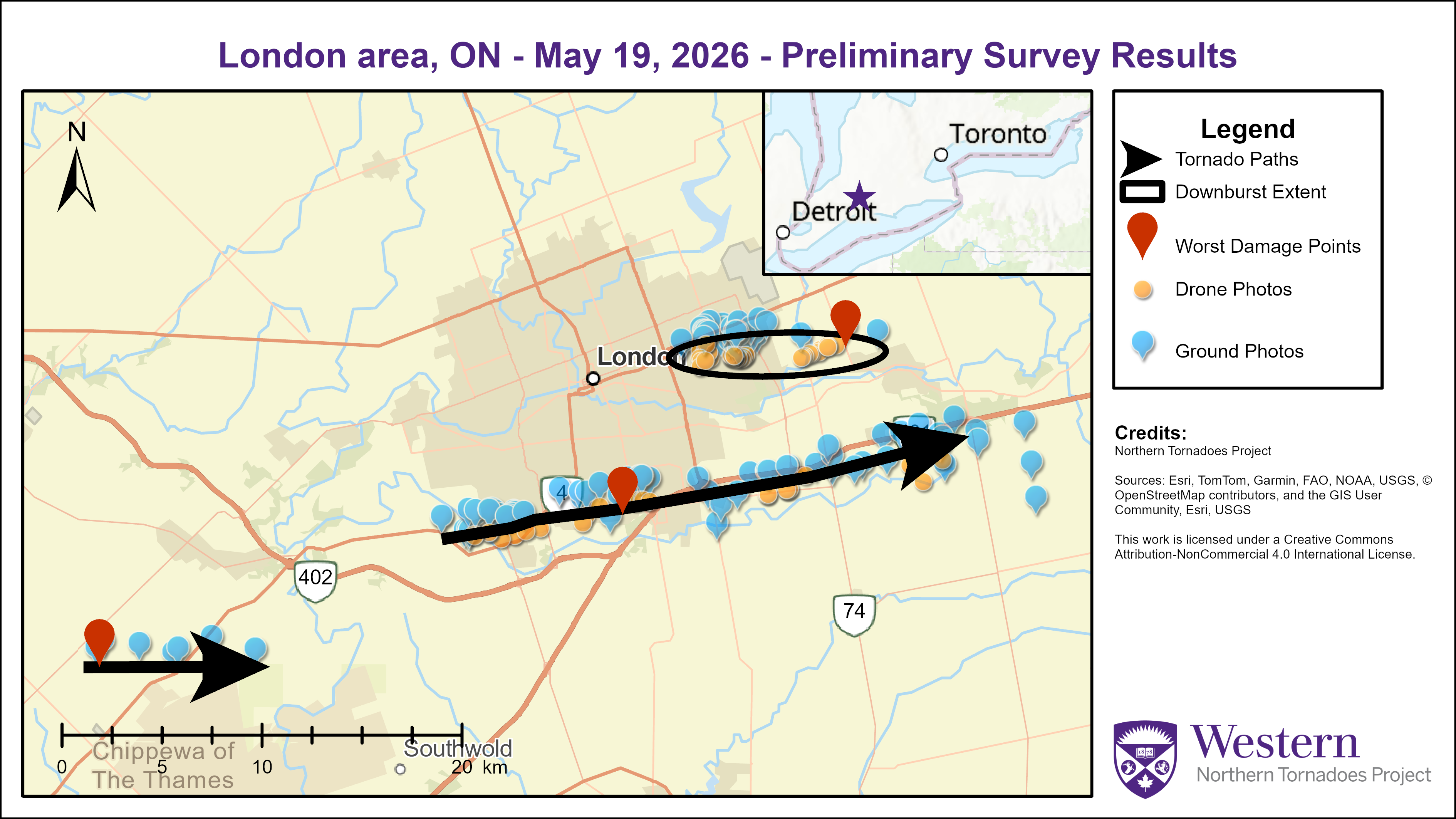
Survey summary map showing the tracks of the EF0 and EF1 tornadoes (arrows) and the location of the EF1 downburst (oval).
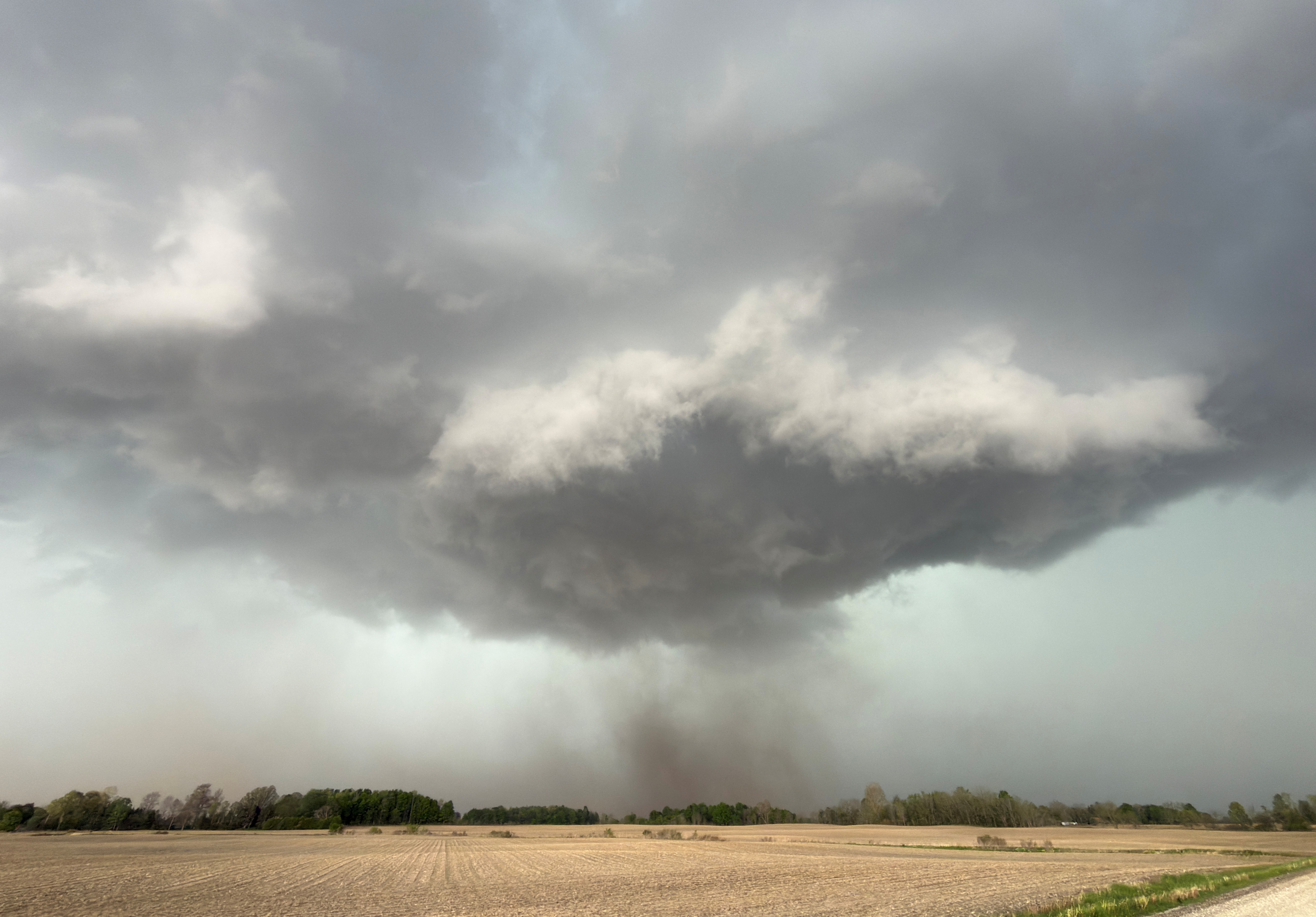
Photo of dirt and debris being lofted by the Melbourne EF0 tornado (photo by D. Sills). A number of trees were snapped or uprooted and others had large branches removed along the short tornado track.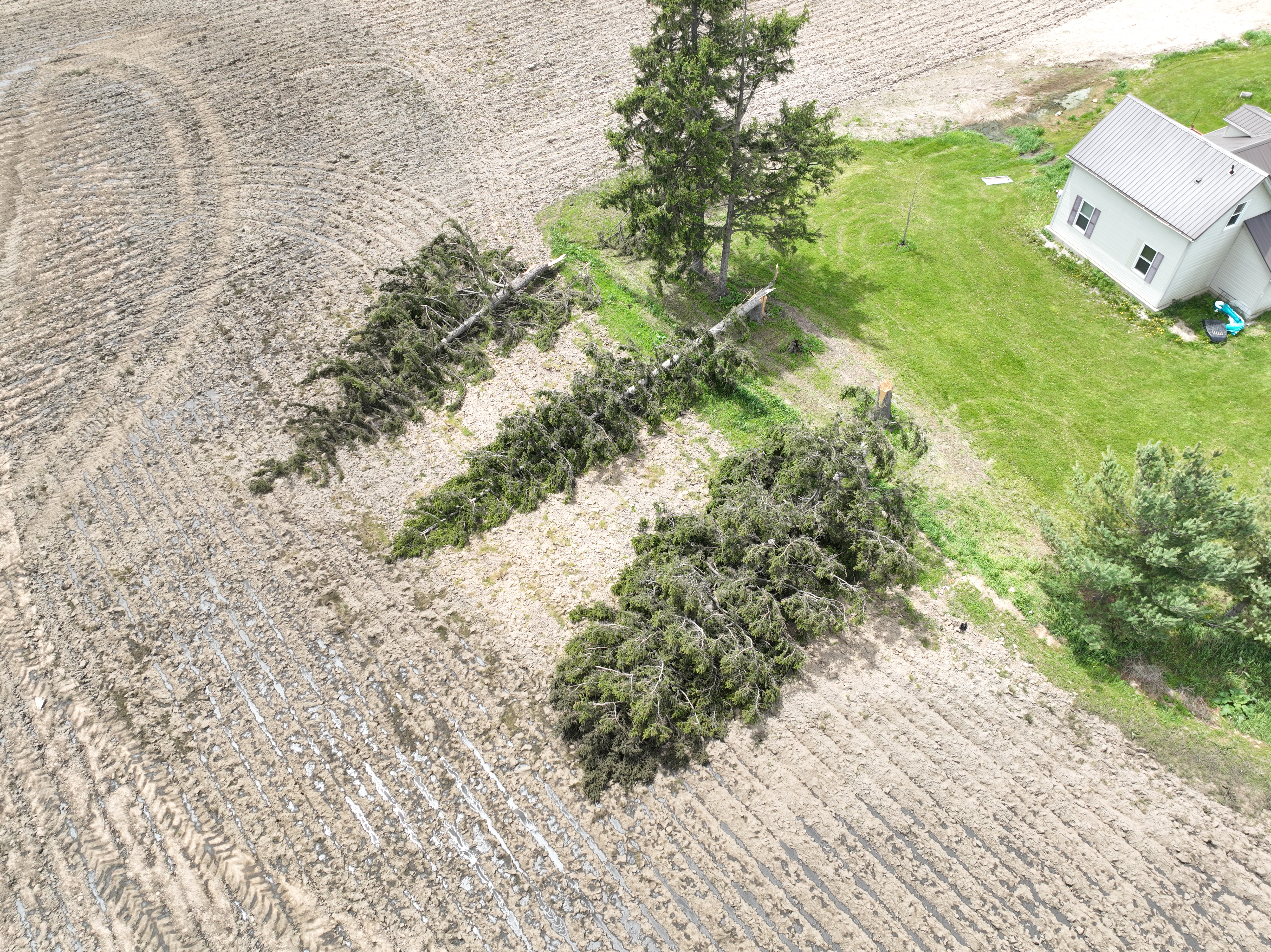
Drone photo of several large spruce trees snapped by the EF1 tornado near Wilton Grove Road and Veterans Memorial Parkway.
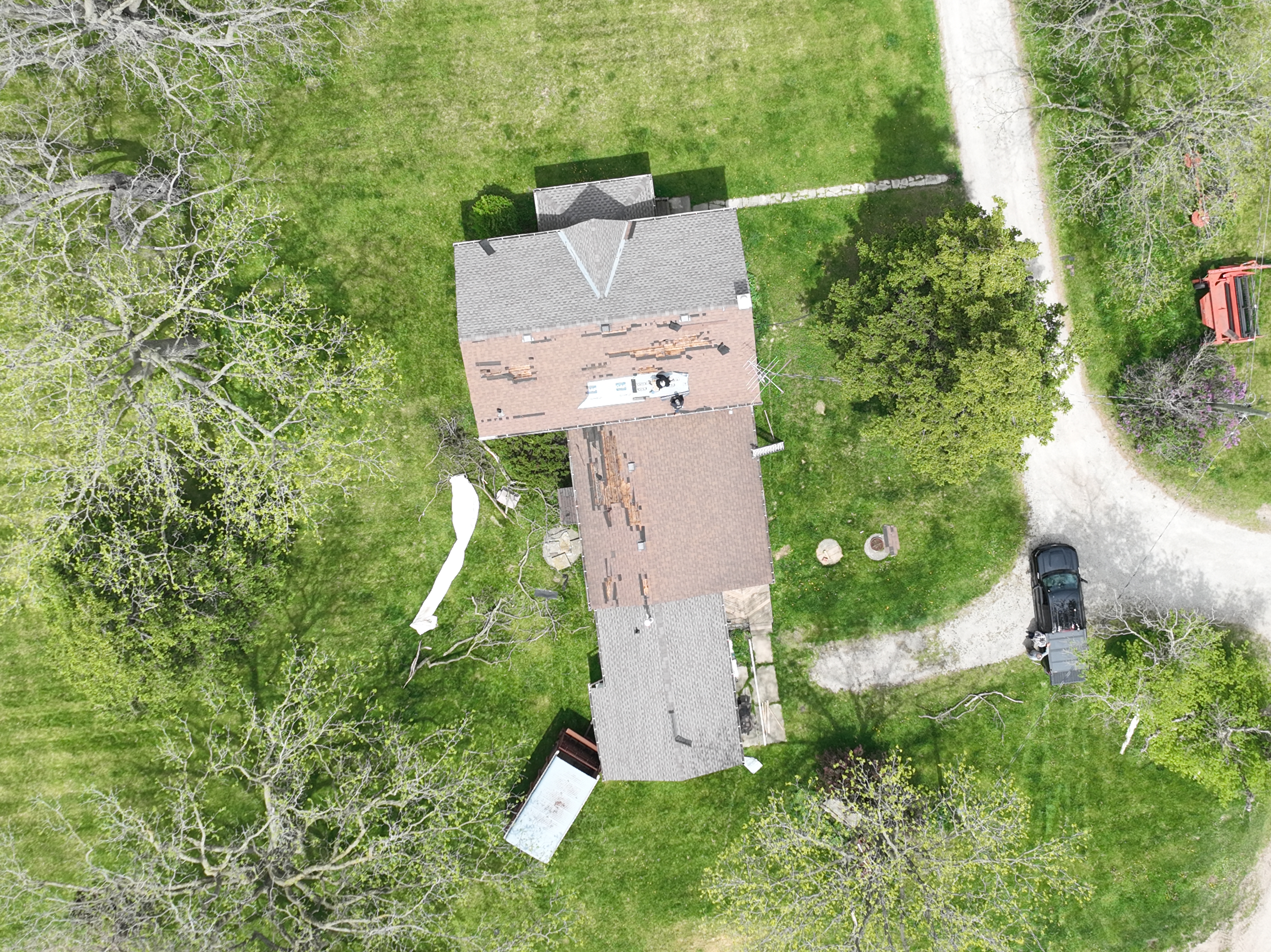
Drone photo of shingle loss on a residential home on Wilton Grove Road along the track of the EF1 tornado.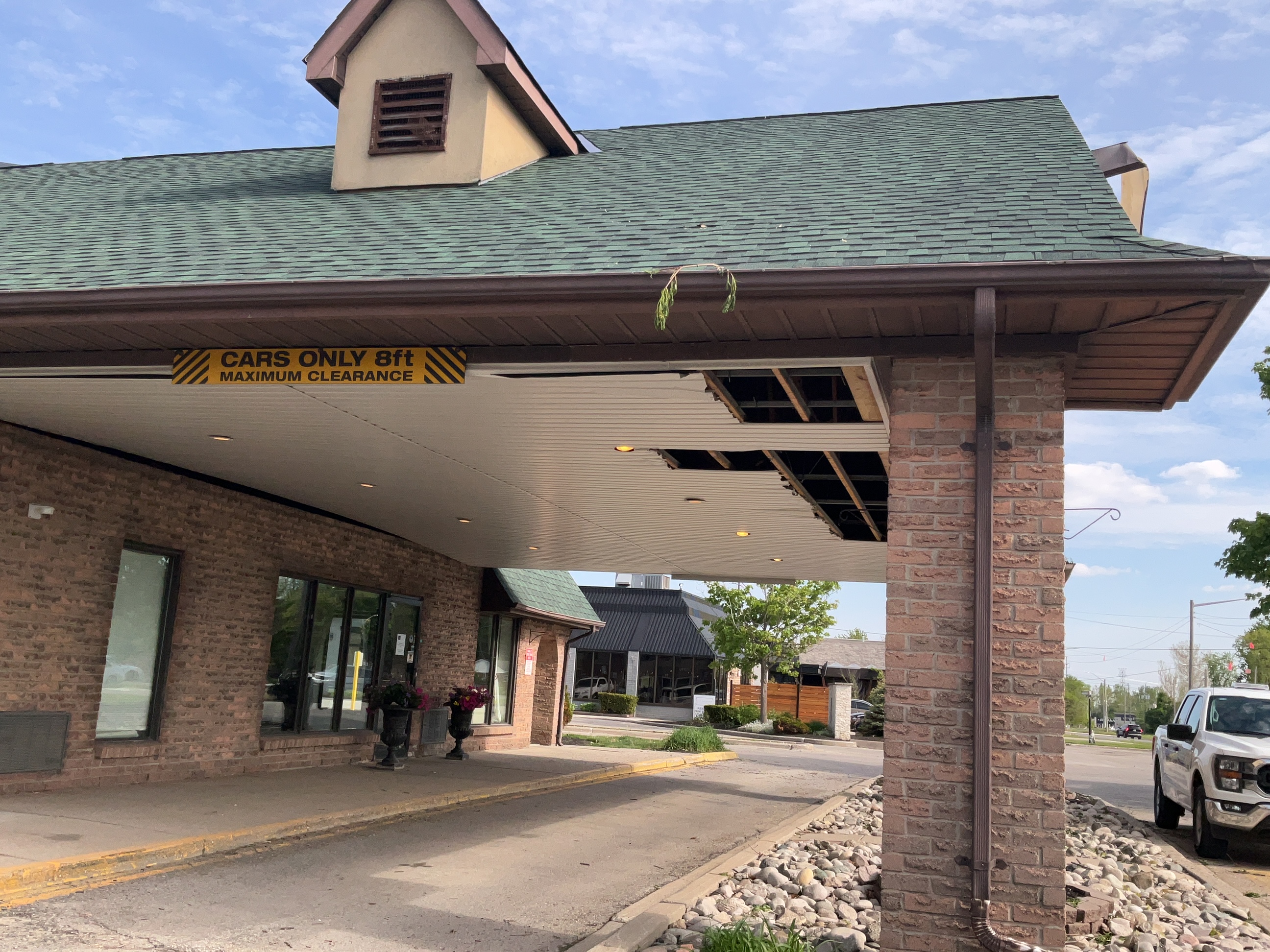
Damage to ceiling panels of the porte-cochère at a hotel on Wellington Road, caused by the EF1 tornado. Note that the worst damage along the tornado path was the snapping of some power poles.
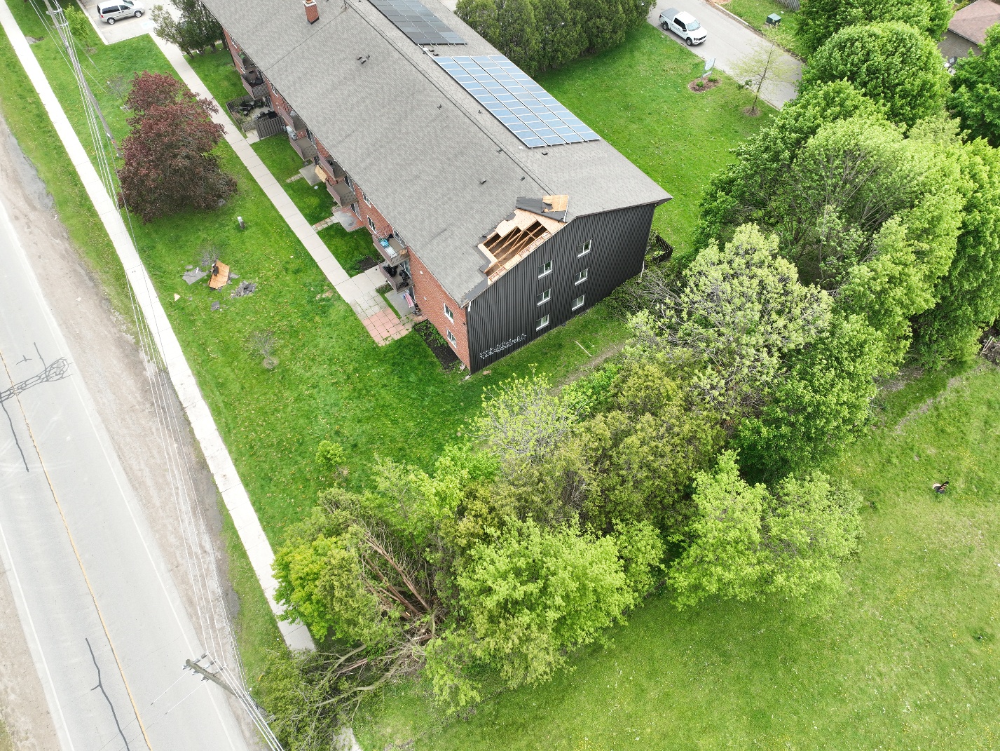
Drone photo of minor shingle and sheathing damage to an apartment building on Cartier Road, caused by the EF1 downburst.
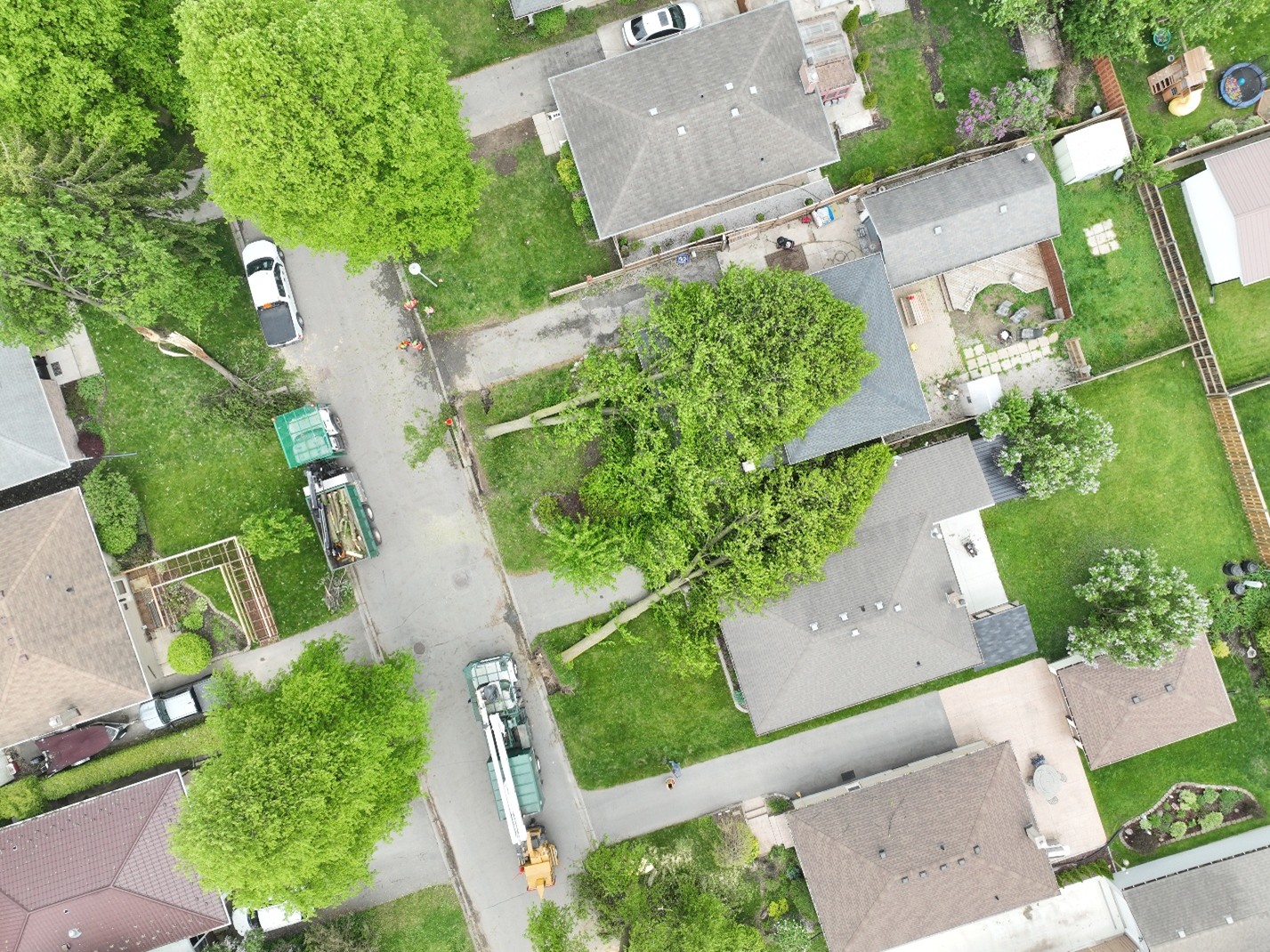
Drone photo of several large trees that were uprooted and fell onto houses on Baffin Road, caused by the EF1 downburst. The worst damage along the downburst damage path was six snapped hydro poles on Shaw Road. 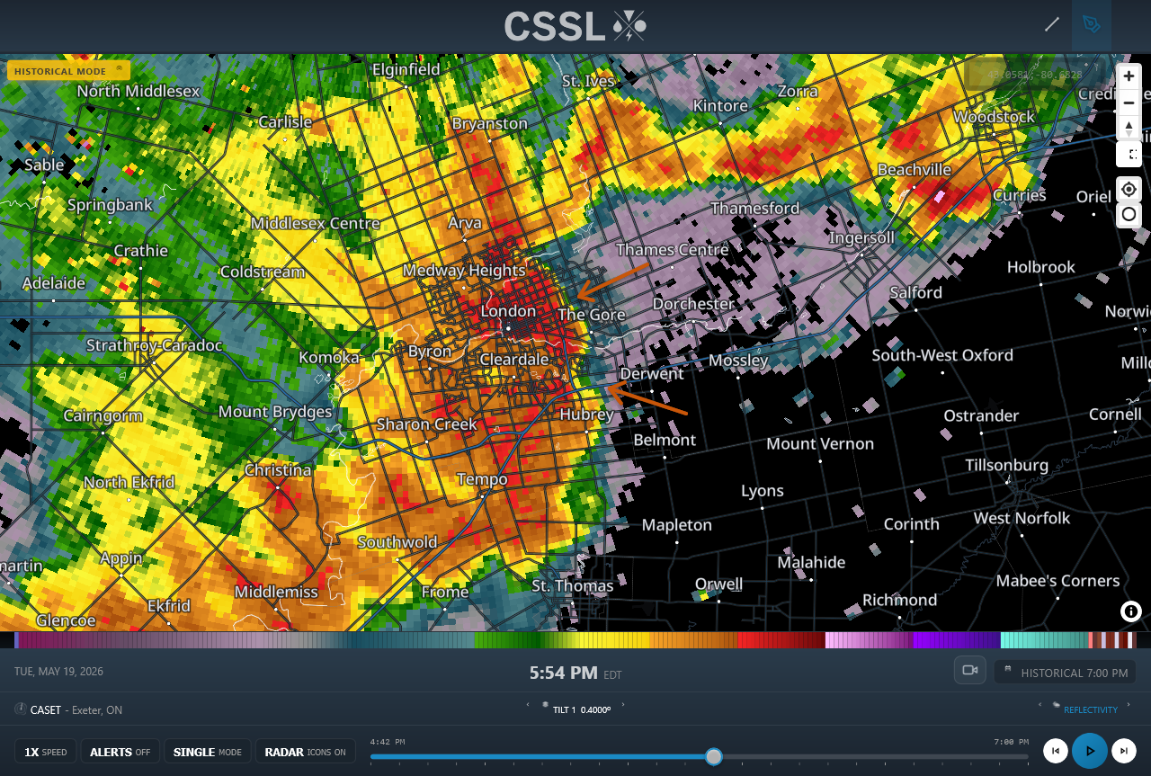
Radar image via IW Pro showing the radar reflectivity at a time that the EF1 downburst (top arrow) and EF1 tornado (bottom arrow) were both occurring. The EF0 tornado occurred earlier. Radar data courtesy Environment Canada.